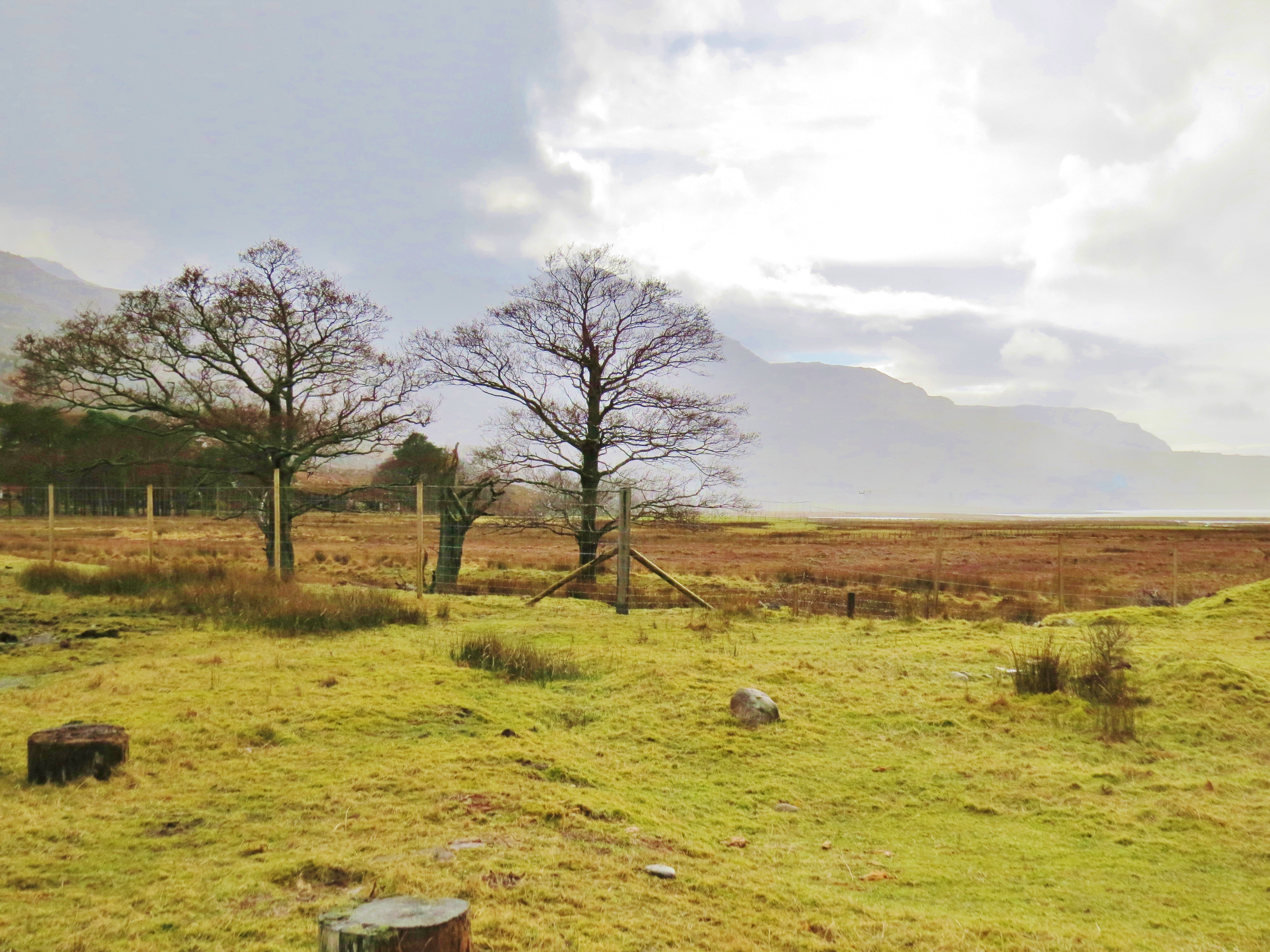
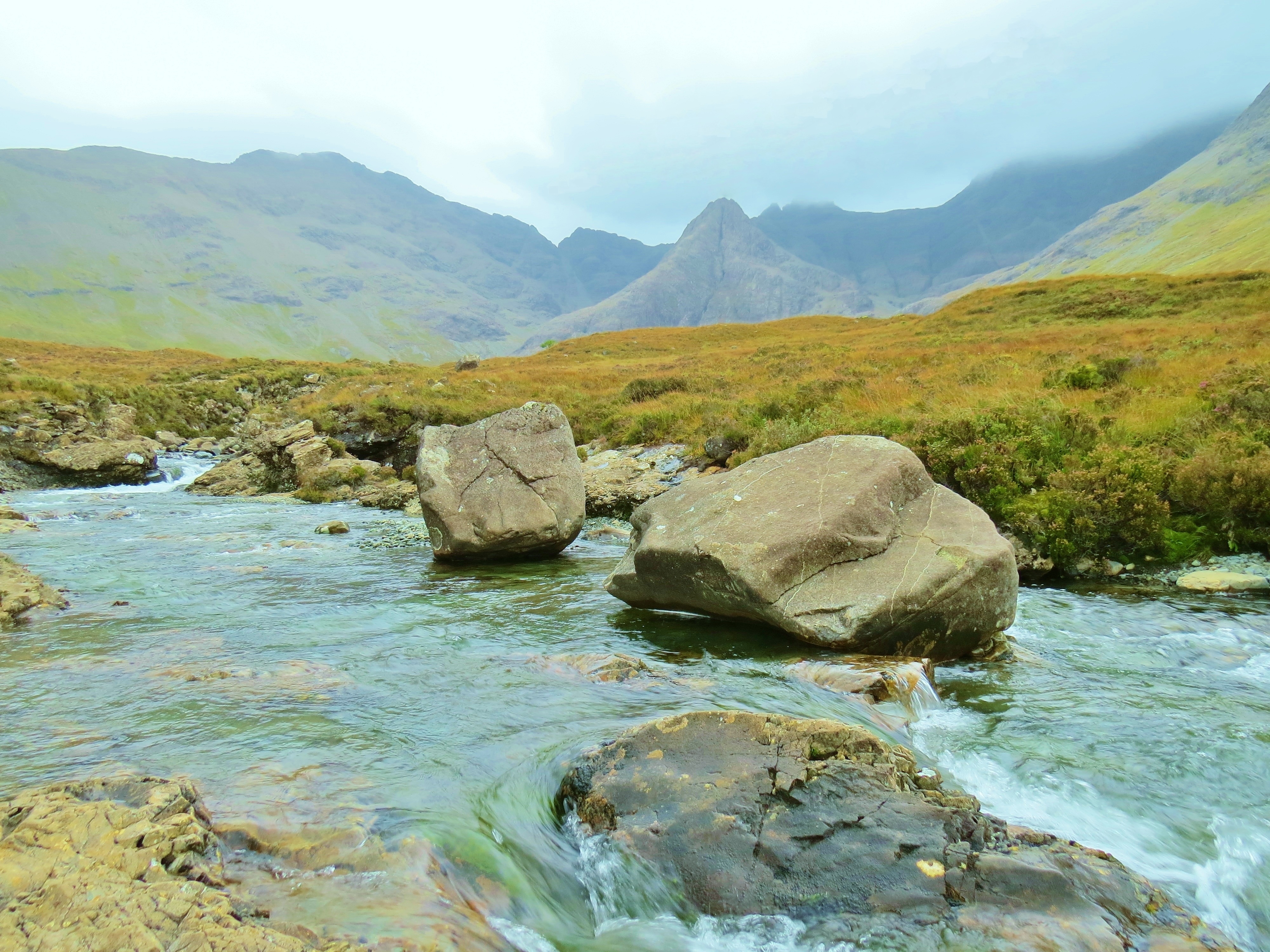
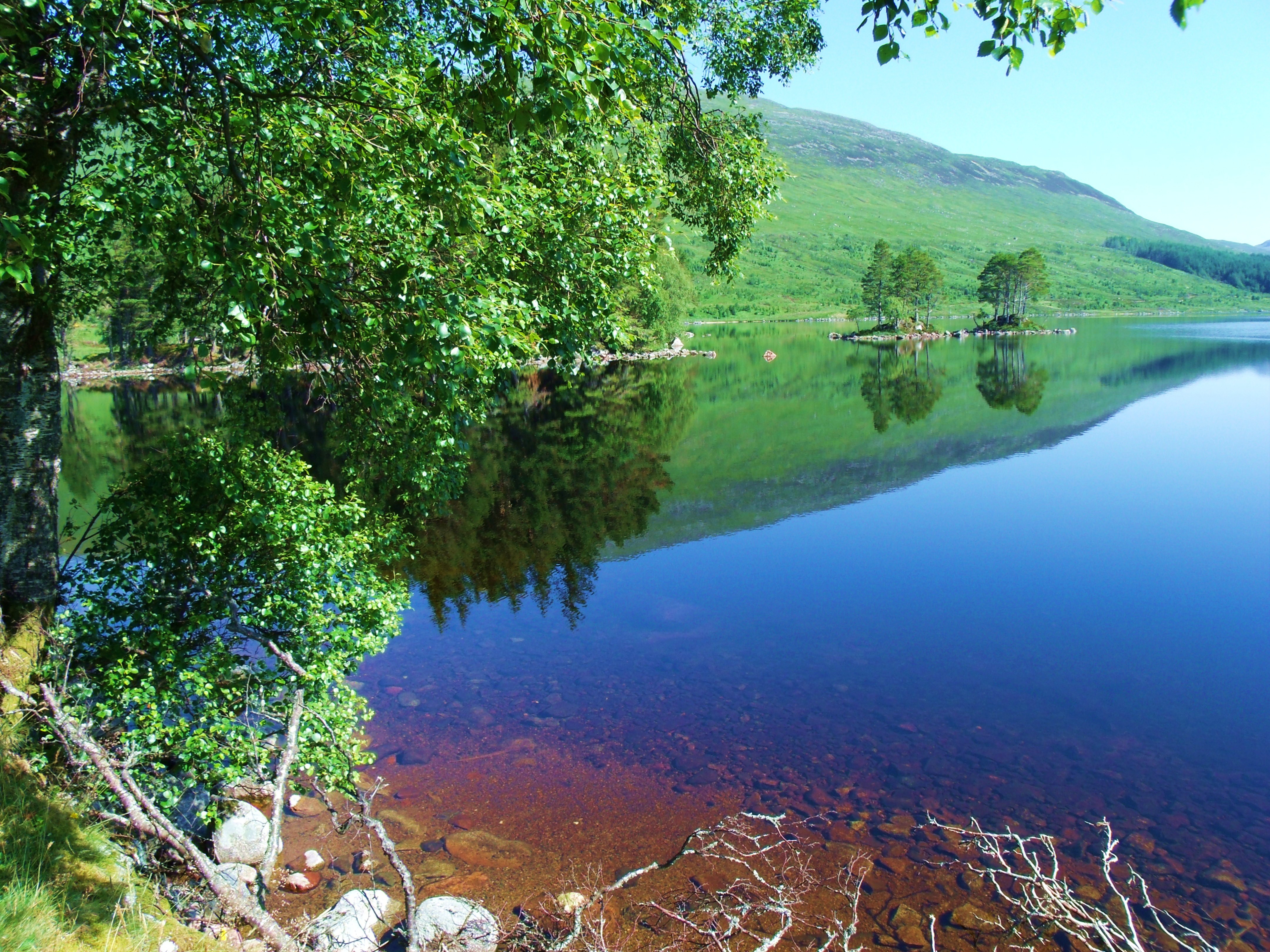
Alive with the shhh-ing, sighing sound of the wind and the rushing, tumbling, tinkling percussion of water; and, when it is time, the bellow of the stag and the clash of warring antlers. Animated, too, with the soaring, circling, swooping of golden eagles; the constant bustle of ever-hungry buzzards; the pretty progress of grazing deer along the valley floor; the silent dashing and darting of fish in still, placid pools. Kissed, by the sea. This is Glen Etive.
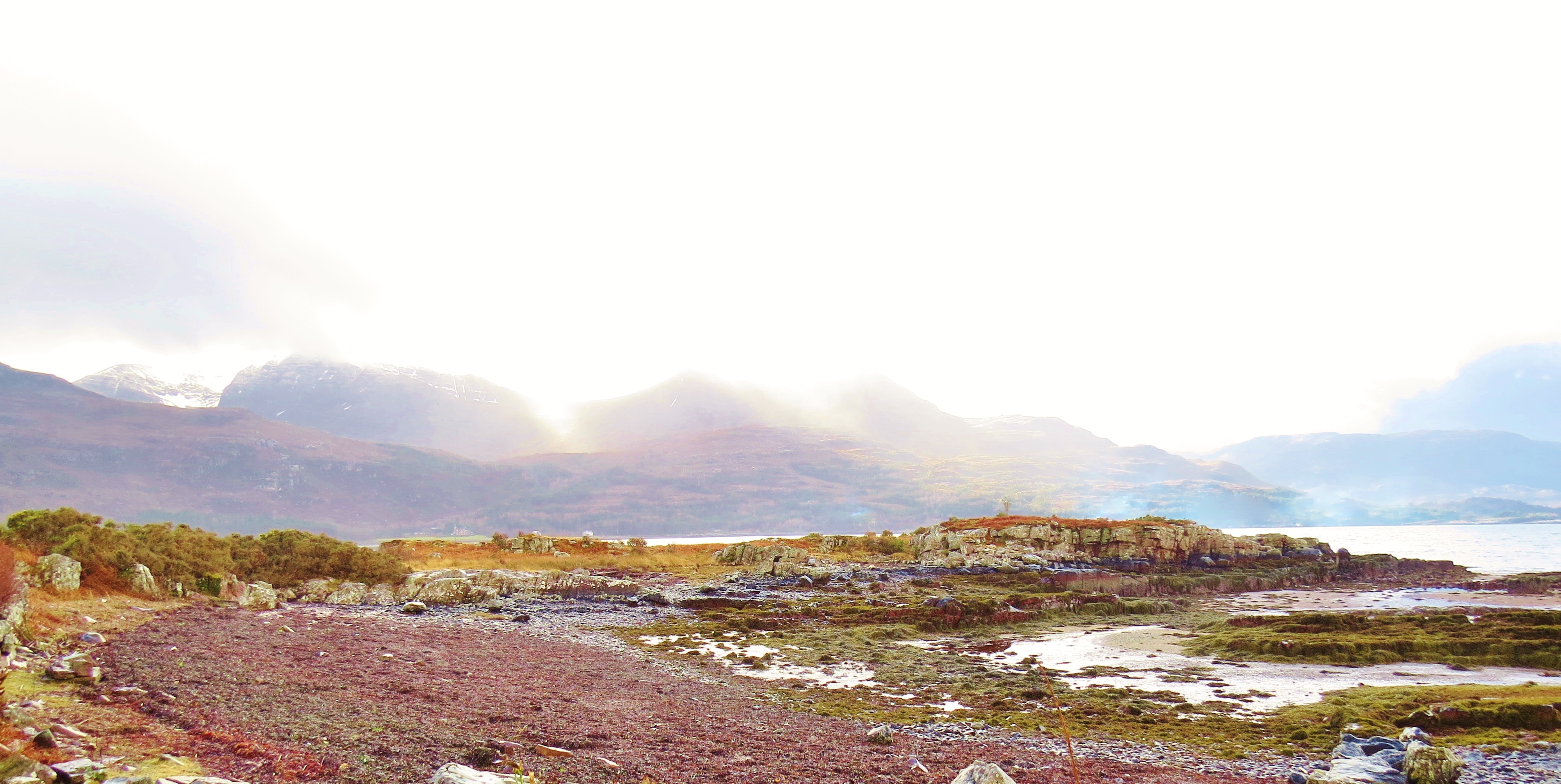
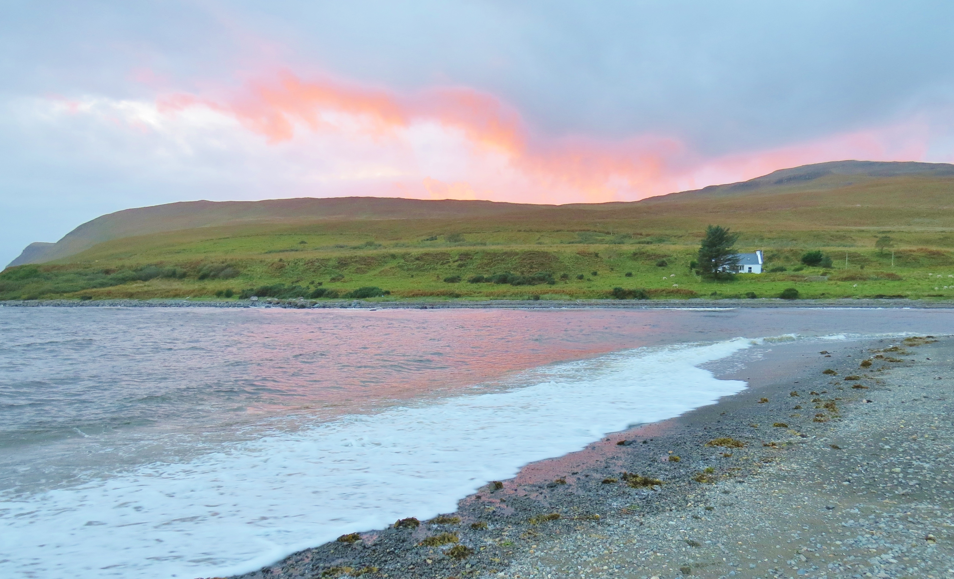
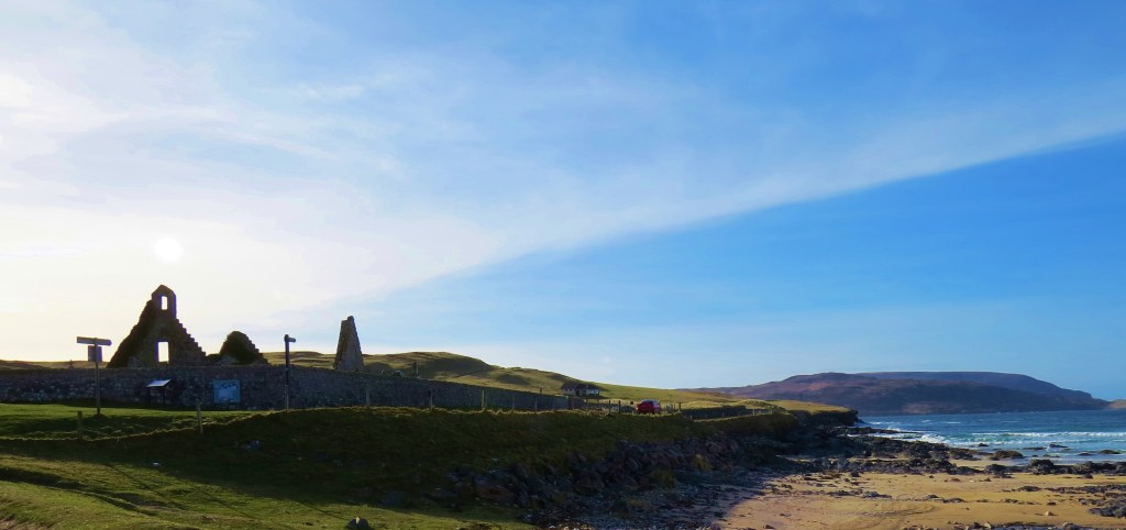
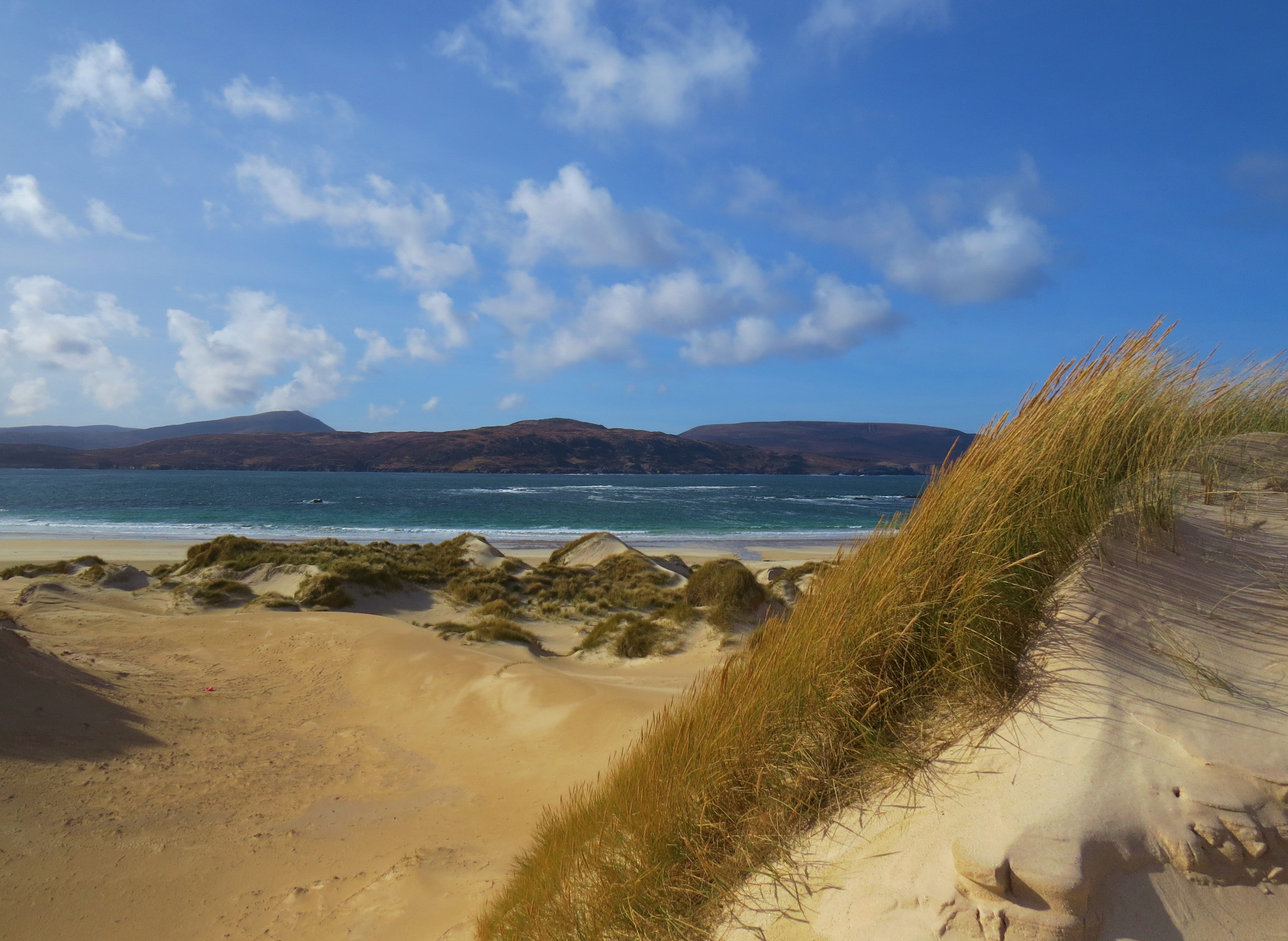
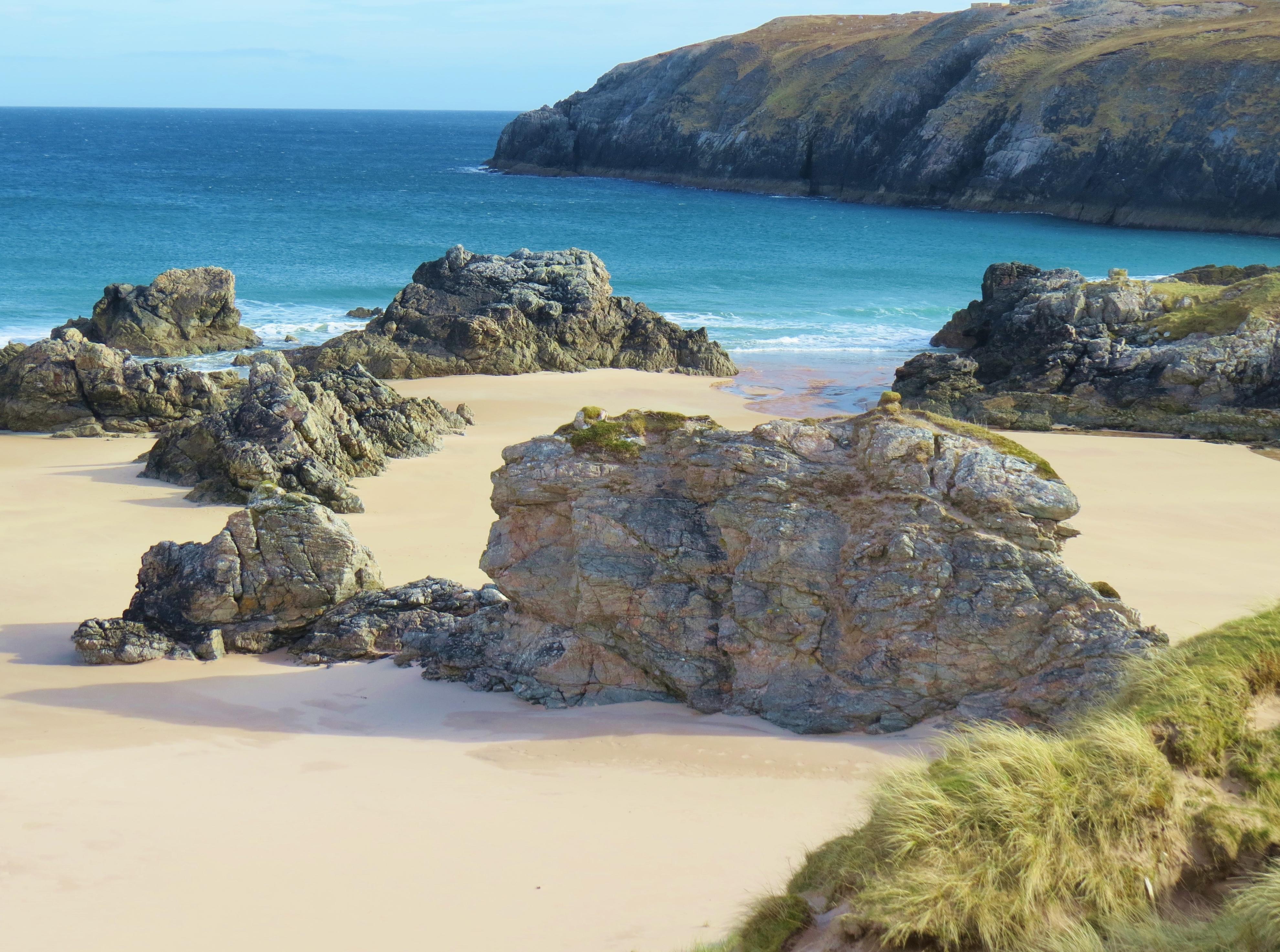
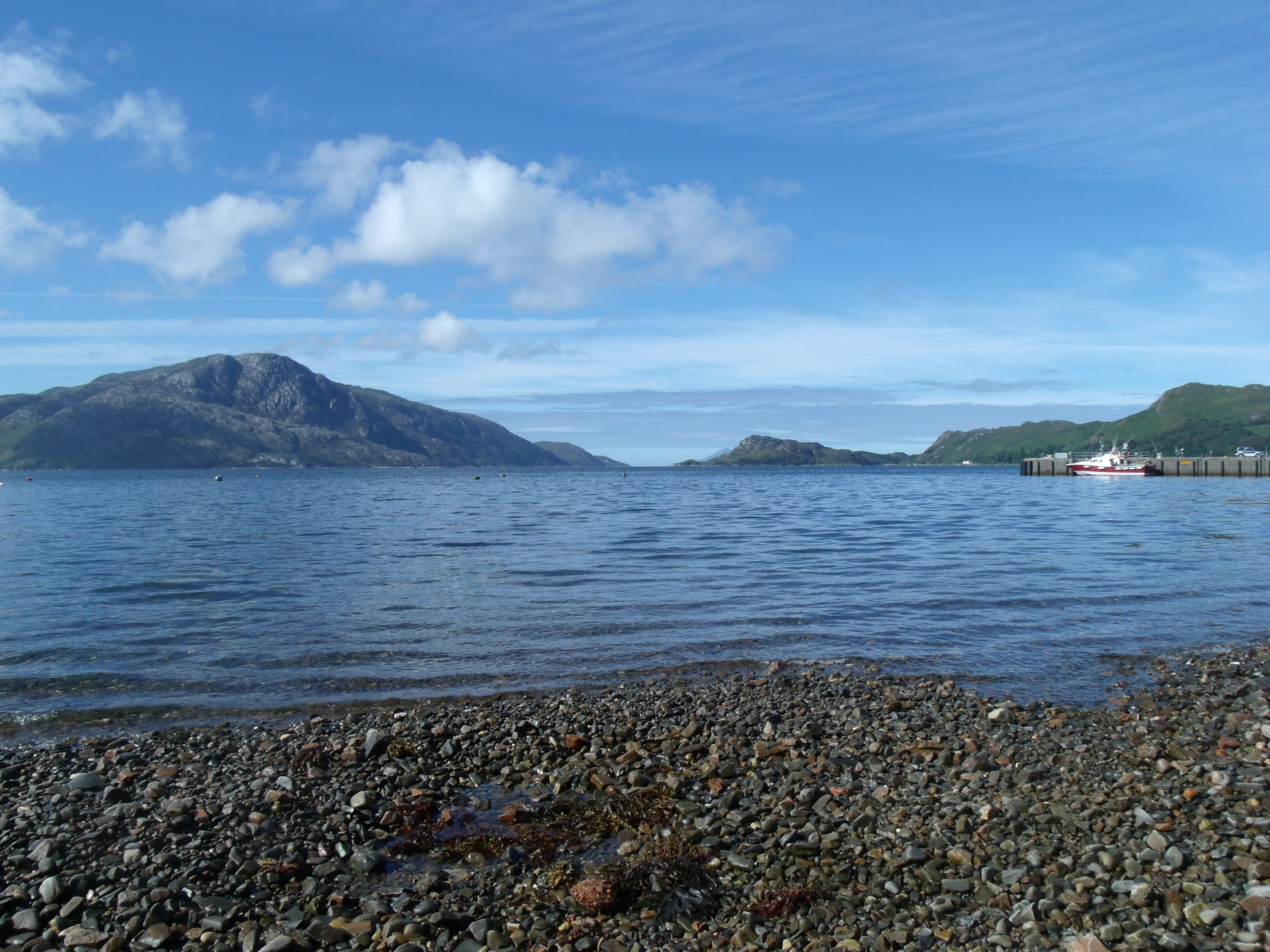
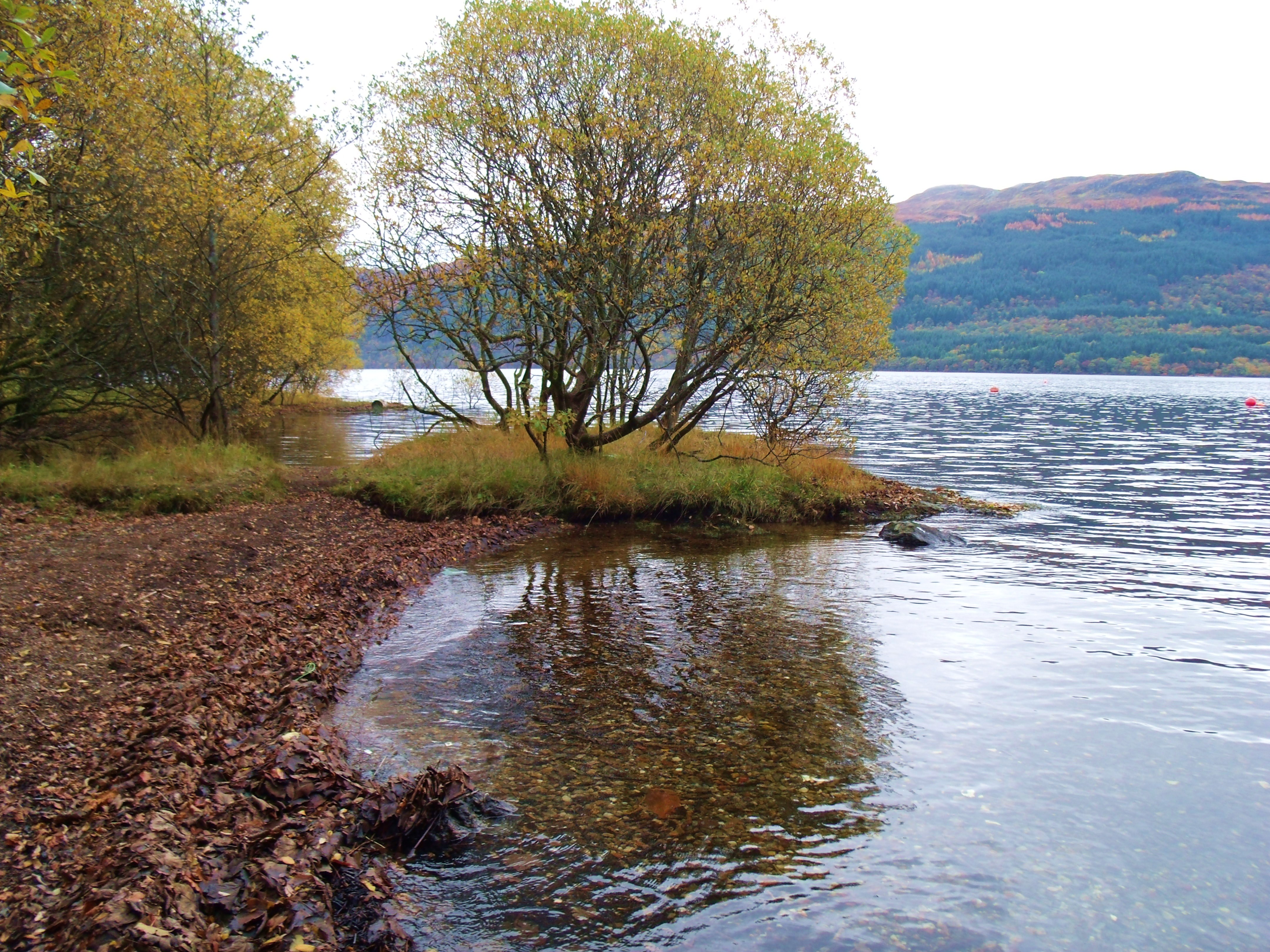
Beach At Loch Etive
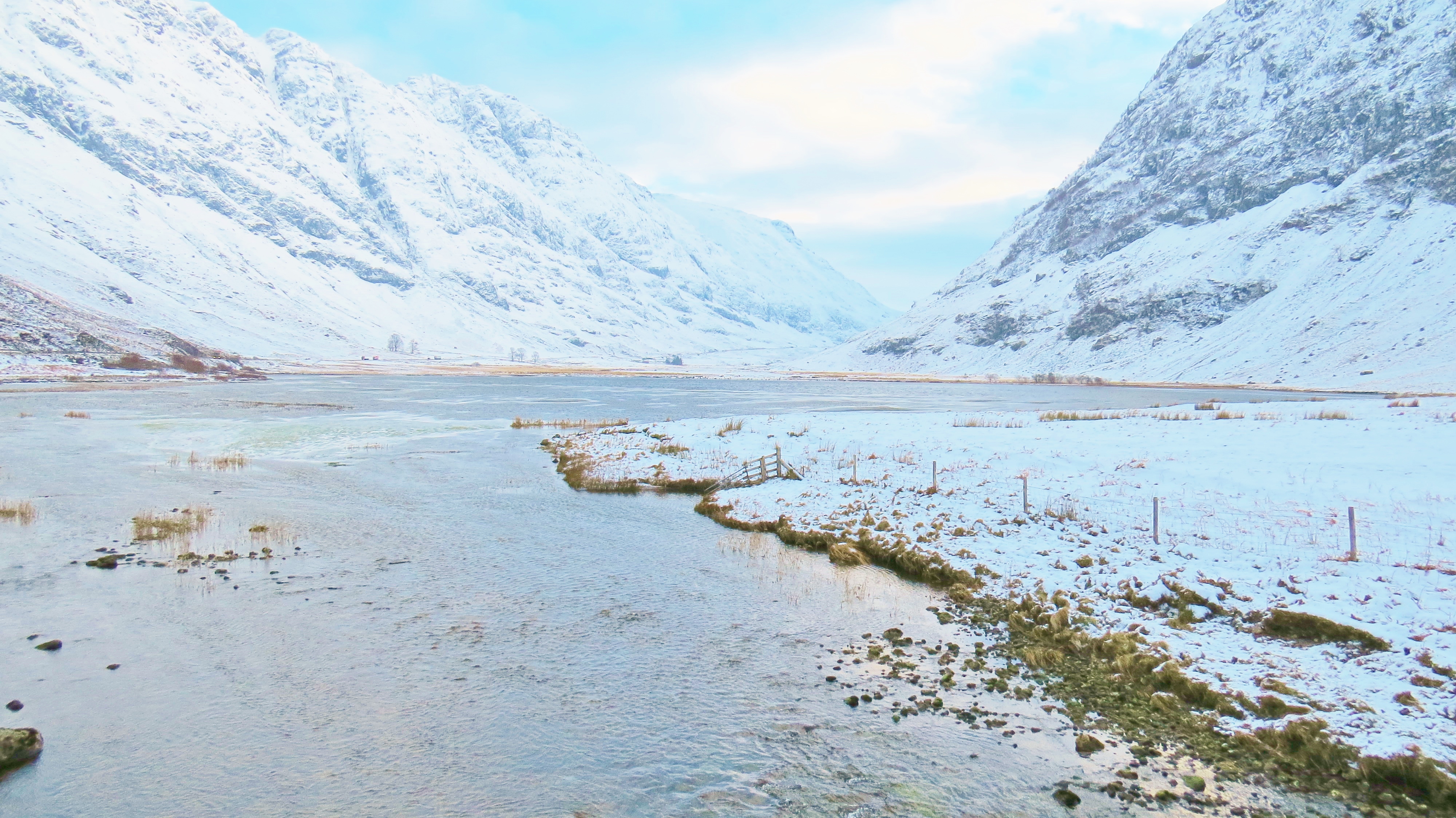
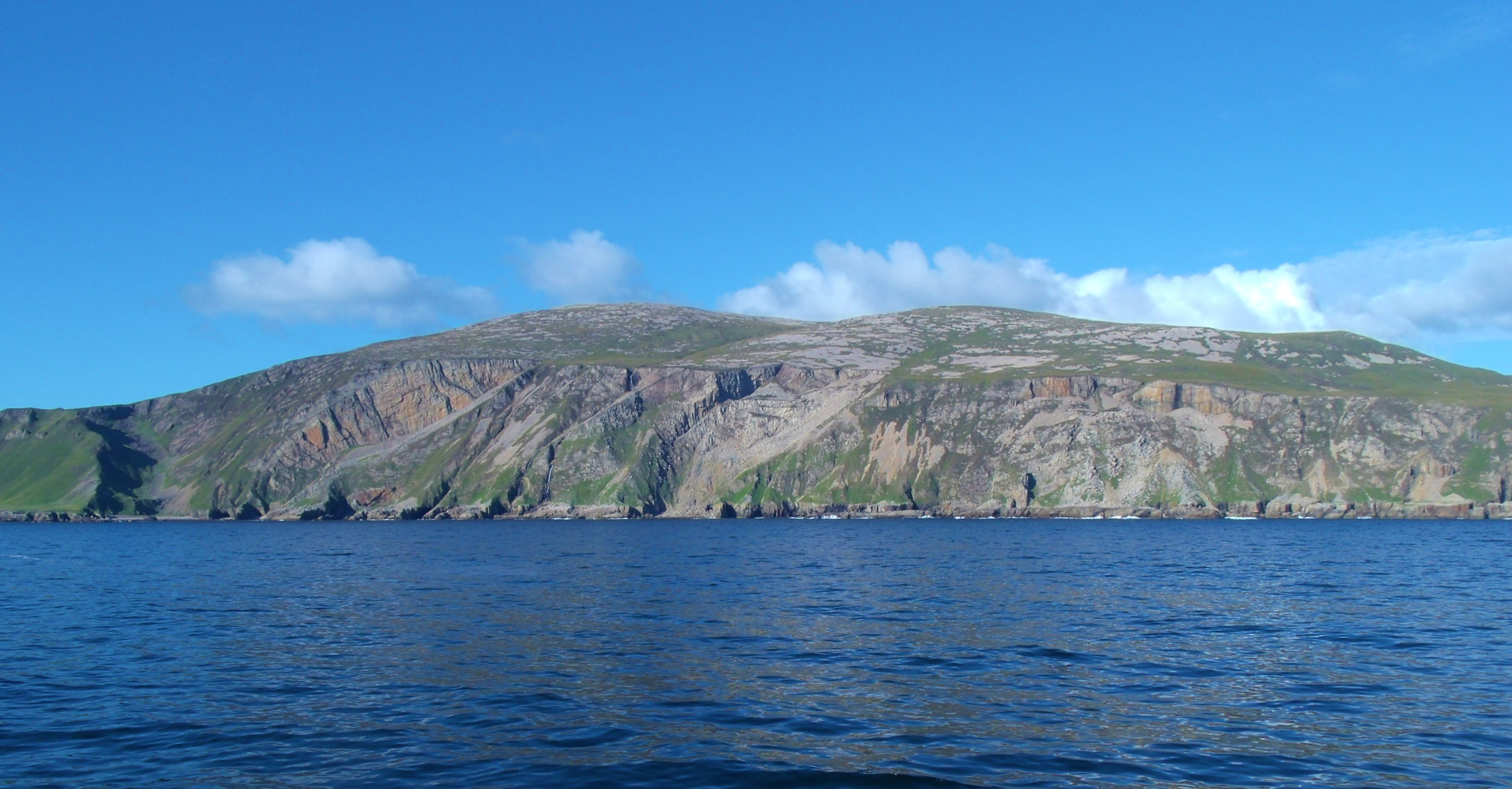
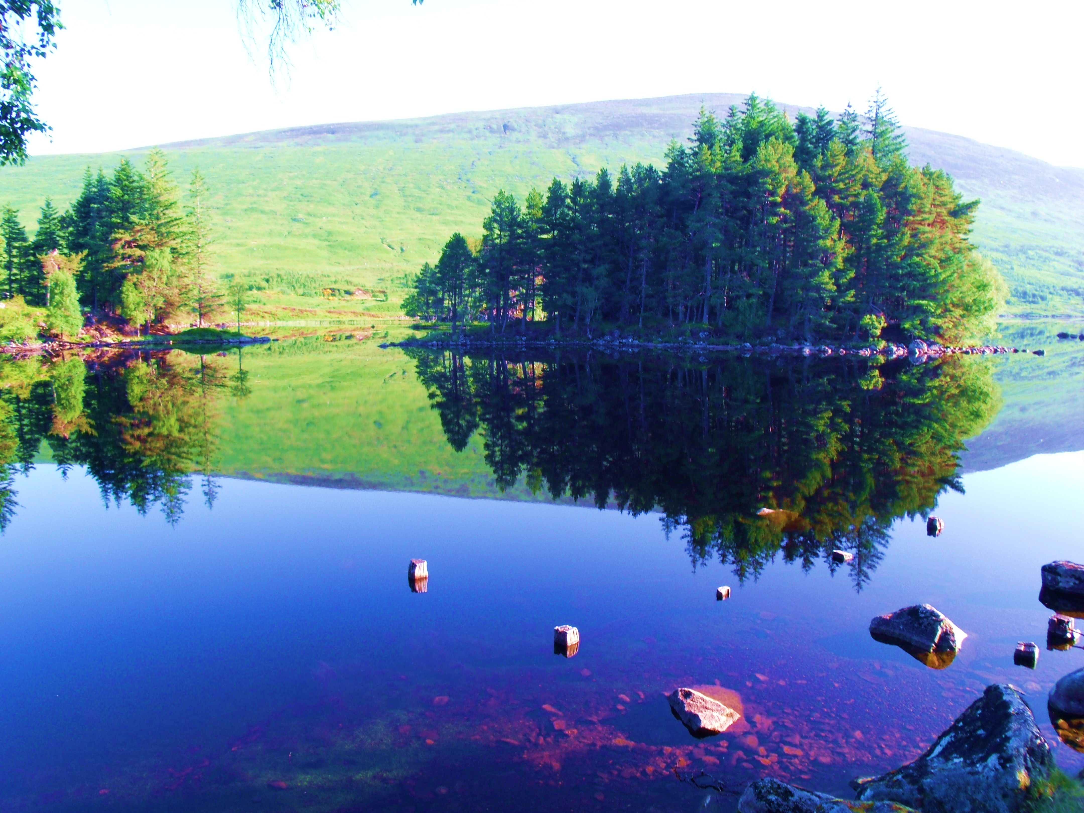
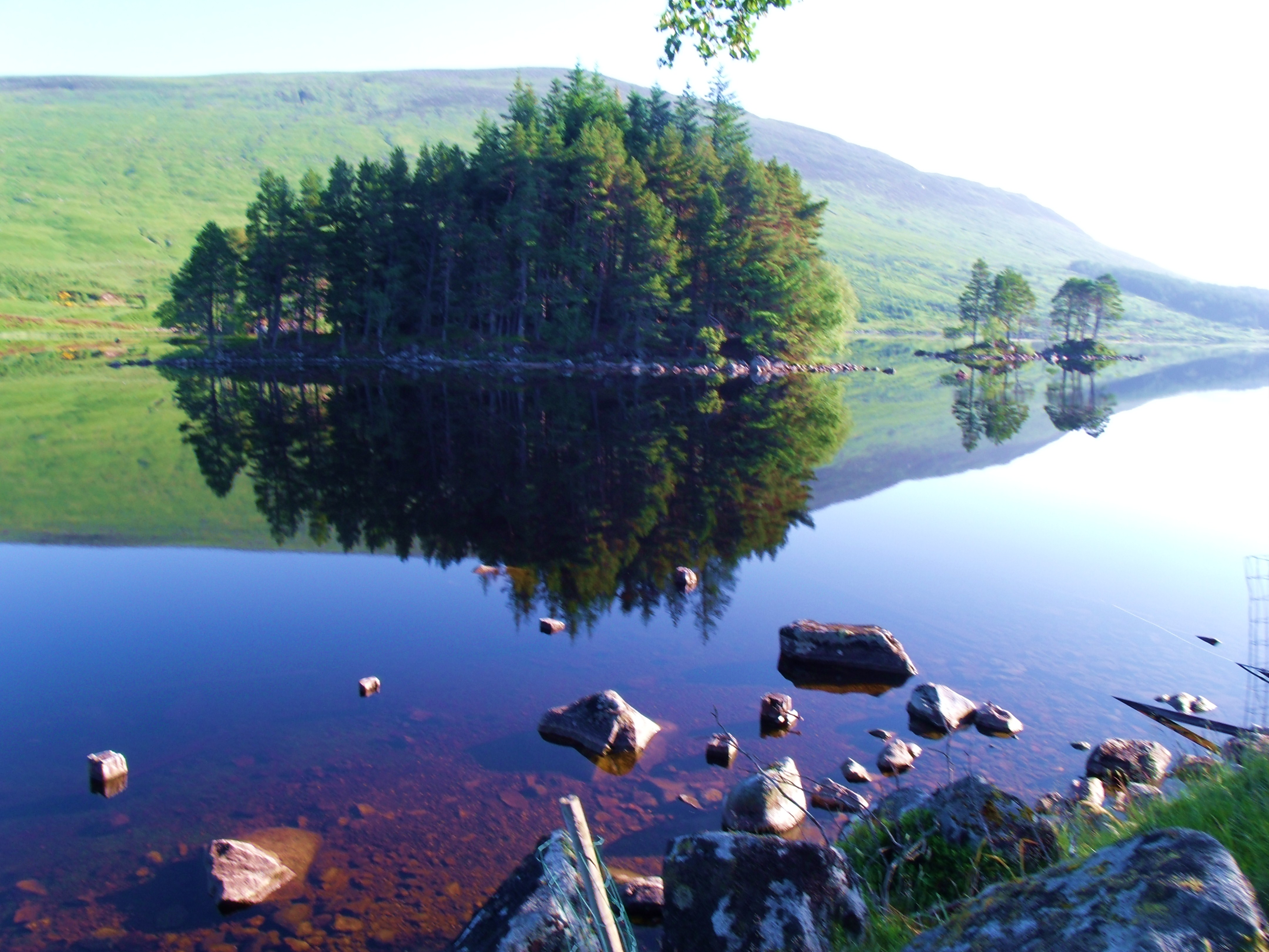
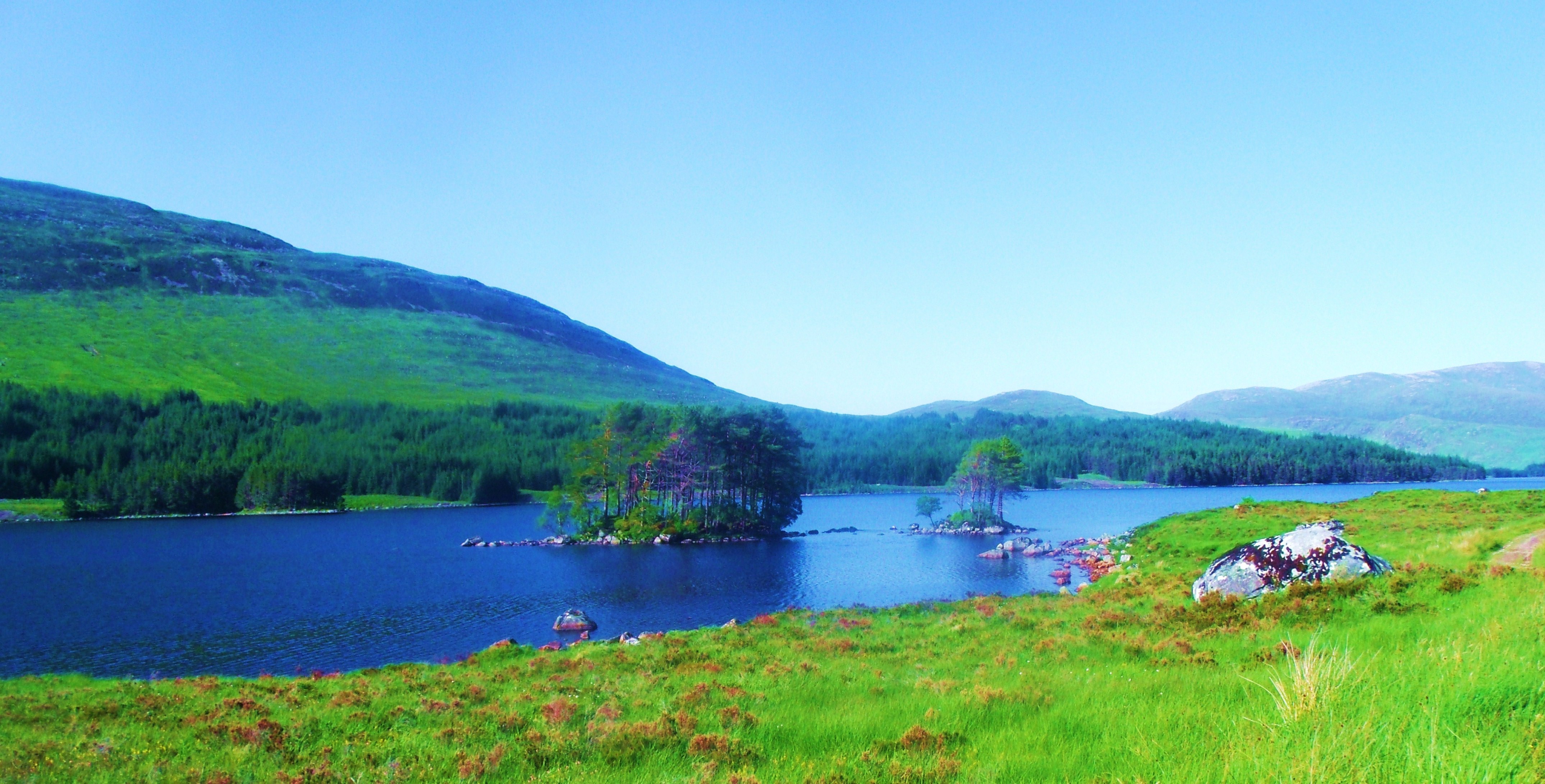
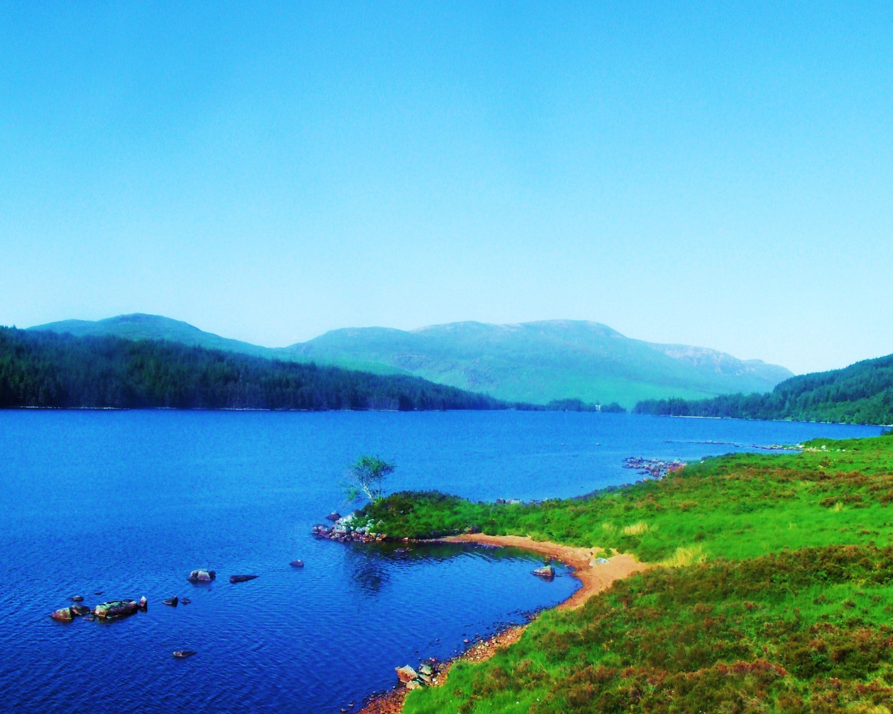
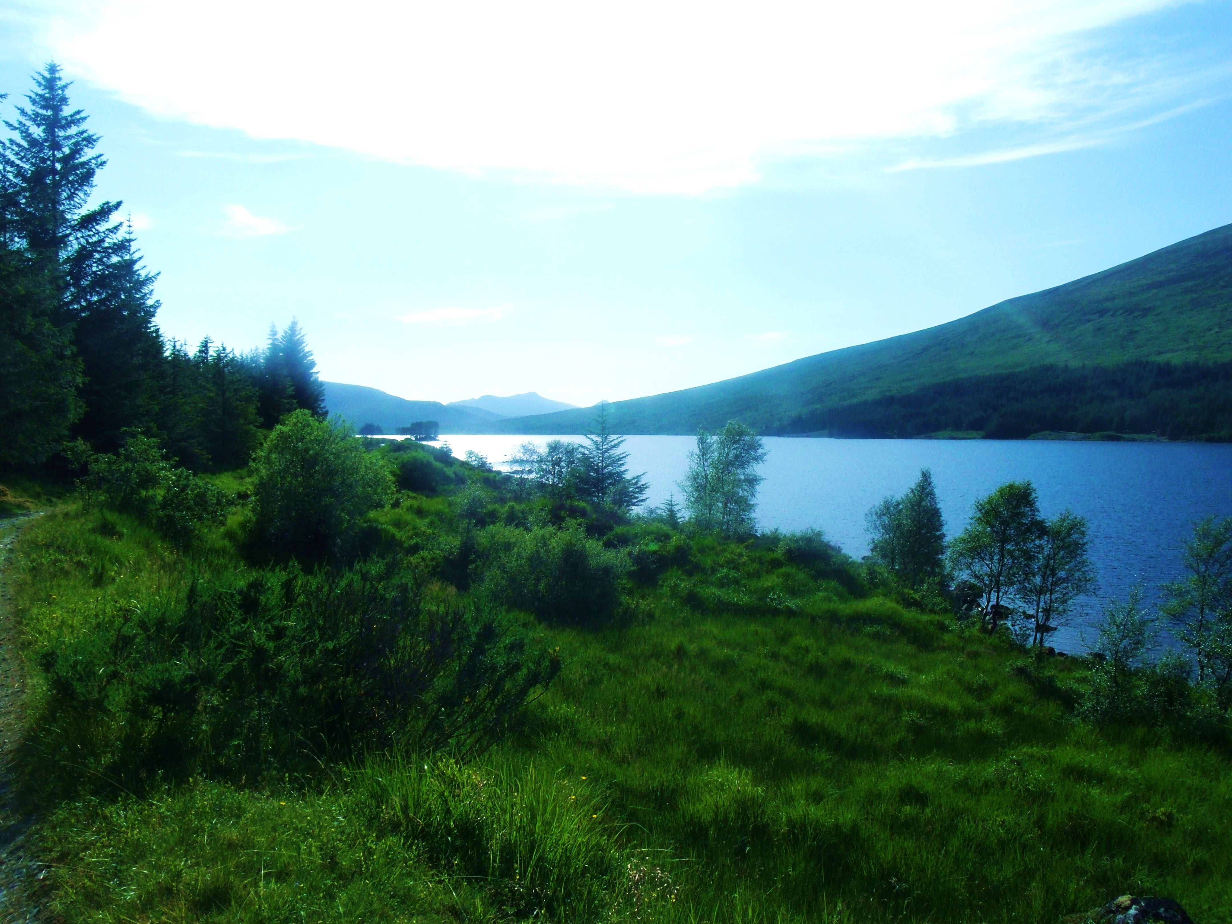
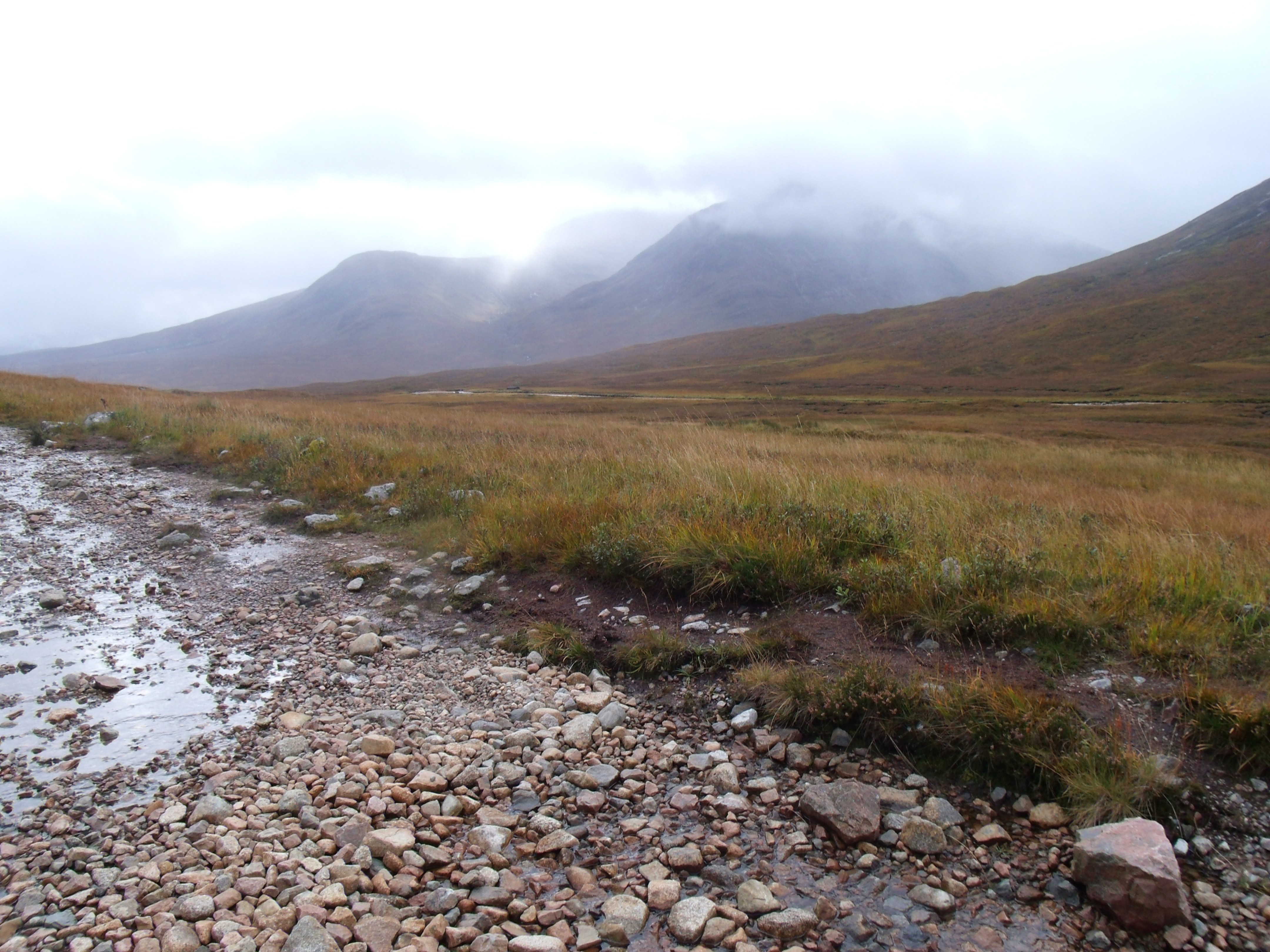
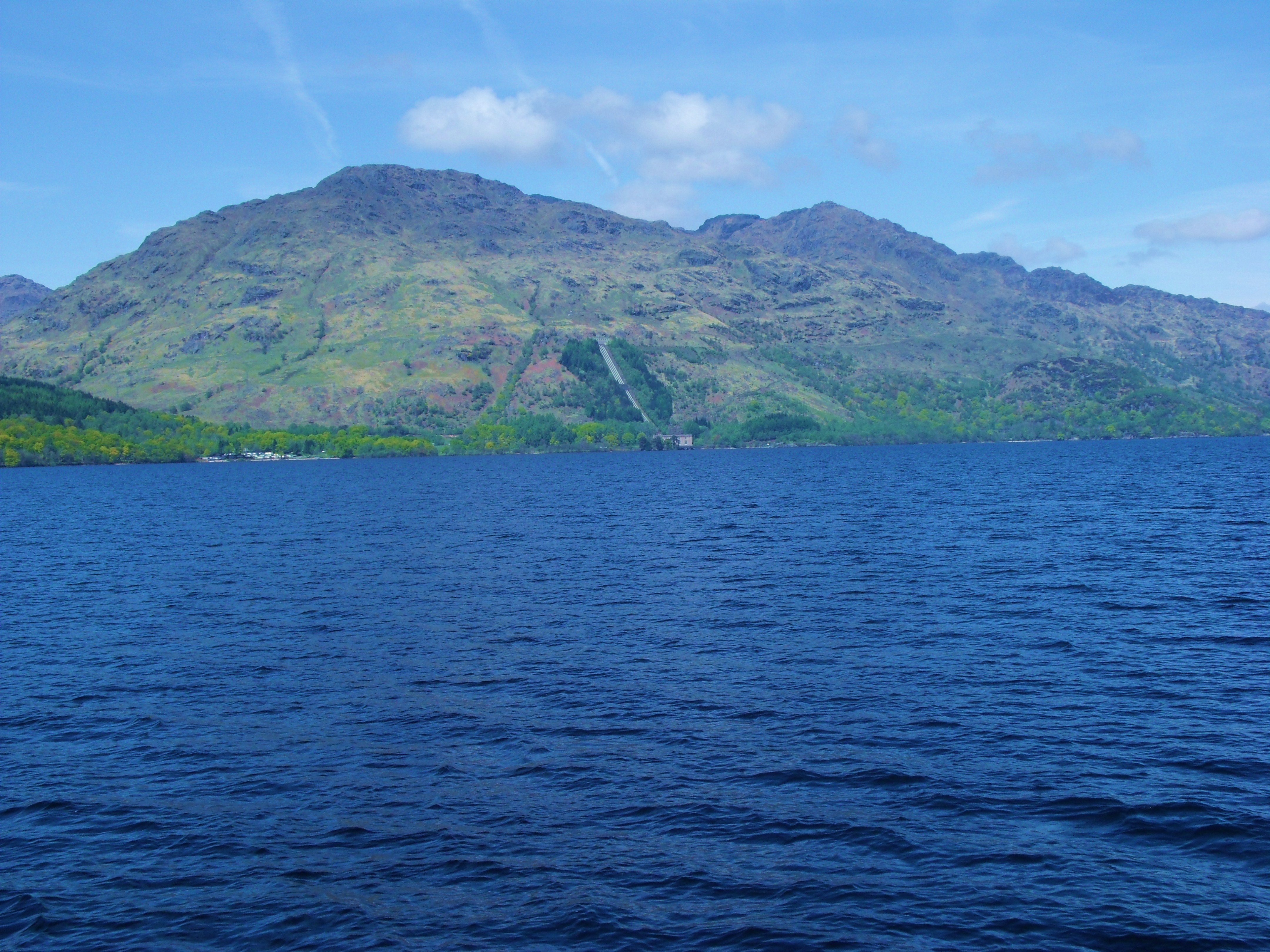
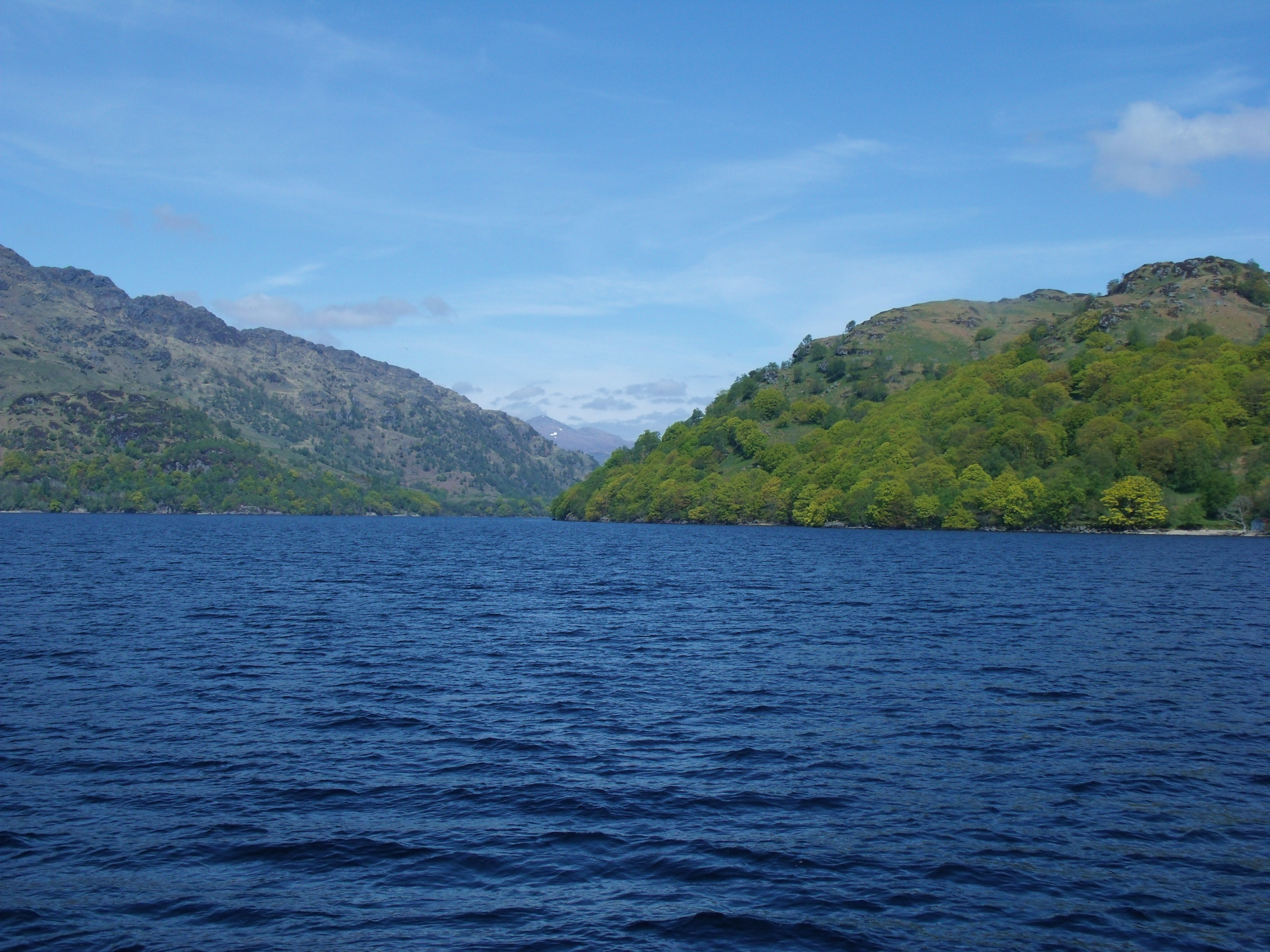
Scotland has two types of lochs – fresh water inland lakes and salt water sea inlets – bays and fiords. Loch Etive is the latter, a fiord. It is 20 miles long, stretching all the way to Connel, just north of Oban. So much fresh water flows into it from surrounding glens and mountains that, with fresh water being less dense, it floats on top of the salt water. In places, the top two inches of water is potable. Fishing is excellent with a wide variety of fish including salmon; brown sea trout; rainbow trout; pollock; brownies; spurdog and mackerel in plentiful supply.
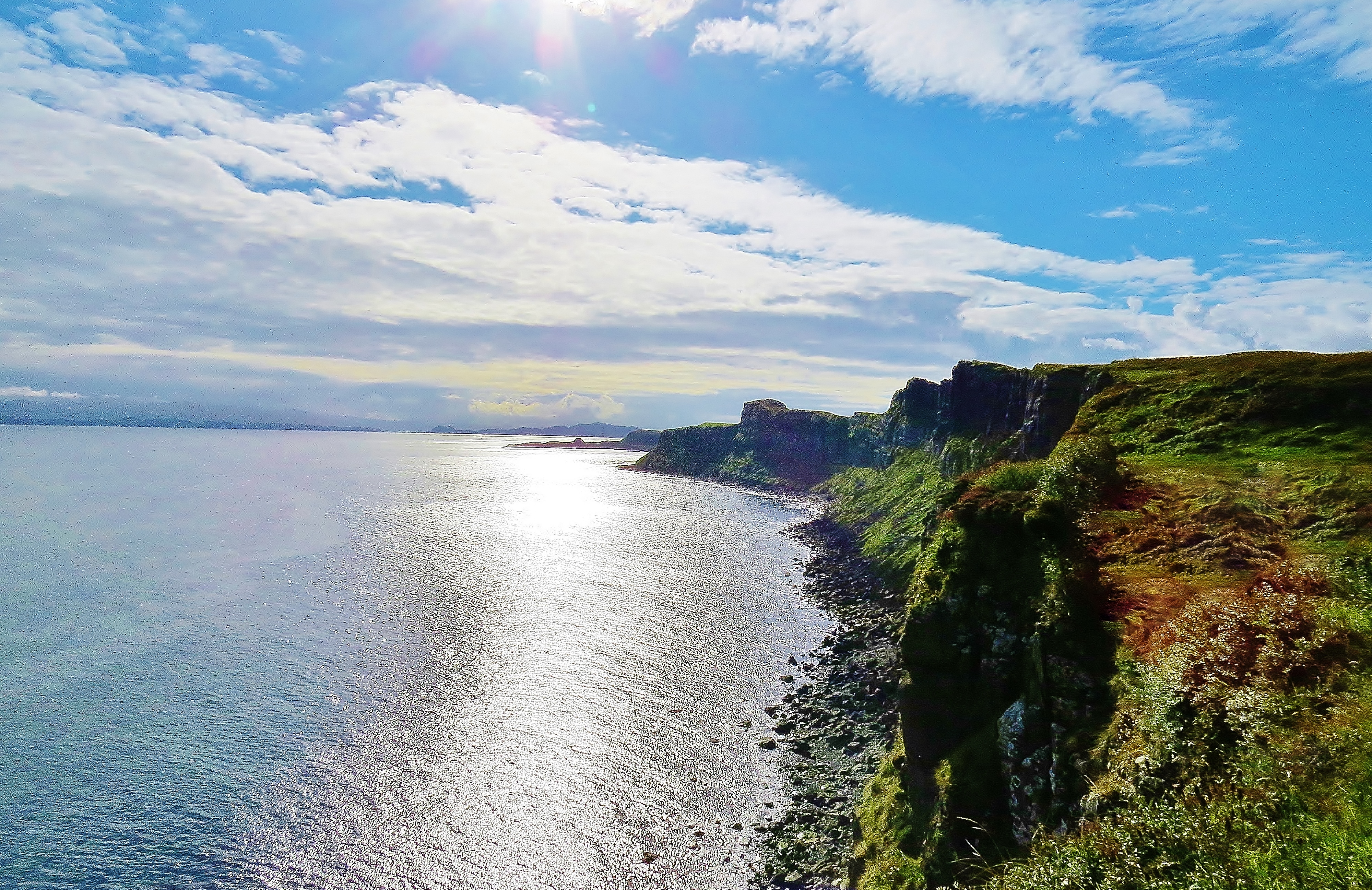
The Head Of Loch Etive (Stob Dubh in background)
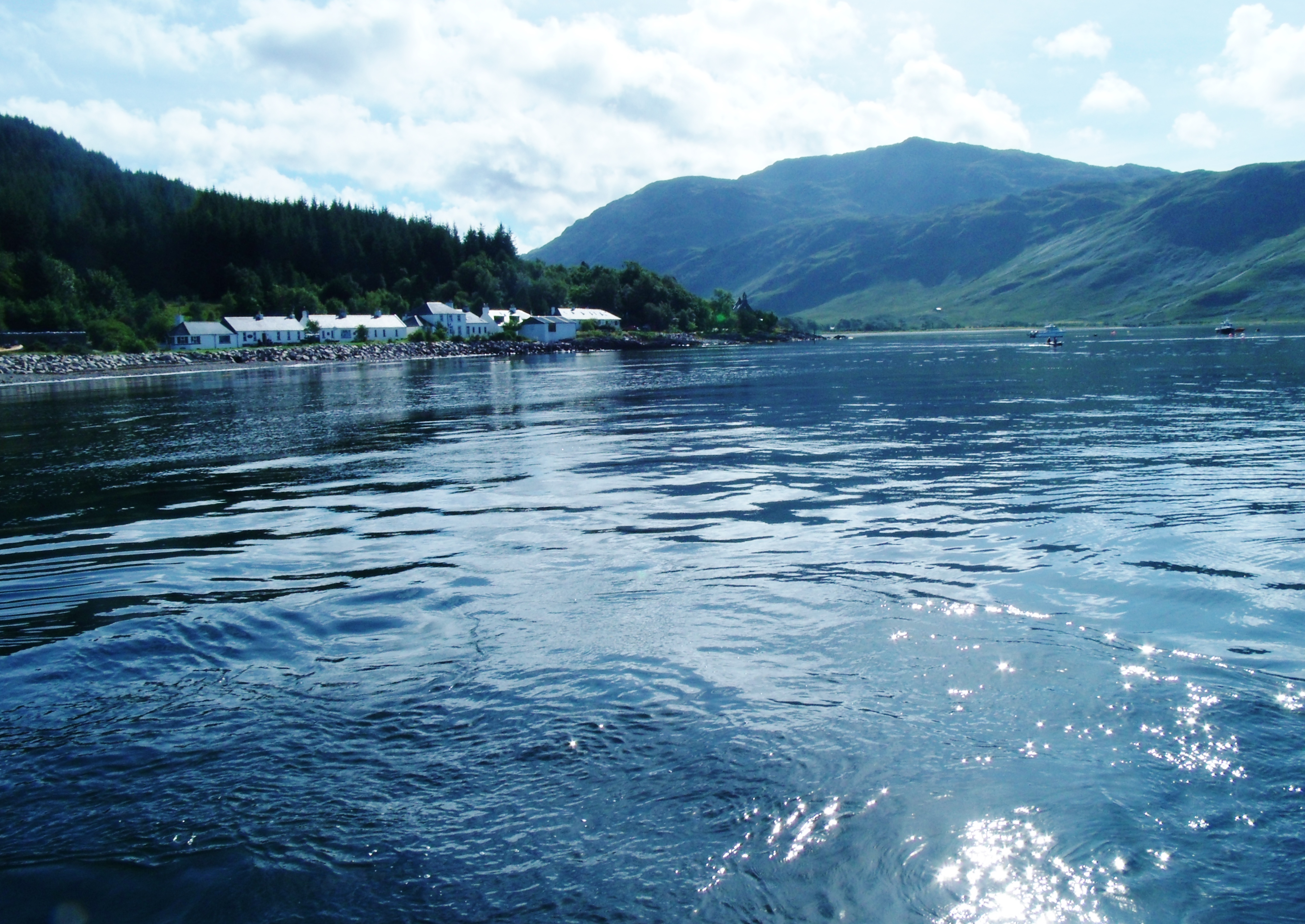
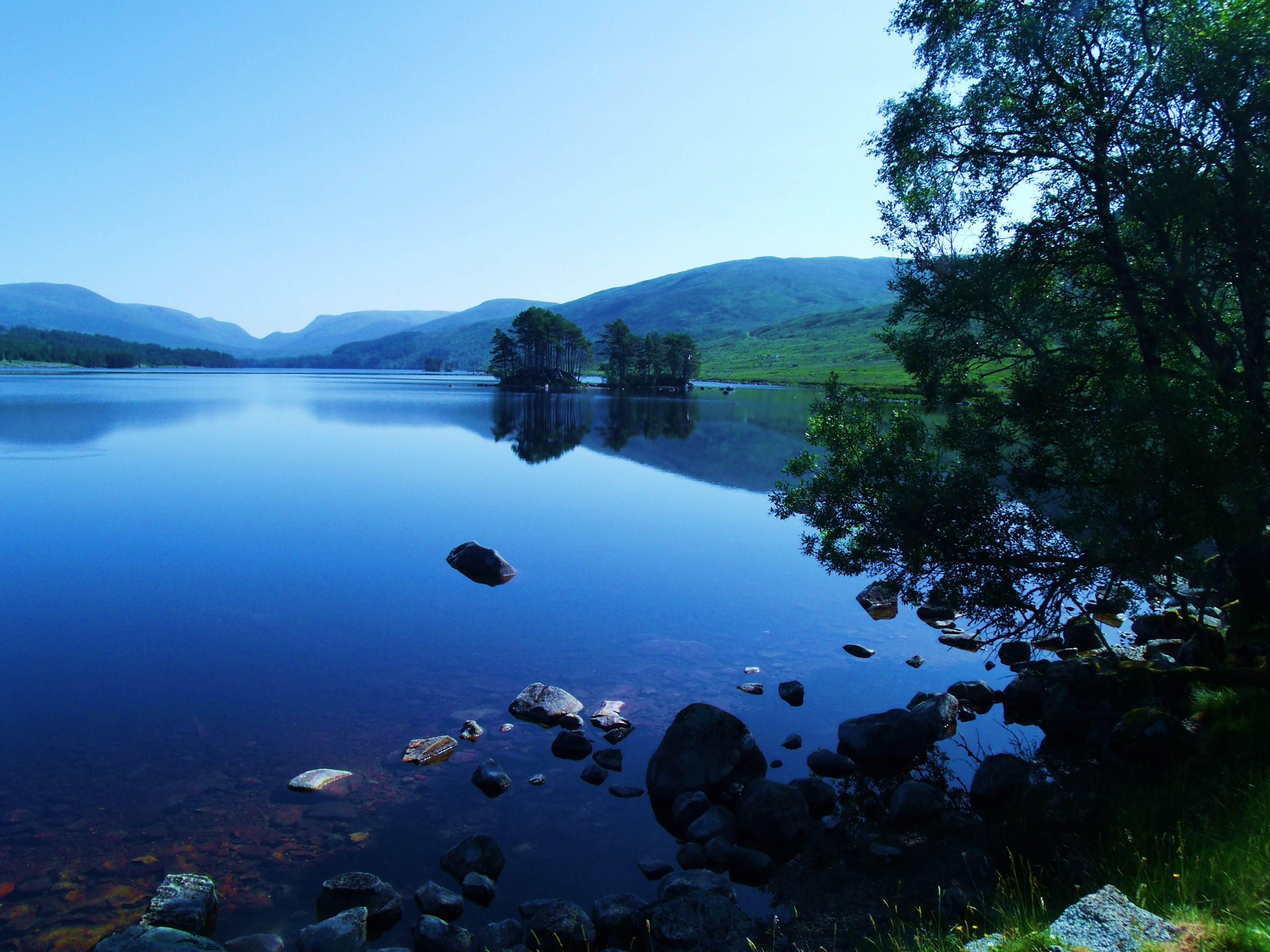
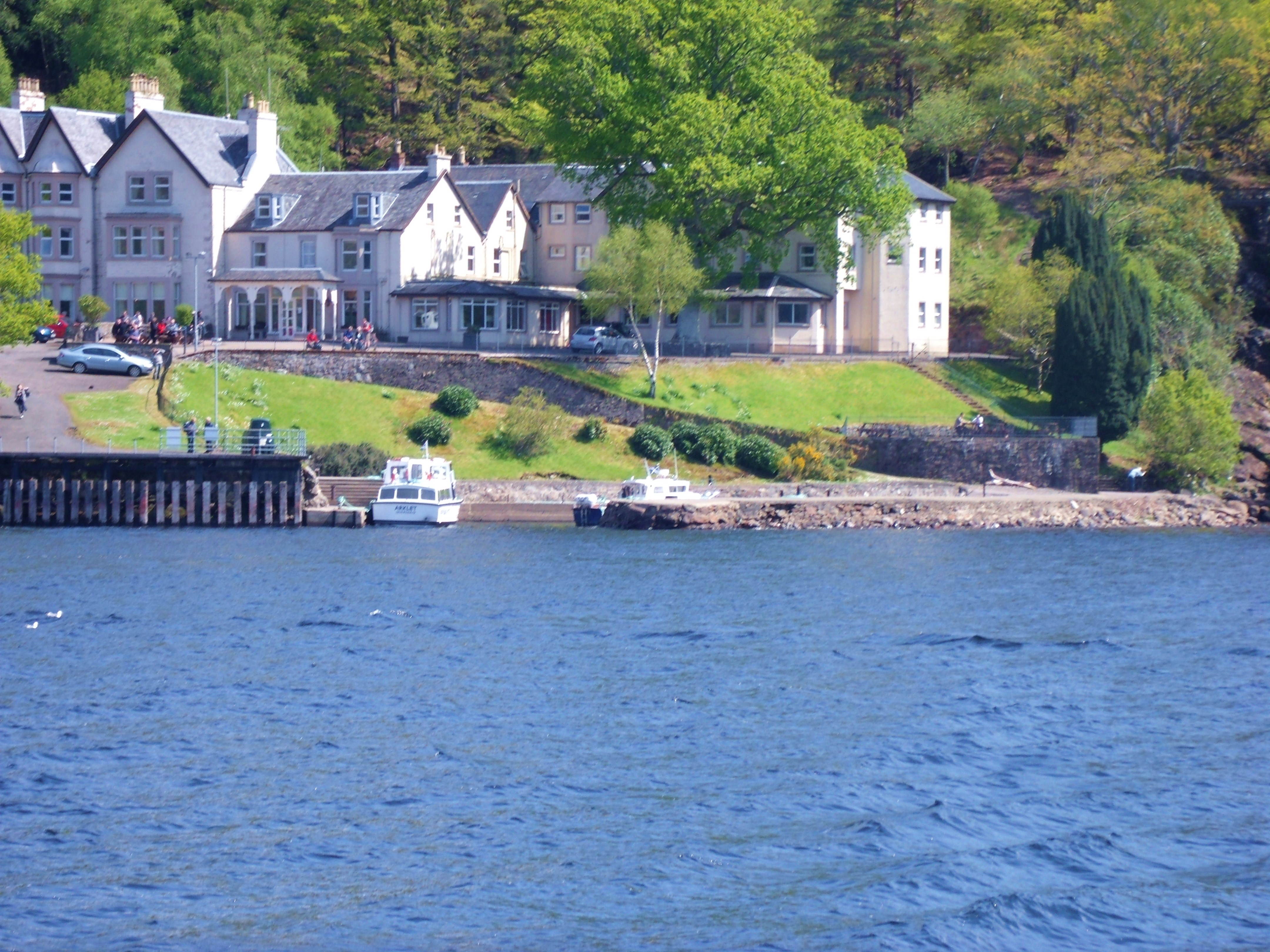
The only road through Glen Etive ends at the derelict wooden pier where once pleasure steamers from Oban brought tourists to sample the delights of the glen. Today, a new concrete structure allows the Forest Commission to move timber felled in the glen down the loch in order to access more large-load-friendly roads.
Old Pier on Loch Etive
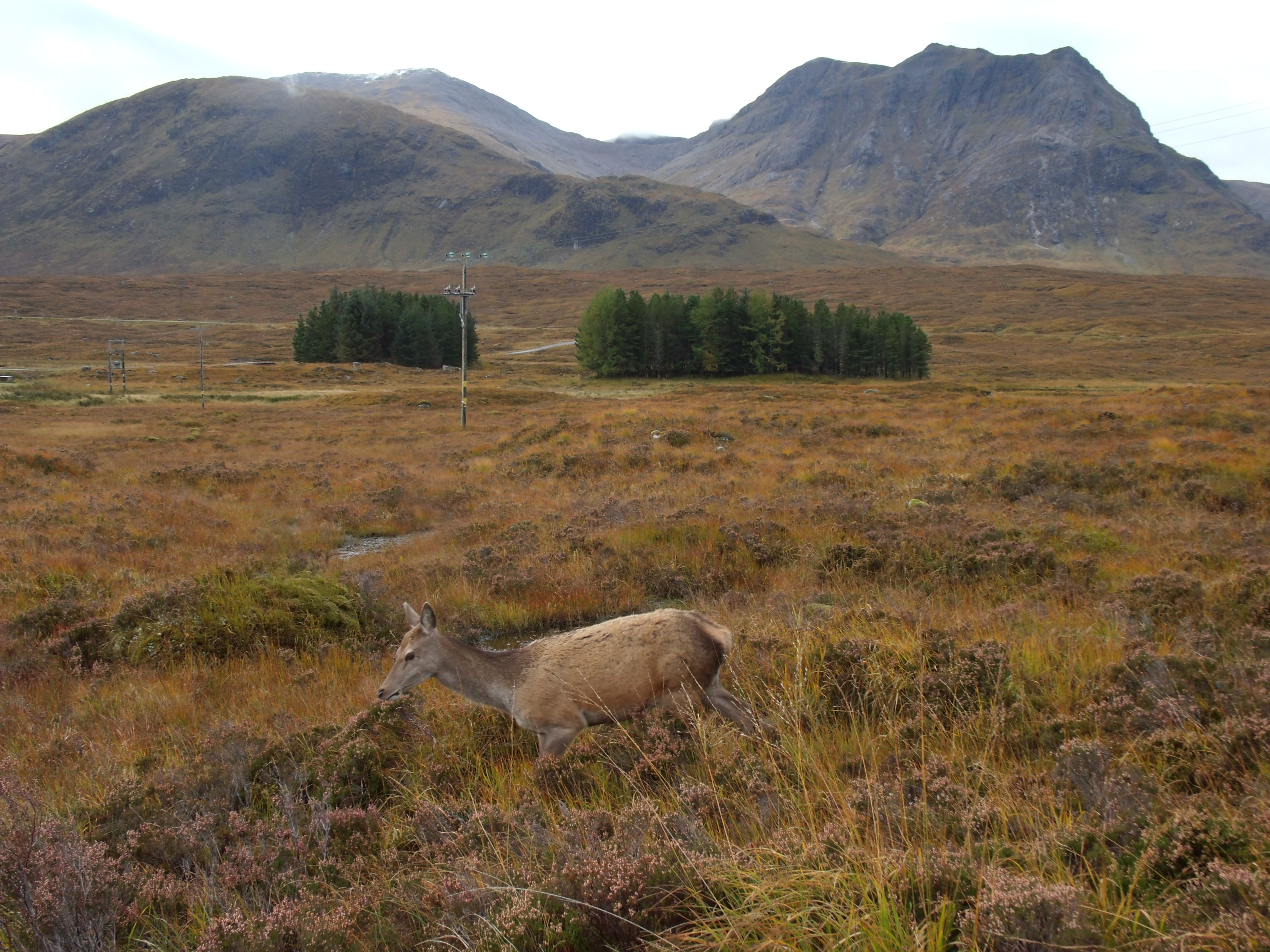
Stag in Glen Etive
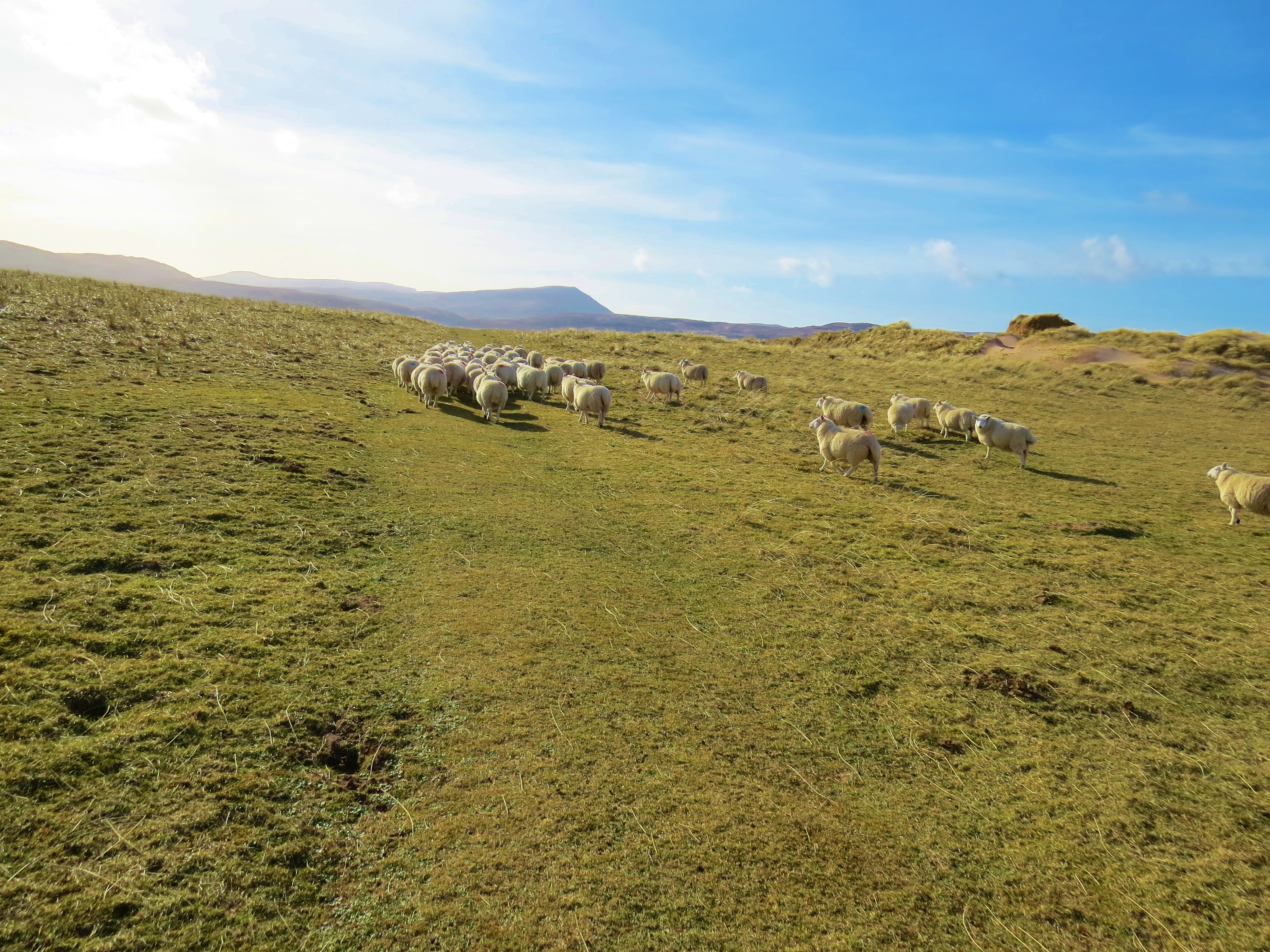
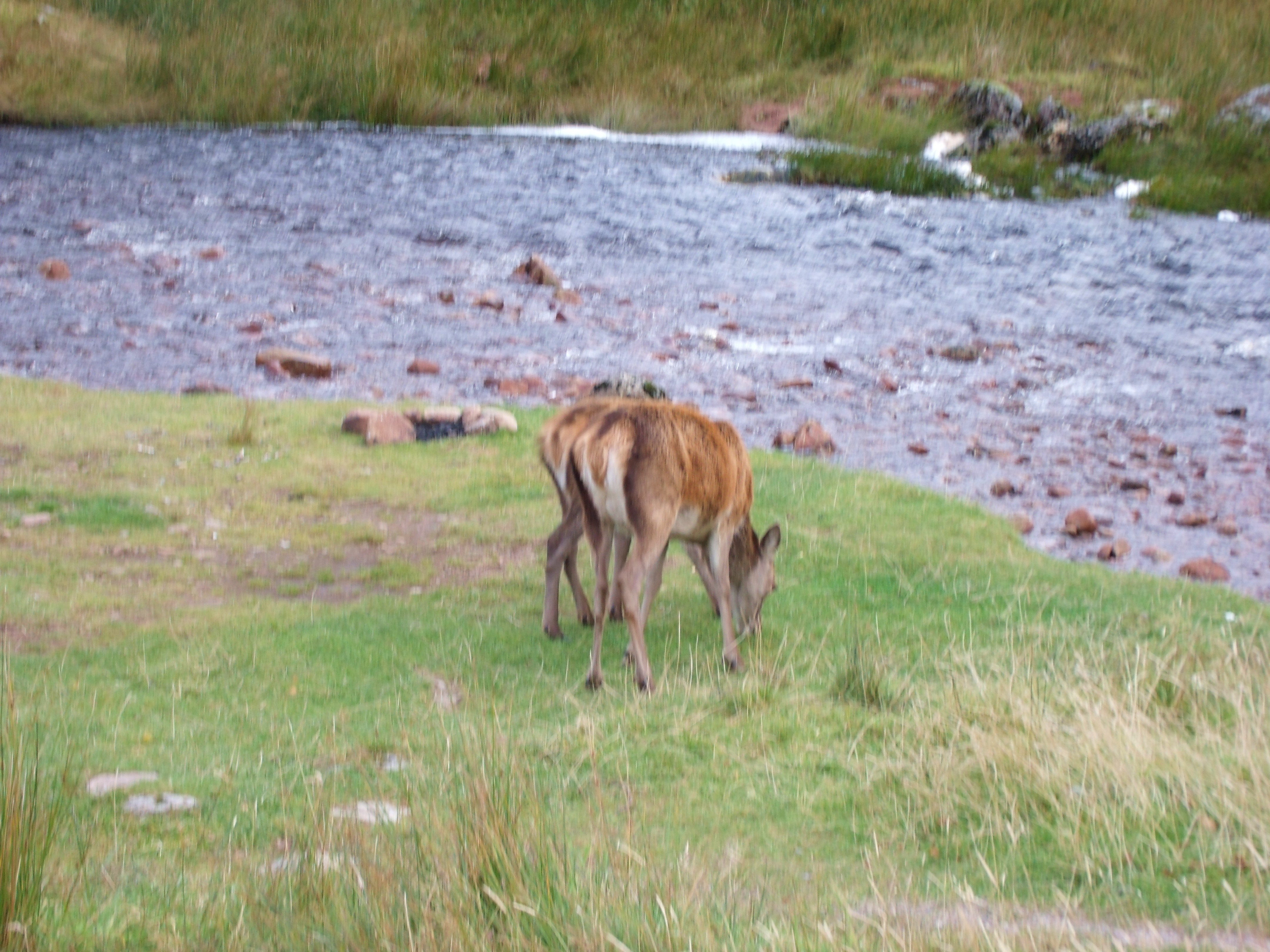
Deer can be seen frequently all over the glen as well as in the mountains. Only a handful are allowed to be hunted and killed each year. Tracking with a camera is fine.
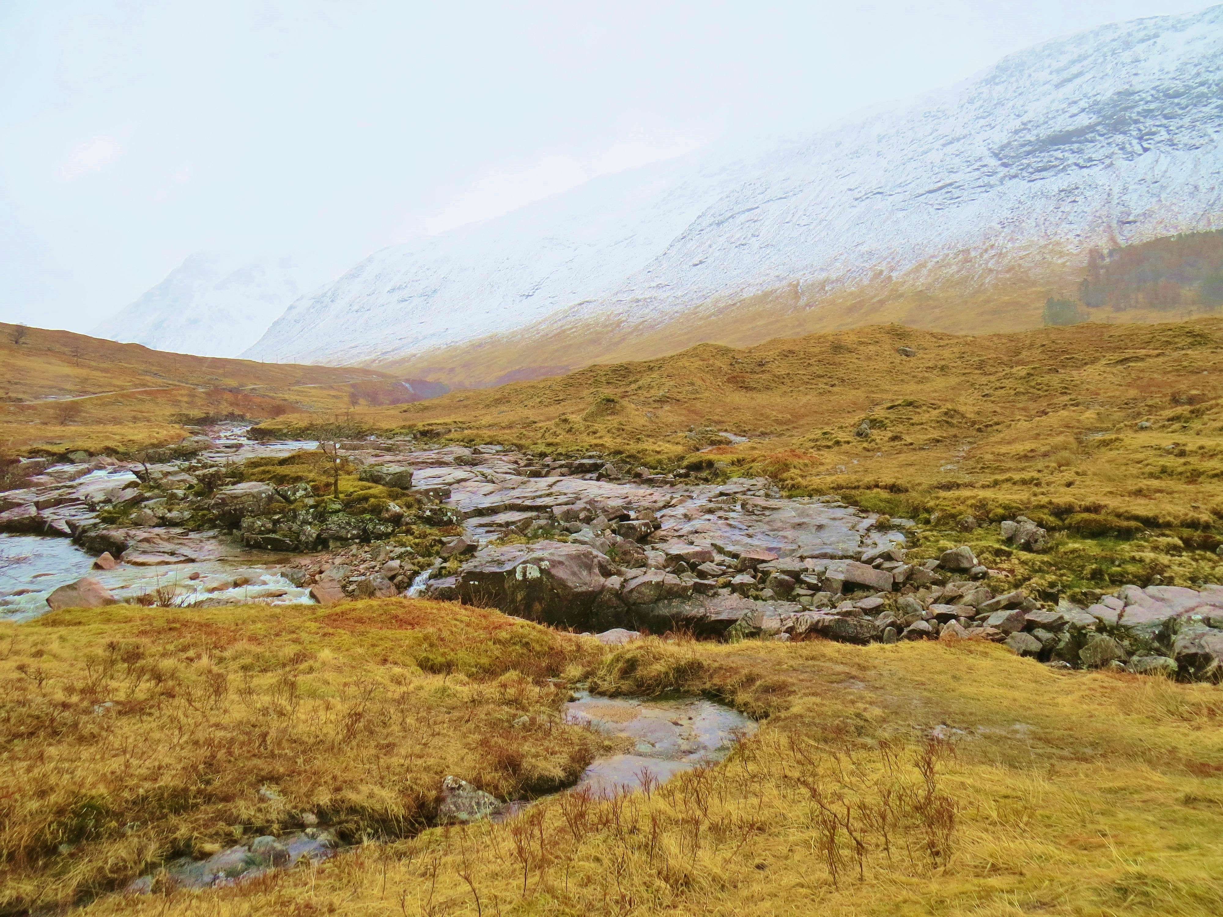
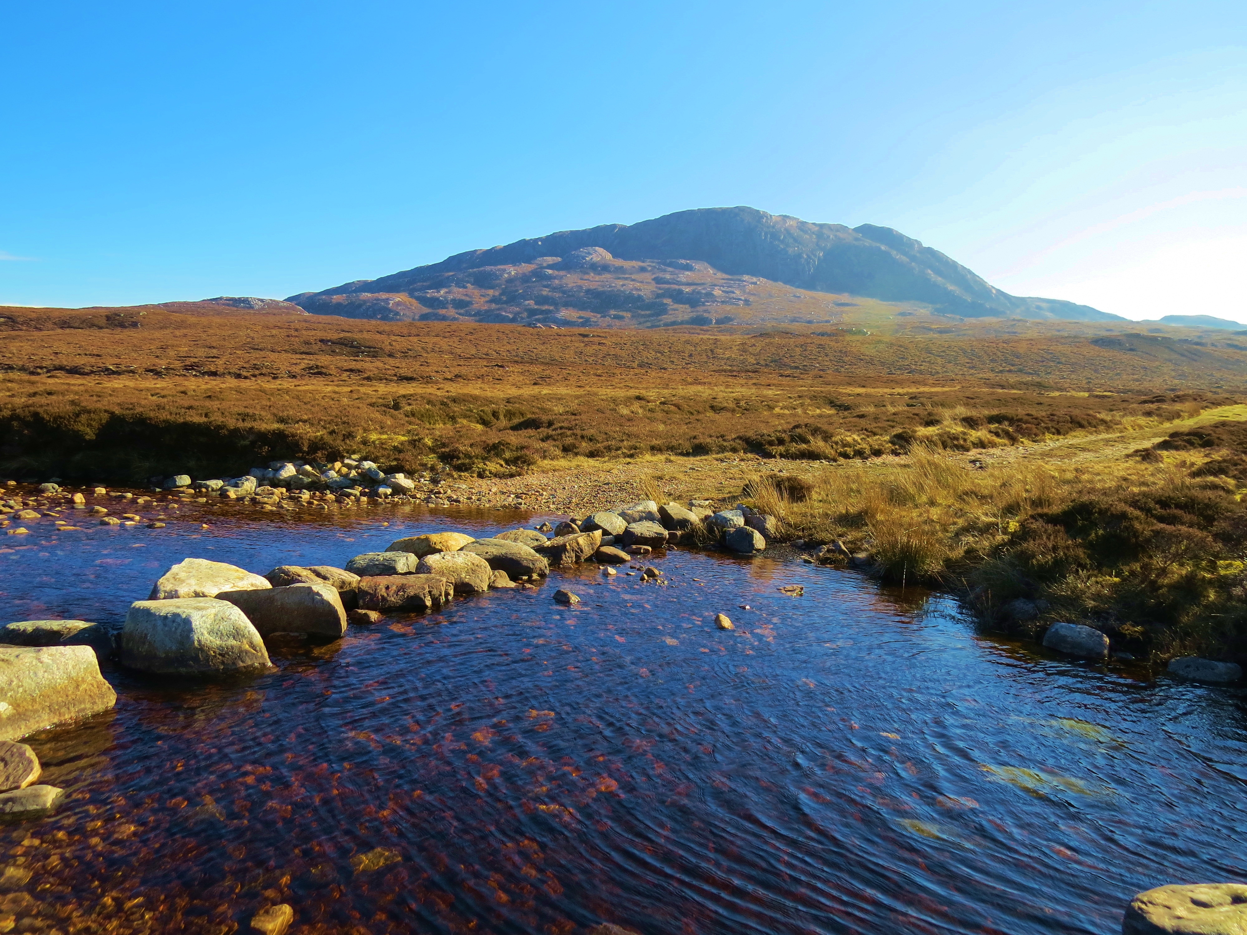
River Etive
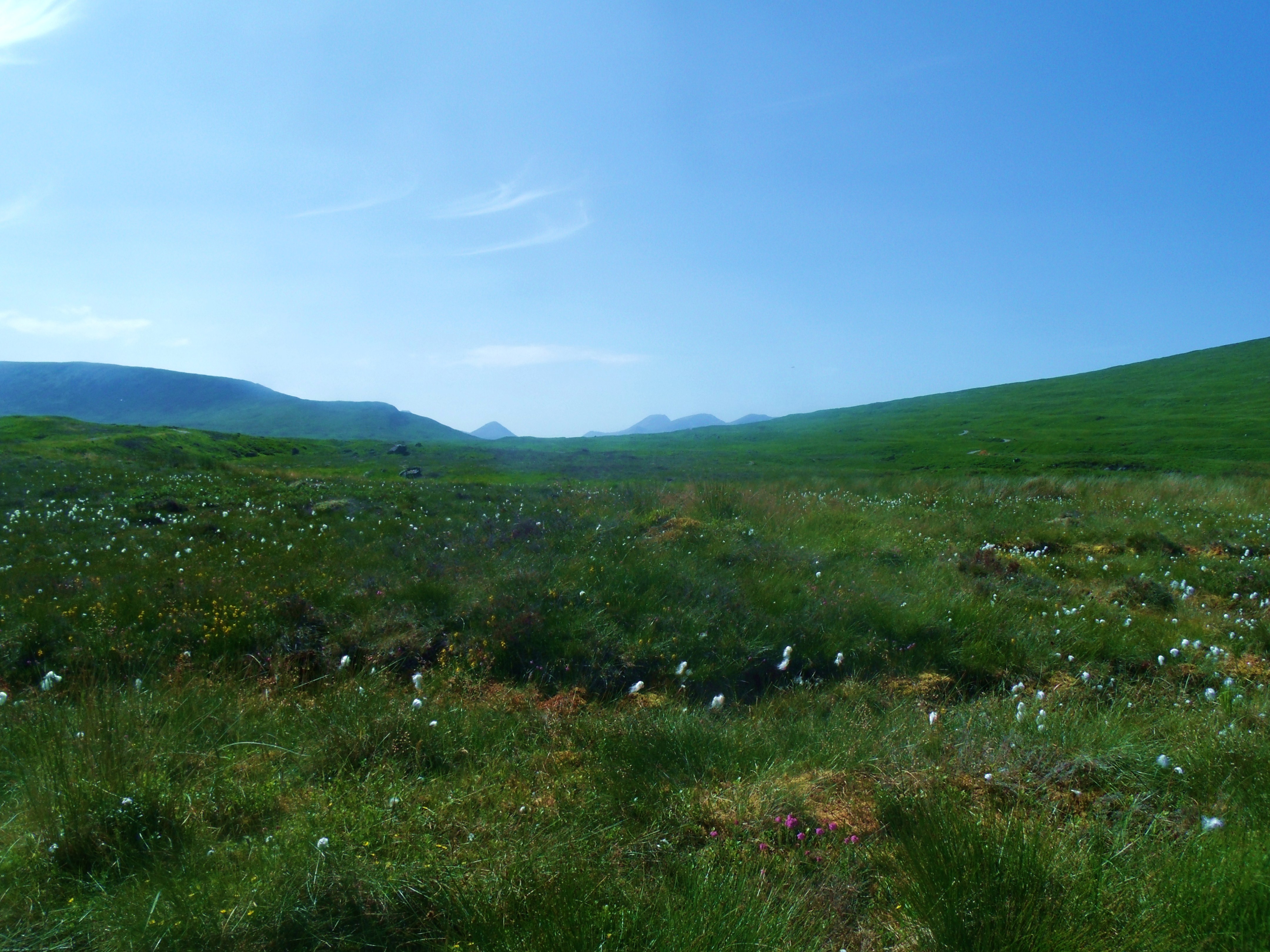
The River Etive, when it is in spate, is considered the best canoeing river in the U.K. It has its beginnings high on Rannoch Moor, starting as a rivulet running out of Lochan Mathair Eitive, (Little Loch, Mother of Etive) and soon joined by countless other tiny trickles and streamlets.
Lochan Mathair Eitive, Rannoch Moor
Rivulet on Rannoch Moor
So the trickle becomes a rivulet and then a stream, constantly increasing volume and speed until, by the time it reaches the Kings House Hotel, where the moor ends and the descent into Glen Coe begins, it has become a fast-flowing river.
Deer Beside the River Etive at Kings House Hotel
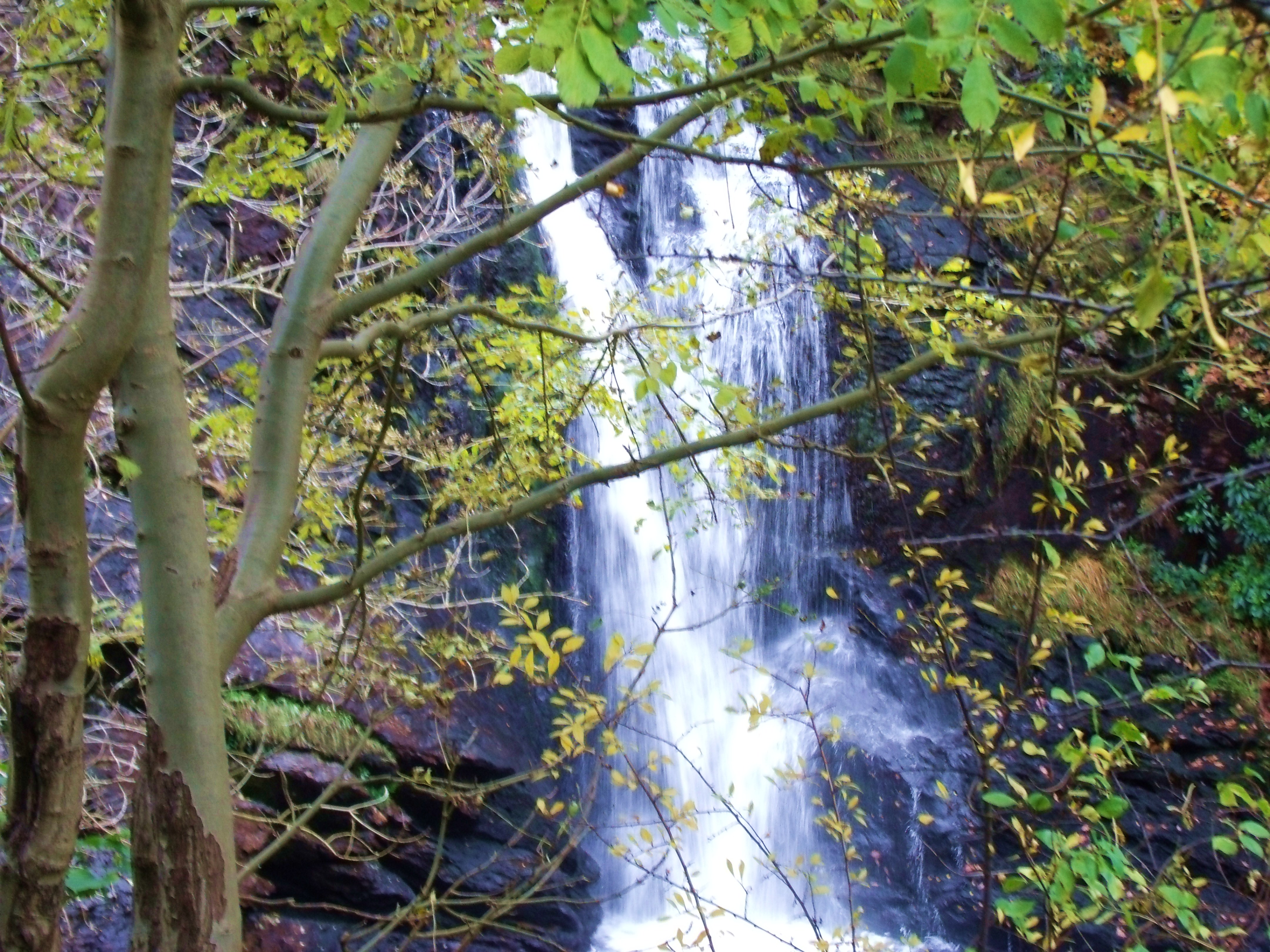
Instead of following the steep descent to the floor of Glen Coe, however, it heads North West around the base of Buachaille Etive Mhor, gathering speed as it flows through dramatic rock formations and tumbles in cascades and falls so loved by kayakers.
Late Snow on River Etive
Increasing Drama In River Etive
White Water on the Etive
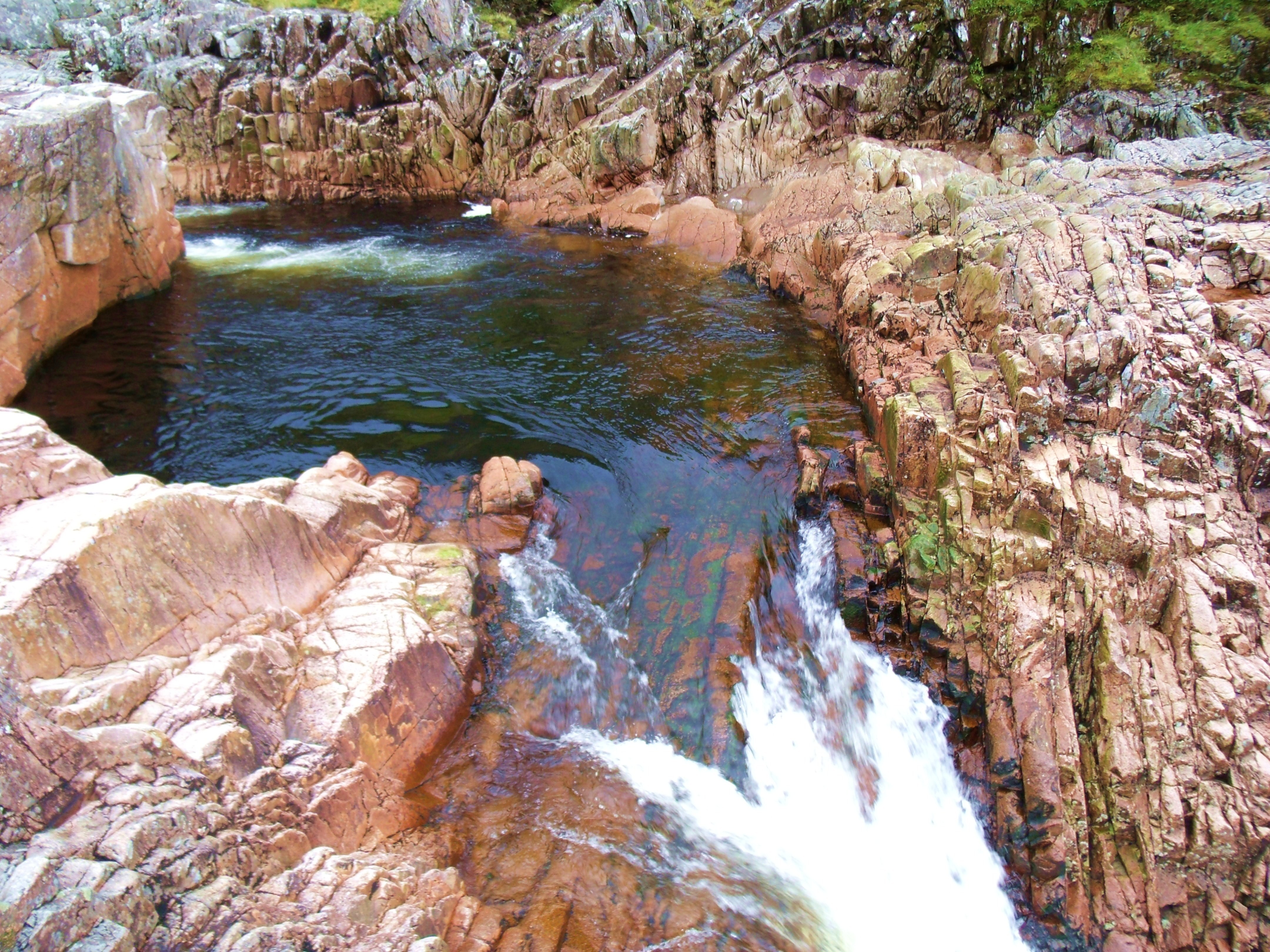
Beer Bottle Pool, River Etive
Right Angle Falls, River Etive
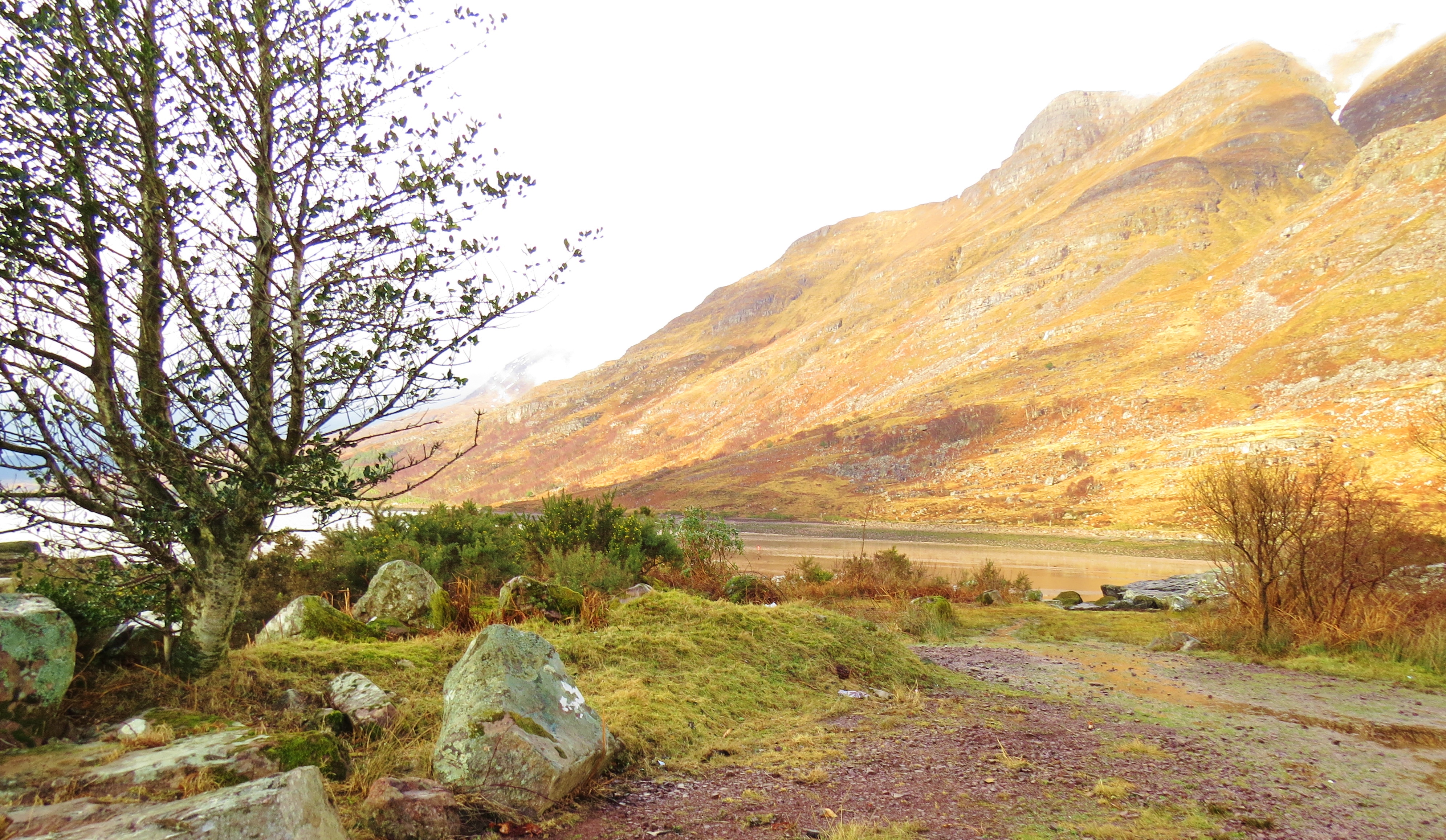
By the time it has reached the floor of the glen, Etive’s progress becomes more sedate. Punctuating the flowing water, deep, still pools create welcome fishing and swimming holes.
The Etive
Rain on the Etive
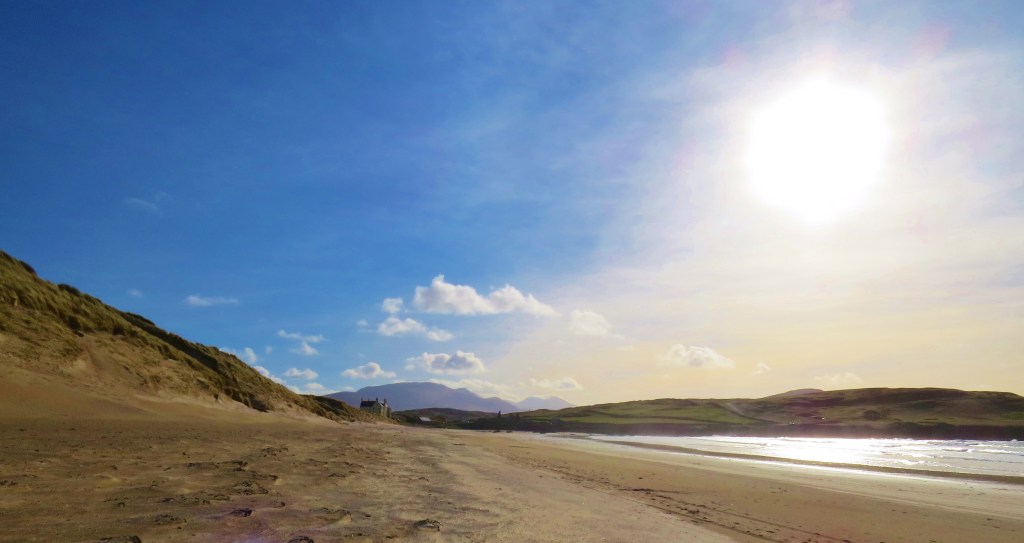
Sixteen miles from it’s beginning high on Rannoch Moor, the river empties into Loch Etive, from there to the Firth of Lorne and, eventually, with the ebb and flow of the tides, into the mighty Atlantic Ocean.
River’s End
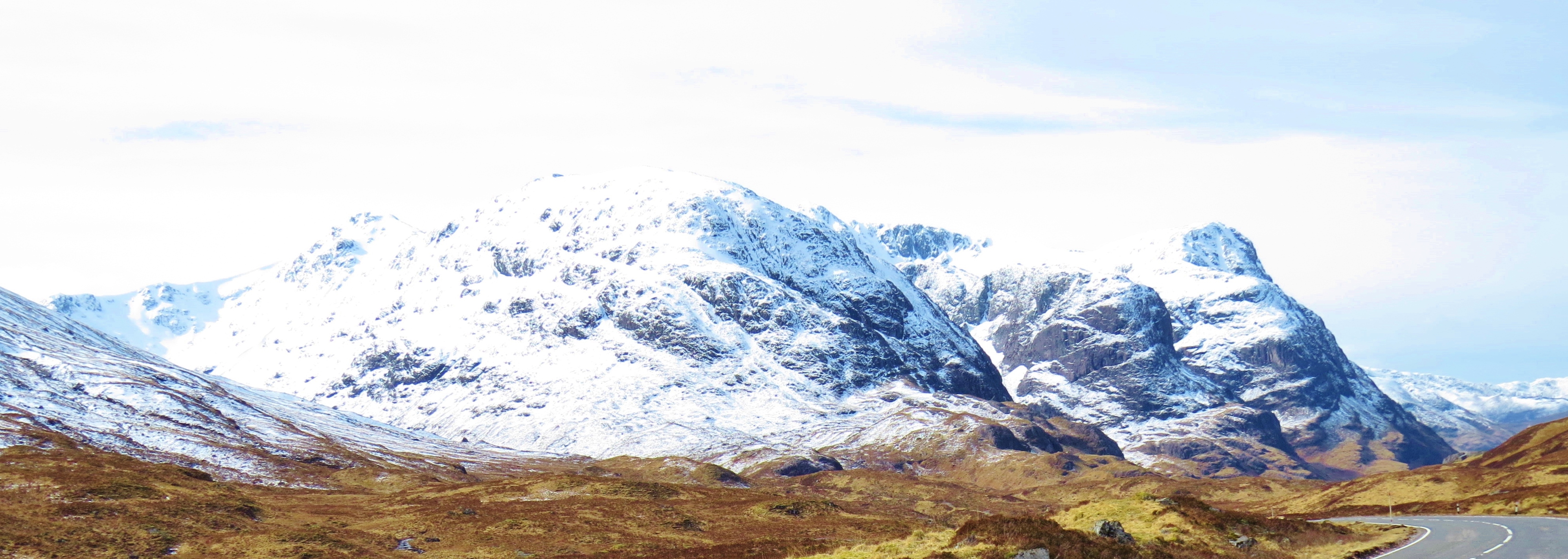
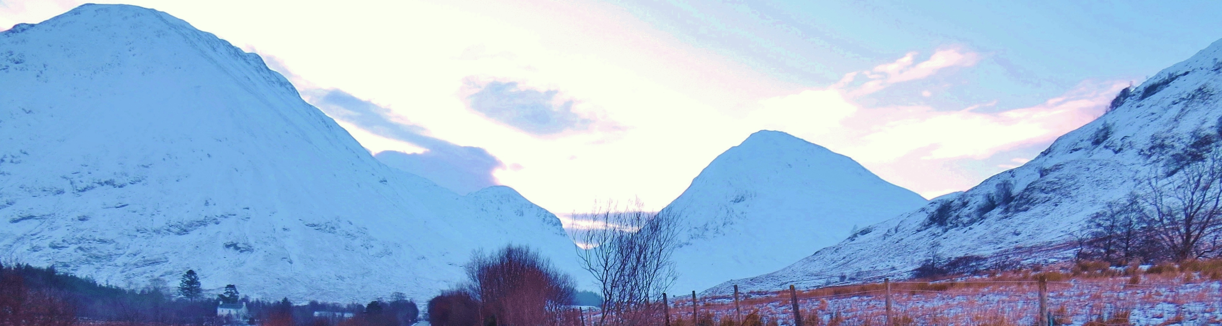
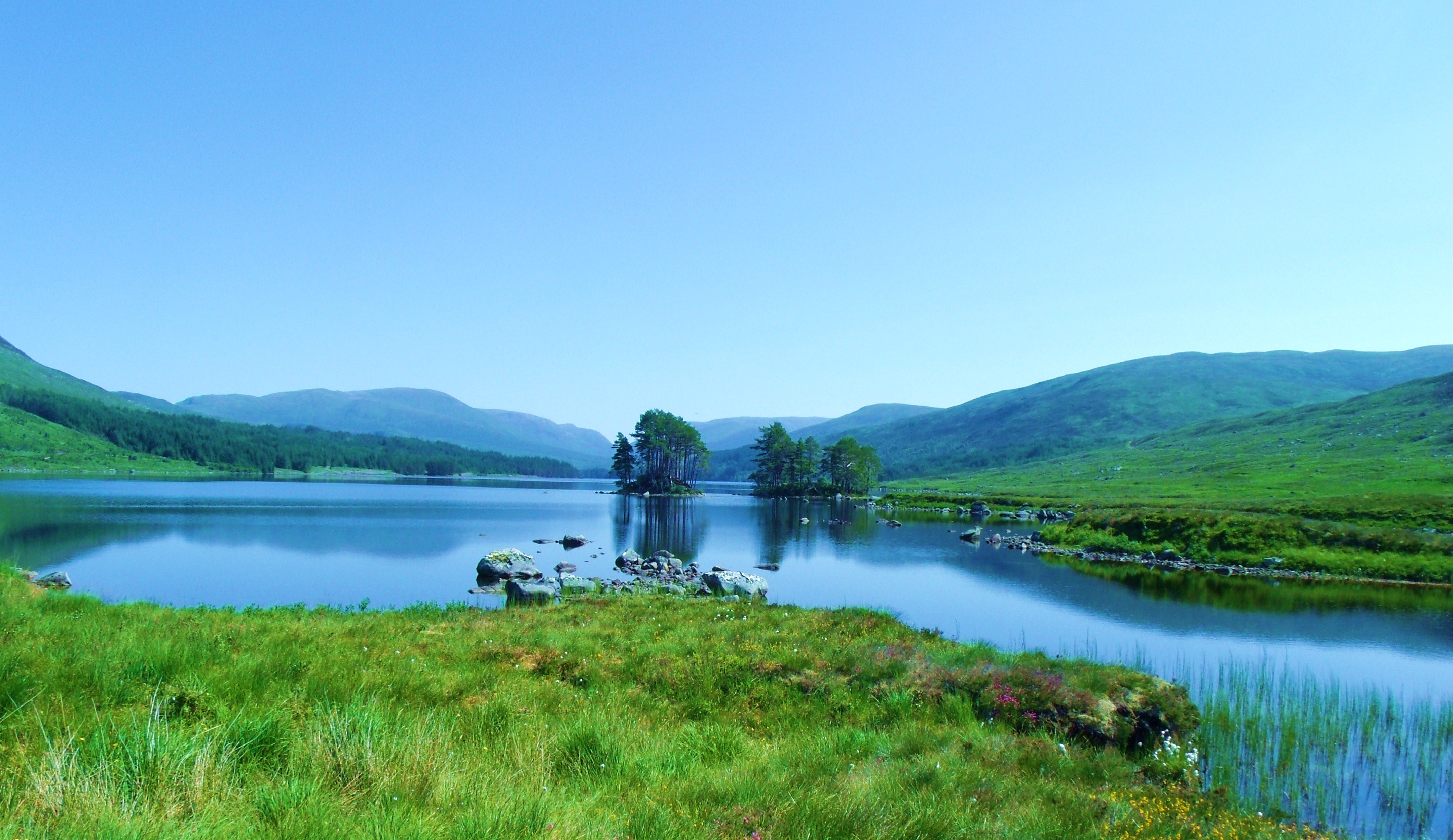
Although close to and geologically linked to world reknowned Glen Coe, until fairly recently, Glen Etive was a little known highland paradise. Now famed as the setting for several movies, including Skyfall, it attracts more visitors. For the most part, though, tourists, awe struck by the wild grandeur of Glen Coe, are still unaware of the unimagineable beauty on the other side of the mountains shared by both glens. The Three Sisters, and The TwoHerdsmen – Buachaile Etive Mhor (Big Shepherd of Glen Etive) and Bauchaile Etive Beag (Little Shepherd of Glen Etive) being the best known.
The Three Sisters From Glen Etive
The Three Sisters From Glencoe
On the right, Buachaille Etive Mhor and Buachaile Etive Beag at the top of Glen Coe
Centre, Buachaille Etive Mhor and Buachaille Etive Beag from Glen Etive
What appear to be two separate mountains on the Glencoe side, are actually twin peaks of one as seen from Glen Etive, The dip between the two summits creates a perfect mountain pass connecting The Great Glen (Glen Coe) with Glen Etive.
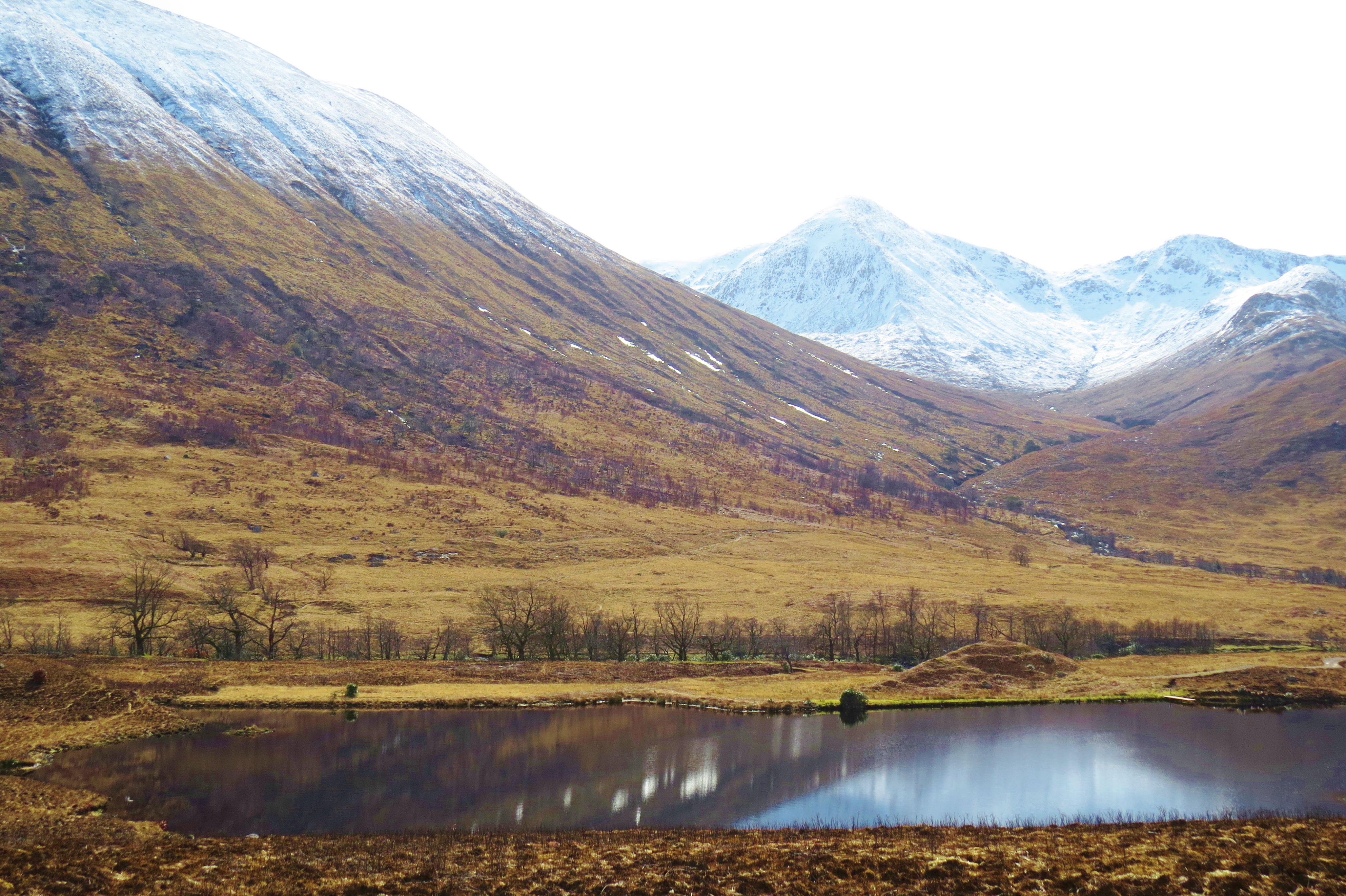
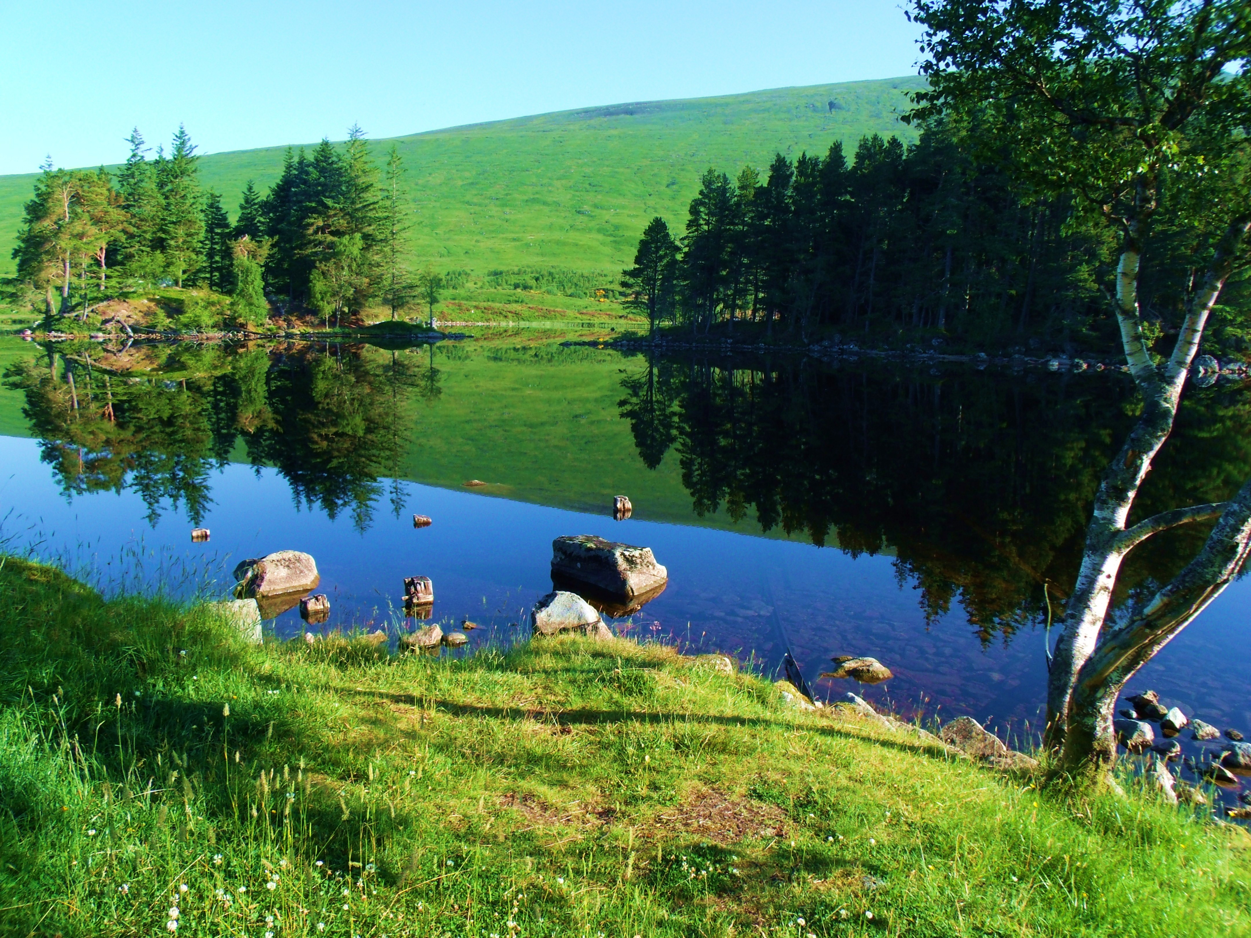
Lochan In Glen Etive
(A ‘lochan’ is a very small loch)
In the mountains of Glen Etive, the lochans are great places for anglers to catch both brown and rainbow trout. Those in the valley provide watering holes for the many deer that make Etive their home.
How to get there: The road to Glen Etive is just that. A one lane road turns left off the A80 just past the KingsHouse, around the base of Buachaille Etive Mhor. Running alongside the river for much of the way, it heads north west through Glen Etive, reaching Loch Etive fourteen miles later It goes no further.
Where to stay: Few could afford to stay in the scarce but costly accommodation in Glen Etive. The only option, short of camping, is to stay in Glencoe. Booking ahead at hostels or hotels is strongly advised as places are limited.
Note: To visit Glencoe without experiencing Glen Etive would be a serious omission. If, like me, you are on foot and short of a way to get there, contact Keith at Go Glencoe. He is a wonderful guide and accommodates groups or singles, taking on difficult mountain terrain, a leisurely photo safari, and everything in between.
A land of enchantment, Torridon is situated in Wester-Ross, the most westerly area of Ross-shire in the Western Highlands of Scotland. Although it is neighbour to Sutherland, the physical features of Wester-Ross are markedly different.
White Horses in Torridon
And now, a very short, magical video.
Torridon has the most dramatic scenery in the area and, while sharing the tragic history of Sutherland, there are unique and surprising historical episodes in Wester-Ross that haunt the landscape still.
Torridon At Low Tide
Torridon is situated at the head of salt water Loch Torridon, a sea inlet which washes the fields and grazing land at high tide, far inland from the sandy beaches exposed when the tide is out.
Sunbeams
Low tide
As well as sandy beaches, low tide reveals interesting stone formations and tide pools.
Tide Pools
While crops are few, grazing for cattle and horses is adequate, if not abundant. Unlike Sutherland and most other places in the Highlands, there are no sheep to be seen. Past history accounts for this.
Pasture
Like the rest of the Highlands and islands, Ross-shire suffered the ‘clearances’, a disgraceful episode in Scottish history when all of the Western Highlands and islands were cleared of people to make way for sheep. Land owners forcibly removed there tenants from the crofts they relied on for their existence, often herding them on to ships and transporting them to colonies, mainly Canada. Croft houses were demolished and sheep, believed to be more profitable, were brought in. Wester-Ross, particularly Torridon, endured some of the worst suffering. In 1831, the area, then a single estate, was purchased by a Colonel Burnet. This ruthless businesman had made his fortune by exploiting plantation workers in Jamaica. The details of his crimes against the crofters in the area is well documented by Steve Carter, Historian,suffice to say, thecrofters in Torridon were contained rather than cleared – crammed together in abject poverty, forbidden from keeping livestock of any kind and only allowed a tiny plot on which they could grow potatoes.
Farmland
For decades, this state of affairs continued until the estate was bought by Duncan Garroch of Gourock. This business man was also a philanthropist. He returned the land to the tenants; got rid of the sheep and replaced them with a deer forest; built walls and fences to keep the deer off the tenants land; allowed the tenants to keep livestock; encouraged them to harvest seaweed to use as fertiliser, a practice formerly forbidden; gave them access to peat bogs and even provided loans so they could buy livestock or build boats.
Geological Facts
Torridon Hillside
The area is a geological treasure, the red sandstone, at times overlaid with white quartzite being among the oldest rock in the world, some 250 millionyears old. The ancient red sandstone and white quartz are evident among the variety of rock types in the many mountains that ring this ancient basin.
Winter Afternoon
Available Accommodation
Torridon Youth Hostel
The many, many mountains surrounding Torridon make this a favourite year round getaway for serious climbers as well as scramblers, hill walkers and hikers. Kayaking and fishing also attract many visitors. The Torridon YouthHostel definitely deserves five stars. It is large, airy, beautifully furnished and has a warm, welcoming, relaxing vibe.
Rain Clouds
Walking to the local store from the hostel one rainy day, the silhouette of a street lamp prompted me to take the picture above. Along the way were several houses some of which, I think, offer Bed and Breakfast
For those wishing more opulent accommodation, the Torridon Hotel offers that and much more – and therein hangs a tale. Annat is divided from Torridon by the River Torridon.
Torridon From River
River Torridon
A bridge across the river connects Torridon and Annat. While Duncan Garroch owned the estate, he sold 59acres to the Earl of Lovelace. This acreage was a half mile or so from the river on the Annat side and here the Earl built Torridon House, now the Torridon Hotel, still surrounded by the beautiful landscaping laid out by the Lovelaces.
Annat
Torridon House (Now a hotel)
(I was prevented from getting a photo of Torridon House by the onset of a hail storm so got this one by an unnamed photograper from the internet.)
The Earl’s wife was Ava, the only legitimate daughter of Lord Byron, famous poet. Ava Lovelace, born in 1815, was remarkable in that she was a gifted scientist and mathematician who helped CharlesBabbage, the foremost mathematics authority of his time, create the Babbage Engine, the very first computer. Ava is credited with writing the first computer programme. The international ‘Ava Lovelace Day’ celebrates women in technology. She and the Earl lived in Torridon House until her early death in 1852. While Ava’s public life as a scientist and math expert are well documented, of her life and habits at Torridon House little is known.
Ada Lovelace
How to get to Torridon
Loch Torridon
How to get there: Take the earliest Inverness train from Glasgow. Change at Inverness and take the train heading to Wick. Alight at Strathcarron and get the minibus that meets the train and goes to Torridon. there is only one bus a day, so getting the earliest train is essential. Booking your journey in advance is recommended.
Note: For a comprehensive history of the area go to: Steve Carter’s web link in side bar – Torridon and Sheildaig– a historical perspective.
Trivia: According to Steve Carter, Historian, ‘Records show that QueenVictoria loved to travel the road between Torridon and Diabaig’.
Born of fire and ice, Glencoe is an area of mountains, hills, lochs (lakes)and glens (valleys). Volcanic action formed the wild, rocky terrain, with movement of the earth’s plates later crushing the rocky surfaces together to form rugged hills and mountains. At the end of the ice age, the huge glacier that sat atop what is now Rannoch Moor, moved, as it melted, gouging out Glen Coe and creating a network of valleys and depressions where lochs (lakes) formed. But along with the scientific facts and the geological history which produced the amazing results evident today, there is an undeniable, other-worldly aura about this place.
Loch Achtriochan, Glencoe
The shores of this fresh water, inland loch within the glen are littered with rocks of subtle colours, giving, even a snowy winter lanscape, the warmth to prevent bleakness.
Glencoe has a tragic, bloody history that adds to the air of eerie desolation often felt here and has earned it the title ‘Glen of Weeping’. In the winter of 1692, a massacre took place, during which, most of the Glen’s inhabitants were murdered as they slept, while others fled to the hills and died from exposure. It was a shameful act of betrayal and butchery against the Macdonalds of Glencoe, ordered by King William III, crafted by John Dalrymple, Master ofStair, and carried out by a member of the king’s army, Captain Robert Campbell of Glenlyon. Many people believe that the spirits of the victims still inhabit the Glen and can be heard crying and wailing, especially on February 13th, the anniversary if the slaughter.
Road Past The Three Sisters
(with Buichaile Etive Mor in the background)
That is not the only way Glencoe presents itself, however. It has many faces. I caught it in one of it’s rare, gentle moods. Most often it is known as a place of great beauty and grandeur, but mist shrouded, desolate and eerie much of the time. (See ‘Joyful Journey, Part 2’) For many, like myself, it is loved in all its moods.
Loch Leven
Loch Leven and the mountains of Glencoe
An inlet from the Atlantic forms the salt water, tidal, sea loch known as Loch Leven. It has a varied coastline, from wooded to slate-covered as in the photo above.
Loch Leven
Loch Leven
Loch Leven
Note: Due to icy road conditions, on this visit, I had to keep to roads more travelled. As a result, the photos contained in this report show mostly the edges of Glencoe. Once the back roads are safe and open, I will return to record the heart of the glen.
The floor of Glencoe has areas fertile enough to support a few crofts. (small farms). Arable land is in short supply but sheep graze on hillsides and grassy fields.
Glencoe Farmhouse
Glencoe is not known for its gentleness, however. At their worst, the hills and mountains are death traps. Weather conditions change without warning, the capricious nature of wind, rain and cloud seemingly bent on catching the unwary. Experienced climbers have perished, lost while challenging elements and terrain that draw them like magnets. Even the stubby, non-threatening-looking hills known as ‘The Three Sisters’ must be treated with respect.
The Three Sisters
Rannoch Moor
Glen Coe is situated beside and below Rannoch Moor, a vast, wild, ancient unspoiled area of peat bogs and lochans. Like the glen, closely attached to it both geographically and geologically, it is loved and hated. Desolate and threatening in bad weather, inviting-looking when the sun occasionally shines, always deadly for anyone trying to traverse it over anything but the one road and few pathways available – a glorious prehistoric adventure. (See ‘JoyfulJourney, Part 3′ for images and details of Rannoch Moor).
Close to Glencoe, at the Glencoe Mountain Ski Resort, modern activities prevail in the wilderness.
Skis
Glencoe Mountain Ski Resort
Glencoe from Rannoch Moor
Deer on Rannoch Moor
Cairn on Rannoch Moor
While Rannoch Moor and Glen Coe are almost devoid of creature comforts, the surrounding area has a fair supply of accommodation and facilities.Glencoe village boasts a shop, café and several assorted businesses.Two hostels cater to the outdoor types while a hotel at Glencoe Village offers more luxurious quarters.
Glencoe Village
I stayed in Glencoe Independent Hostel’s cosy wood cabin and highly recommend it. Apart from the hostel, there is a sleeping barn, cabin and several caravans to choose from. The business is owned by a delightful young couple, Keith and Davina Melton who maintain a relaxed, welcoming atmosphere. Proprietor, Keith, also runs GoGlencoe, a guiding business. Without his help I would have been unable to take the photos featured in this report. With his intimate knowledge of the area, he guided me to places I requested and others he recommended. He also drove me to the best viewpoints, given the icy conditions. I plan to go back when the back roads and lanes are clear to explore the heart of the glen, again, with the help of GoGlencoe.
Glencoe Independent Hostel
Cabin and caravans at Independent Hostel
The ski centre at Glencoe Mountain also has accommodation – chalets – and a good sized restaurant. It is open year round.
There is also a SYHA hostel, The Glencoe Youth Hostel, a short distance from the Independent.
The King’s House on Rannoch Moor which featured in Joyful Journey, Part 2, has changed hands since my stay there, so I have no knowledge of how the new owners operate.
How to get there: If you are using public transport, take the Fort William, Isle of Skye,citylink bus from Glasgow or Edinburgh.
The Isle of Skye, largest and most northerly of the Western Isles in the Inner Hebrides, is connected to the Scottish mainland by the Skye Road Bridge.As the crow flies, Skye is only 50 miles long but has over 400 miles of shoreline. The population is around 10,000. For such a small area, the island landscape is amazingly varied.
At the South of the island, Brittle Beach, pictured below, lies on the edge of Glen Brittle, an area of gently rolling hills, moorland and pasture in the shadow of the Black Cuillin, a rugged mountain range that rises straight out of the Cuillin Sound, in the Atlantic Ocean.
Night Falling on Brittle Beach
Fading Light on Brittle Beach
Near the north entrance to Glen Brittle, the landscape dramatically changes to wild moorland, across which runs the River Brittle, from its source below the Black Cuillin.
The River Brittle
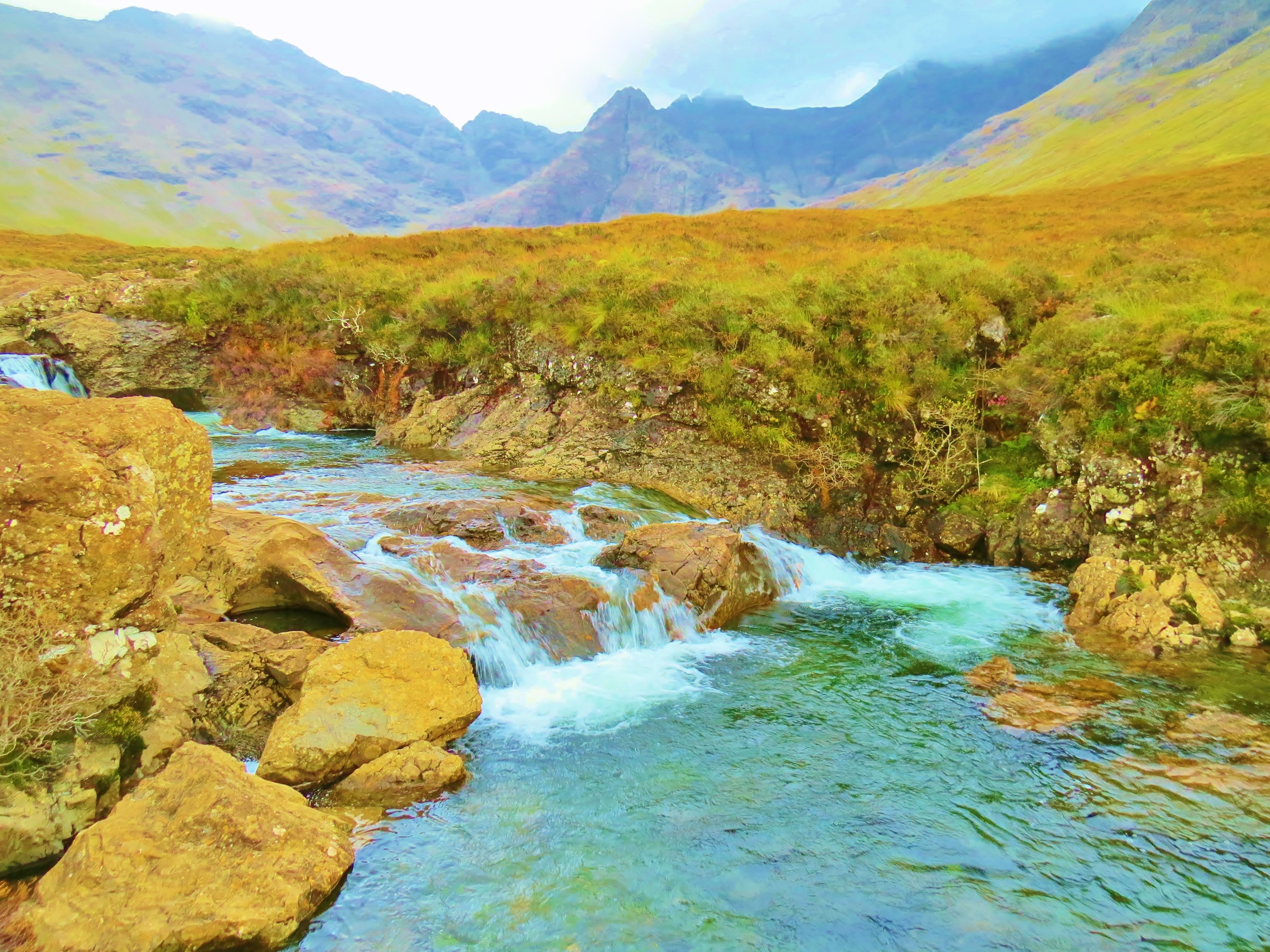
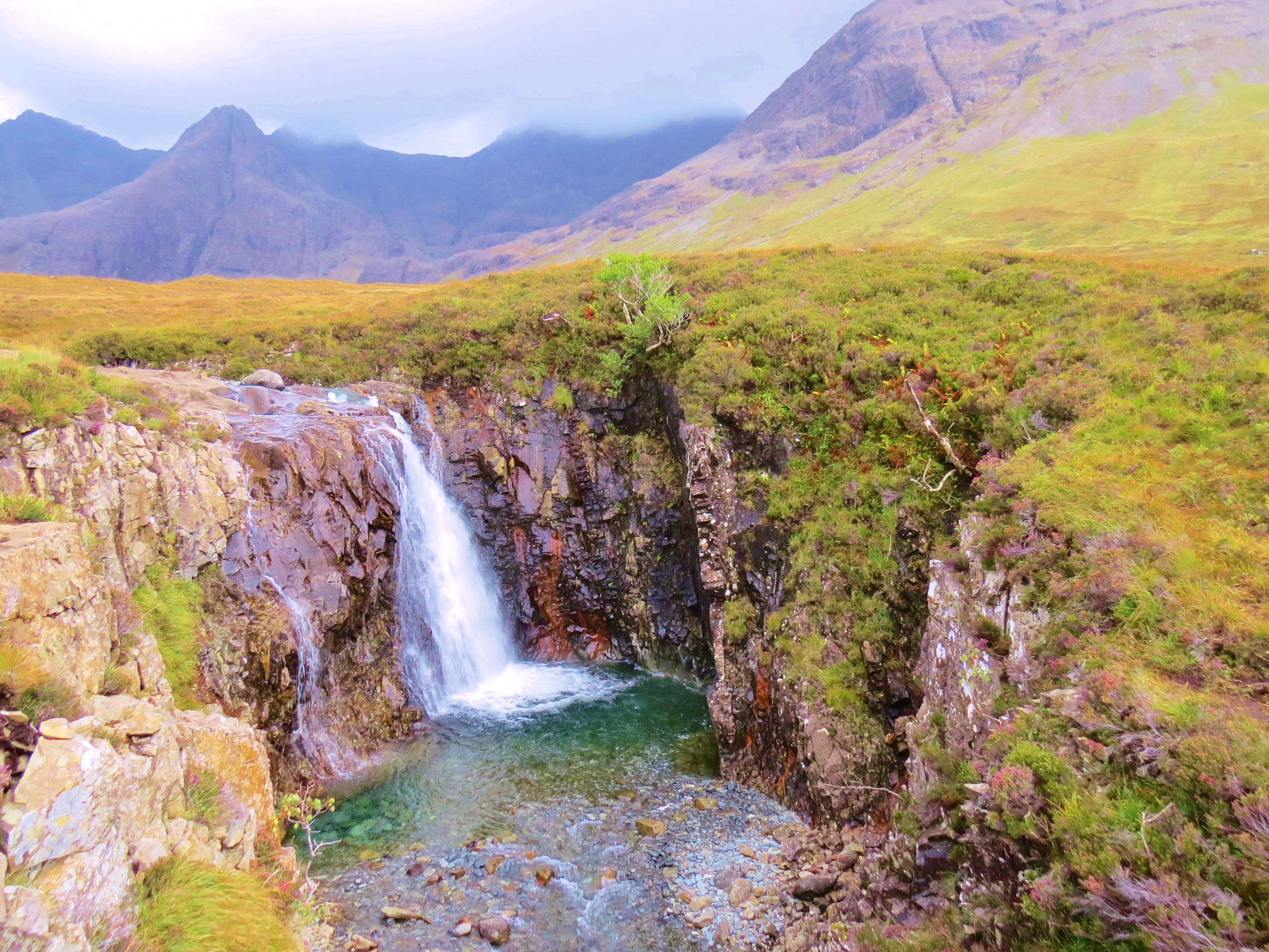
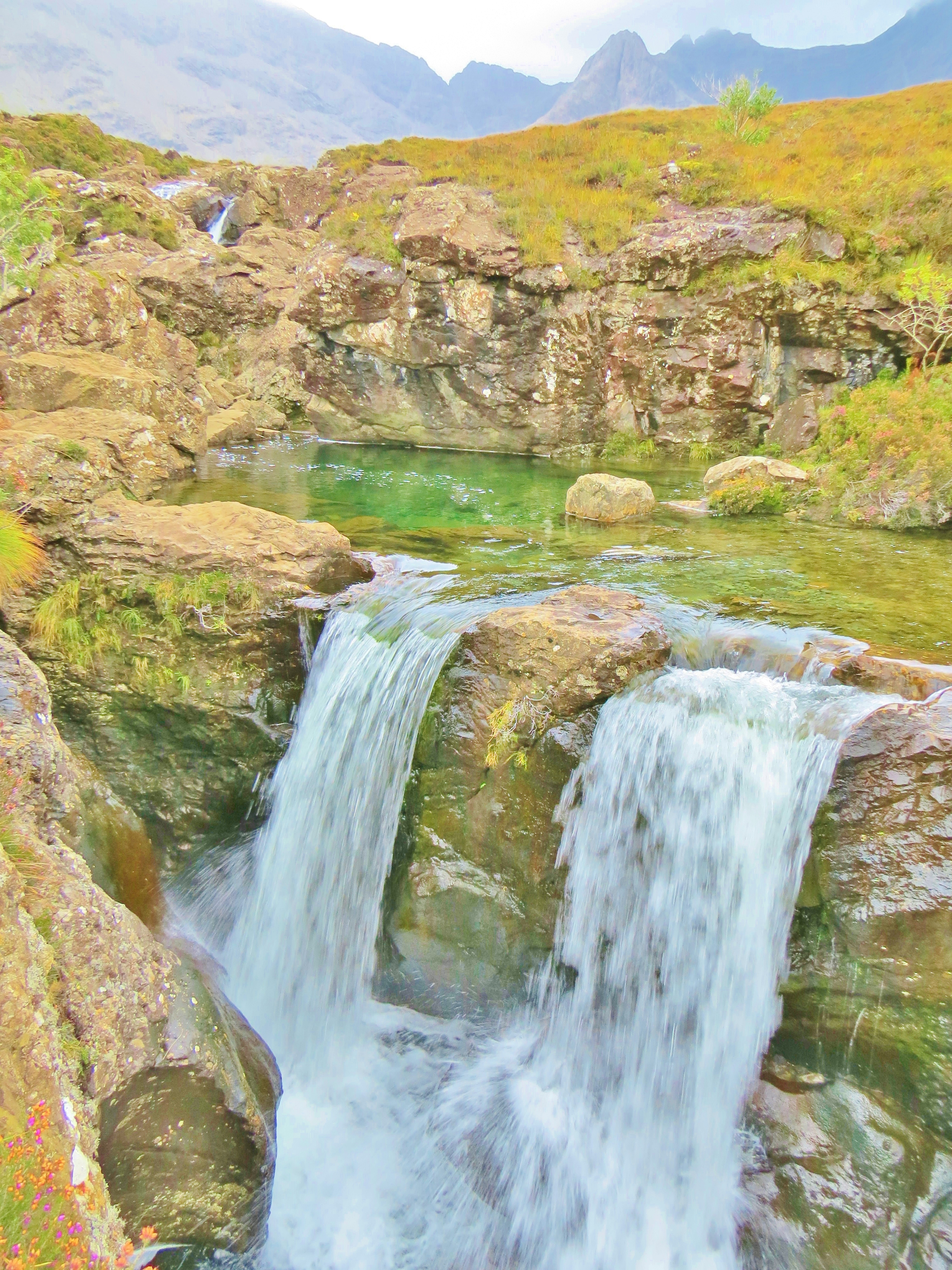
Hidden in the foothills only a short distance from Brittle Beach, is a wonderland of waterfalls, cascades, rocks and magical looking pools. The ferrous oxide (iron) that oozes from the rocks into the water, along with the variety of rock types, gives brilliant colour to the water. This area is well named, The Fairy Pools.
It was late on a cloudy day, in fading light, when the photos of the pools were taken, but, even so, the place looks truly magical.
River Brittle and the Fairy Pools
The area is called Fairy Pools because, in island lore, this magical place is home to fairies, those tiny, mystical entities, who, Celtic people believed, frequent the world of mortals and must be respected lest they use their magical powers to wreak havoc. It is difficult to be in the Western Highlands of Scotland and not find oneself being made into a believer. There is an other-worldly, mystical air in so many places. On Skye, the Fairy Pools is one such.
On a more down-to-earth note, the question of whether or not public swimming is allowed in the Fairy Pools, is often asked. The answer to that is, ‘Yes’. The ‘Right to Roam’, a long-standing Scottish tradition of unhindered access to open countryside, was formalised by a law enacted in 2003. The Land Reform (Scotland) Act spells out which activities are legally permissible to the public on countryside locations that are privately or State owned. It is a long, comprehensive list including swimming – allowed; fishing (without a permit) – not. (Private gardens and some special exceptions such as Ministry of Defense property are off limits, as are farmlands where crops are planted.)
Gathering Clouds on the Black Cuillin
The Black Cuillin creates a dark, brooding, rugged background to the contrasting light, colourful cascades and mirror-like pools. Though not as high as many other mountain ranges in the world, they are challenging nevertheless. At a little over 3,200 feet (975 metres), the weather conditions in the Highlands make traversing the 8 mile long range, or climbing the jagged peaks, an exercise fraught with danger. Gaping gullies will swallow the unwary, or loose scree send them hurtling downwards. Sudden changes can reduce visibility to zero without warning. The Black Cuillin earns the respect it is given by climbers and ‘scramblers’ (those using only hands instead of ropes on the less challenging areas.)
Looking across Loch Fala towards The Storr and the Old Man of Storr
In the north of the island, the Trotternish Peninsula provides some spectacular, varied and unique scenery. Running up the length of the peninsula is a spine-like escarpment known as the Trotternish Ridge, a series of steep hills including thirteen peaks, the highest being part of The Storr. The Storr is a series of rocky peaks, the best known of which is The Old Man of Storr, a basalt, needle-shaped column that affords a challenge to climbers. It was not scaled until 1955. At only 719 metres (2,358 ft), what it lacks in height, it makes up for in level of difficulty.
The Trotternish Ridge
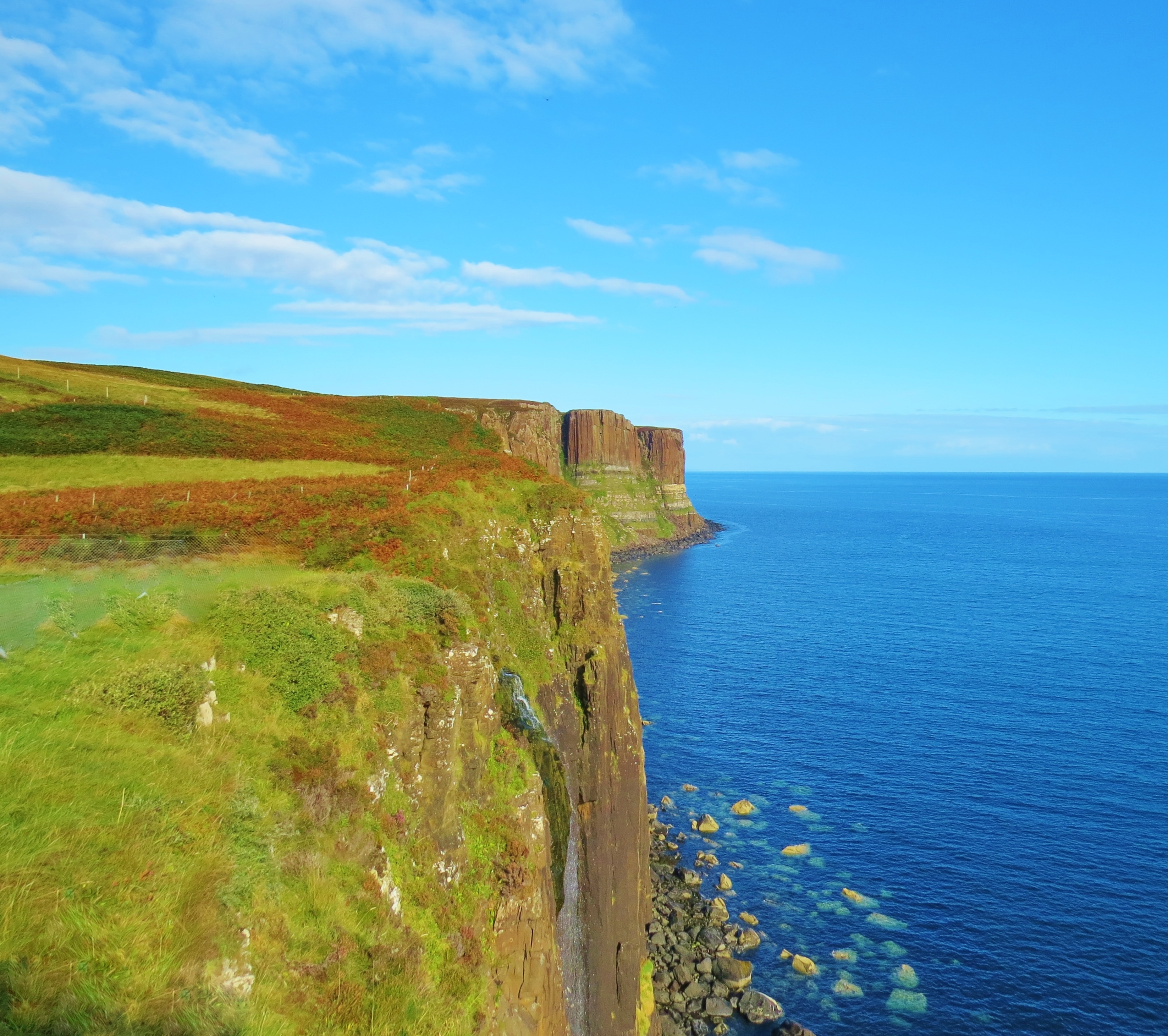
A short distance from the ridge, red coloured doleriterock forms cliffs and columns along the Eastern Coast of the peninsula.
Kilt Rock
Kilt Rockismade up of massive columns of dolerite giving it a pleated look, hence the name. The light coloured lines are evidence of ice sheets pushing across the sedimentary rock. This stretch of coastline affords panoramic views of the Isles of Rona and Raasay with Wester Ross on mainland Scotland in the far background.
Trotternish Coast, Skye
(Looking towards Rona and Raasay)
The unique, one of a kind Quiraing is also part of the Trotternish Ridge. This landslip area of peaks and gullies is made up of many layers of basilistic lava to a depth of about 800 m (2,624 ft). On the east side, the underlying sedimentary rock has collapsed under the weight, sliding downwards with a tipping sideways motion. The result is a somewhat bizarre looking landscape of pointed, grass-covered peaks and bowl-shaped valleys giving it the look of some alien planet.
Looking Northwards from the Quiraing
Looking Westwards from the Quiraing
The slipping of the land on the east side of the ridge continues today as it has done for eons. The evidence is seen at Flodigarry where the road has to constantly be repaired.
The Road up the Quiraing
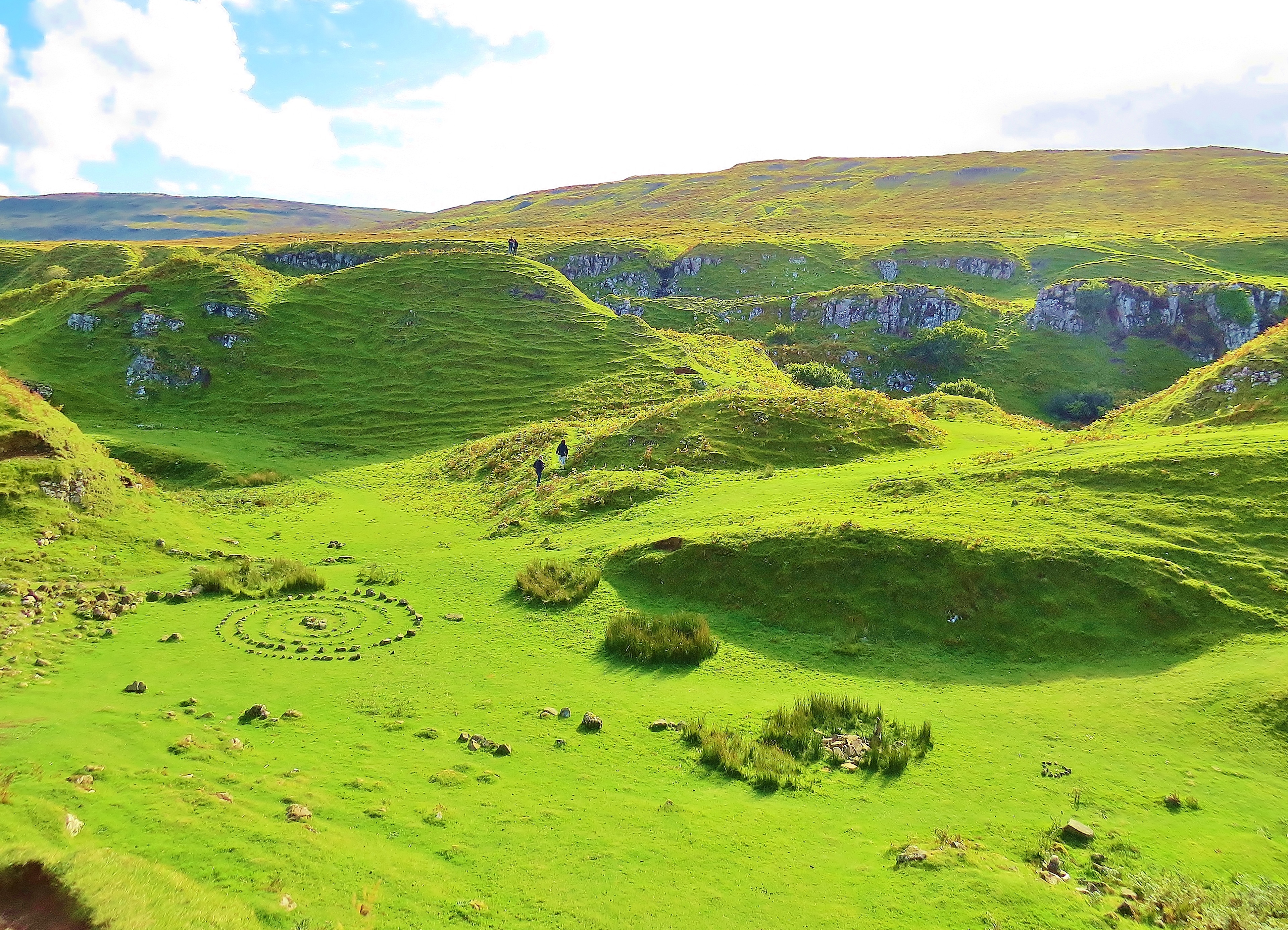
On the west side of the Trotternish Peninsula, near Uig, we once again find an area frequented by fairies, this time, the FairyGlen. This is a place which, like the Fairy Pools, is steeped in fairy lore. It, too, has a magical feel to it. Ask about the circles of stones and the only answer one is likely to get is that this is the work of the fairies.
The Fairy Glen
The Castle of the Fairy King
Watching over the fairy circles is, what geologists would call, ‘a basalt intrusion’, but is commonly known as ‘The Castle ofthe Fairy King’ or Euan’s Castle’.
In The Fairy Glen
West of the Trotternish is the Waternish Peninsula and further west still, as far as one can go, is Neist Point. There is a lighthouse there, but I was, unfortunately, unable to get to it, so contented myself with photos of the headland obscuring my view and the coastline nearby. This is MacLeod country and en route to Neist Point, the road goes through the village of Dunvegan. Dunvegan Castle, home of the MacLeod ‘chief’, is near there, but another place I missed.
Loch Dunvegan and MacLeod’s Tables
The Coast Near Neist Point
Neist Point
On the other side of this pointed headland is the lighthouse which marks the most westerly point of the Isle Of Skye. Across The Minch, the Outer Hebrides are visible.
Geology: The Isle of Skye is a geologist’s dream. The vast variety of rocks and minerals are well catalogued by both professional and amateur geologists as well as rock hounds. Google or any good search engine will provide reams of information if interested parties ask for ‘Isle of Skye geology’.
How to get to the Isle of Skye:Citylink buses run from Glasgow airport directly to Portree on Skye via the Skye Road Bridge. Trains from Edinburgh and Glasgow go to Mallaig. From Mallaig, a car ferry goes to Armadale at the South end of Skye. Good roads lead around the island.
Where to stay: There are a variety of accommodation types – hotels, B & Bs, hostels and camp sites. Portree is a small town that has two good-sized grocery stores, a post office and various other useful shops and services
Credits: The photographs of the Fairy Pools and the Black Cuillins were taken by Niall Palmer of Skye for lochsplus. They were edited by lochsplus. All other photos by lochsplus.
Durness is an area situated on the farthest North West coast of Scotland. Made up of several small hamlets and many crofts, it takes it’s name from the largest of the ‘villages’, Durness, from the Norse ‘Dyrnes’ meaning ‘deer headland’. Part of Sutherland, the least populated area in Western Europe, it is surrounded by landscapes of indescribable, unspoiled beauty, amazing in their variety. On one side, coastline, ‘some of Europe’s most isolated and spectacular’, on the other, vast areas of mountains, lochs and moorlands, streams and lochans, breathtaking in their wild grandeur.
Balnakiel Bay
There are several walks of varying difficulty that one can take to see and experience the area. I first took the road from Mackay’s Bunkhouse (a.k.a. ‘The Lazy Crofter’s Hostel) to Balnakiel Bay, arriving at the ruins of an ancient church located at the entrance to the mile long beach. The existing ruins are from a church built in the 13th century, but before that, the Culdean Monks had their house of worship on this spot. The tiny graveyard is still in use.
The Road To Balnakiel
Old Church
‘The church dates from1619, built on the site of an early medieval building. It was extended in1690 and remodelled in the 1720s.’ Opposite the church is Balnakiel House, built in 1744, former seat of Clan Mackay and home to the Chief’s eldest son, known as the Master of Reay, whose farm ‘was considered to be one of the most productive in the Highlands.’ It is a thriving sheep farm today. ( Courtesy ‘Durness Walking Network’)
Farmhouse at Balnakiel
House At Balnakiel Bay
Opposite the ruined church, at the end of the beach, is a house with a long history. Built in 1744 and now restored, part of the original walls are still intact. Back when Clan Mackay owned most of this area, the eldest son of the clan chief, known as the Master of Reay, had his residence here, from where he ran a thriving farm. According to Wikipedia, when Sutherland was part of the Bishopric of Caithness, the house was the summer home of the Bishop. Today, it is once again the nerve center of a thriving farm, with flocks of sheep grazing above the sand dunes. In this writer’s humble opinion,this is a more fitting use for this ancient place of such awesome beauty.
Keeping Company With Sheep
At one time in my walk, a flock of sheep mistook me for their shepherd, no doubt thinking I brought food. It took a while for them to finally realise it was not so. They left me then, and stoically went to look for pastures new.
Off To Pastures New
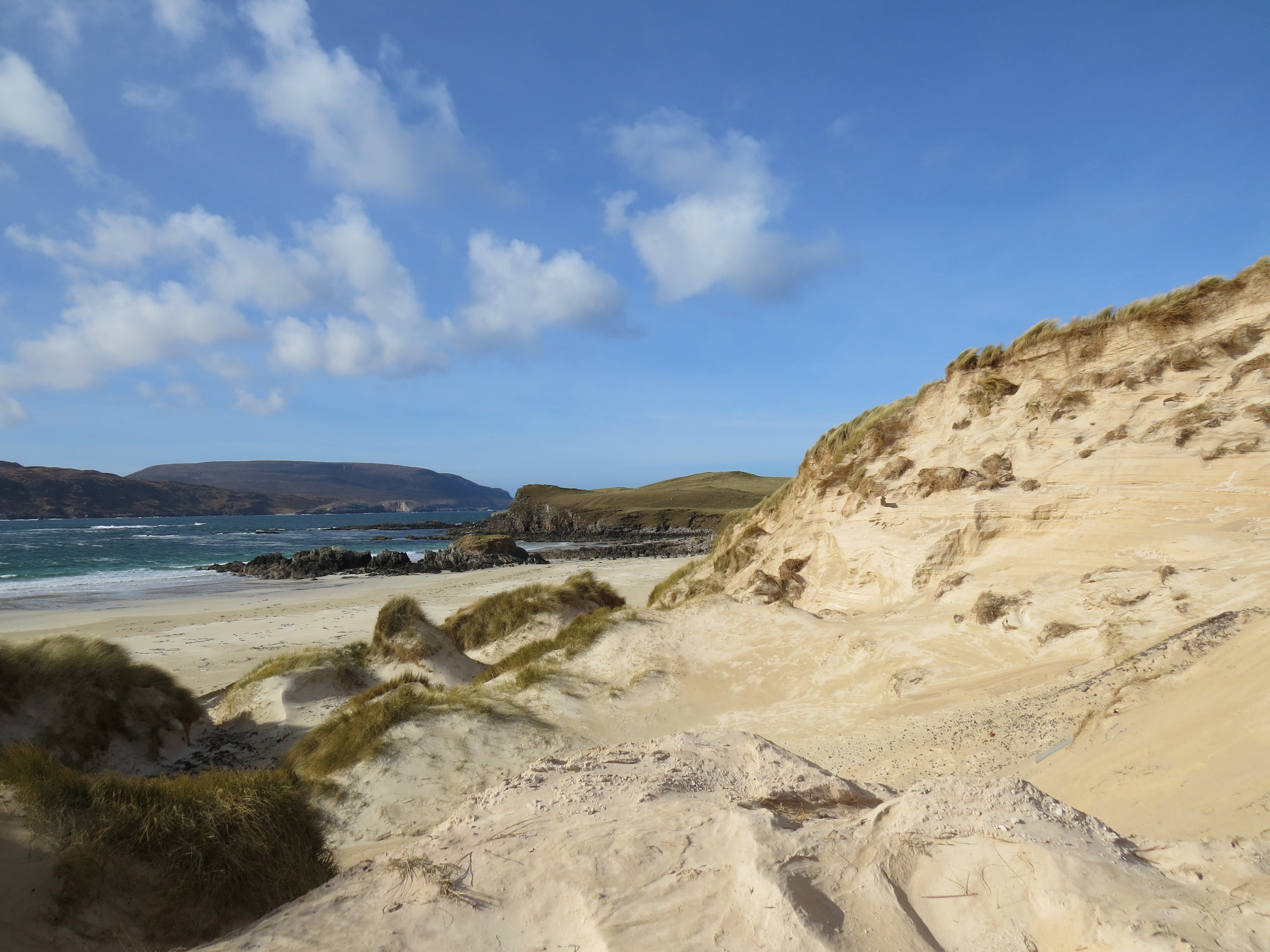
At the end of Balnakiel Bay, The track took me through a variety of sand dunes – one of Scotland’s largest sand dune systems with dunes up to 60 meters above sea level.
Sea Eagles over Balnakiel Bay
Dunes
A few years ago, the body of a young Viking boy was discovered at Faraid Head. Erosion of the dunes exposed this long held secret.
Looking Towards Faraid Head (About 2 miles North)
Having reached the viewpoint I wanted, I was faced with the choice of walking along the cliff tops, following the coast back to the hostel in Durness. That being a rough route, I opted to return the way I had come. The round trip was about 8 miles pretty easy walking.
Two Lochs Walk
On my second walk, I headed East, away from the coast. I passed several crofts outlying the village, and after 10 minutes or so, found myself in a completely different world, surrounded by moors, mountains, rivers, lochs and lochans. Loch Caladail is reached soon after leaving the last croft in the community. Though not as scenically spectacular as the second on my hike,Loch Meadaidh, this one is favoured by fishermen. As a result of more alkaline water, Loch Caladail has more abundant and bigger fish, the large brown trout being particularly prized by anglers.
Loch Caladail
Heather Covered Moorland
It was early March when this was taken. The heather, brown then, will look very different later in the year. Three different varieties of heather, differing in colour, bloom at different times, giving an ever-changing look to the landscape.
Heather Covered Moor and Lochan
Loch Meadaidh
After two miles or so, I came to the awesomely beautiful Loch Meadaidh and shortly thereafter, the stepping stones over Smoo Burn. A ‘burn’ being the Scottish word for stream.
Smoo Burn (Stream)
The stepping stones lead to a track used by hill walkers and mountain climbers en route to wilder terrain a short distance further inland.
Once past this point, having walked in a rough semi circle, the building alongside the coast road comes into view. Another mile or less brings one onto that road a short distance west of Smoo Cave.
End In Sight
Heading Towards Smoo
Cairn By The Roadside.
Arriving back at the coast, on the side of the road where the trail ends, sighting this cairn let me know that I was heading in the correct direction of my next destination. A mile or so East, I came to the canyon at the bottom of which is Smoo Cave.
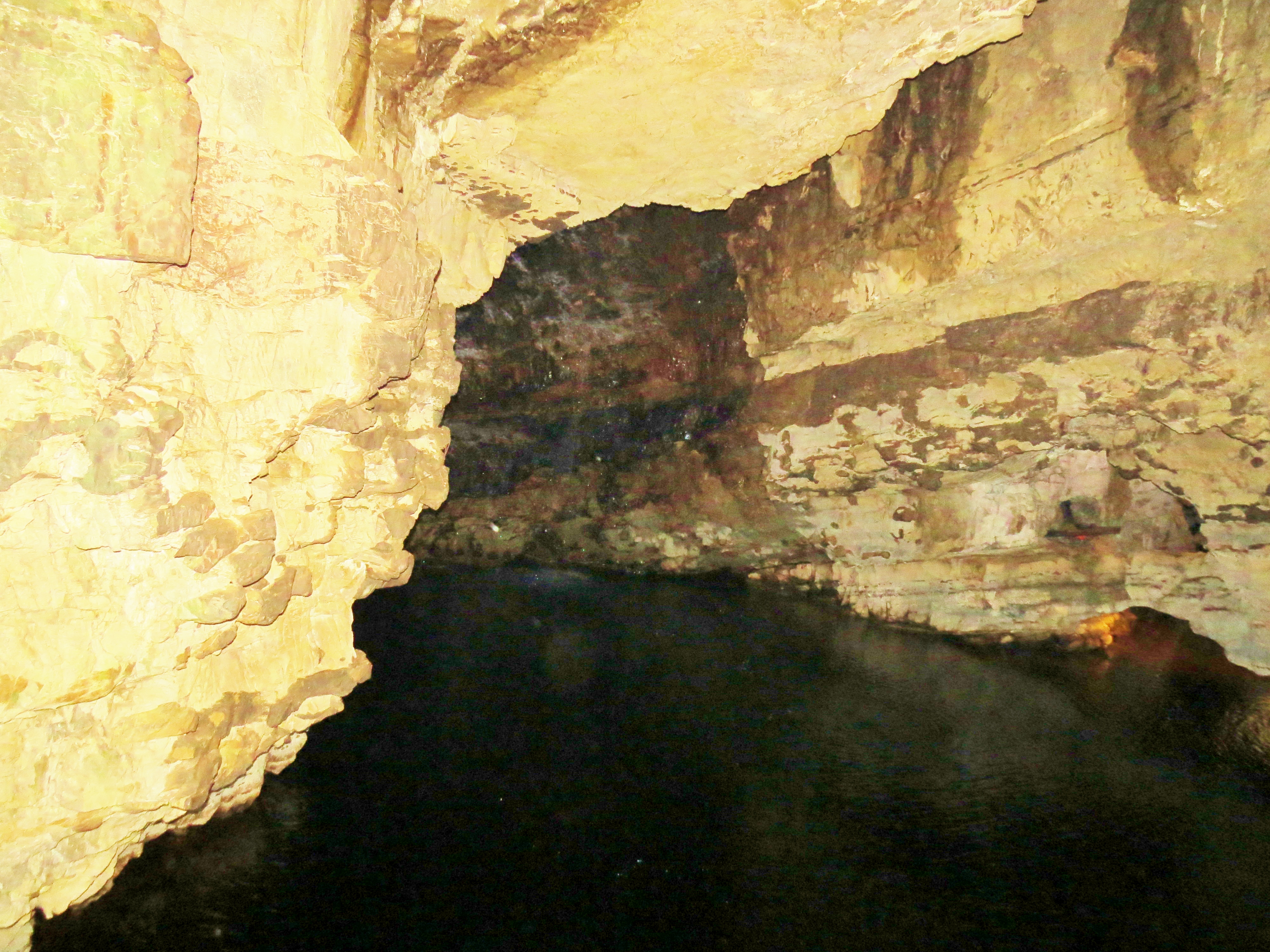
Smoo Cave Canyon
Smoo Cave is actually conjoined sea and fresh water caves. Formed by erosion of the limestone cliffs, it is accessible only by boat, though once inside, visitors have to get out of the small craft and walk for a bit. When I visited in early March, access was impossible since the boatman had not yet got his boat in the waterdue to adverse weather conditions. However, I was able to enter the small outer chamber via a wooden walkway. In June, I will return and, hopefully, be able to see all of this amazing, one of a kind phenomenom.
Approach To Smoo Cave
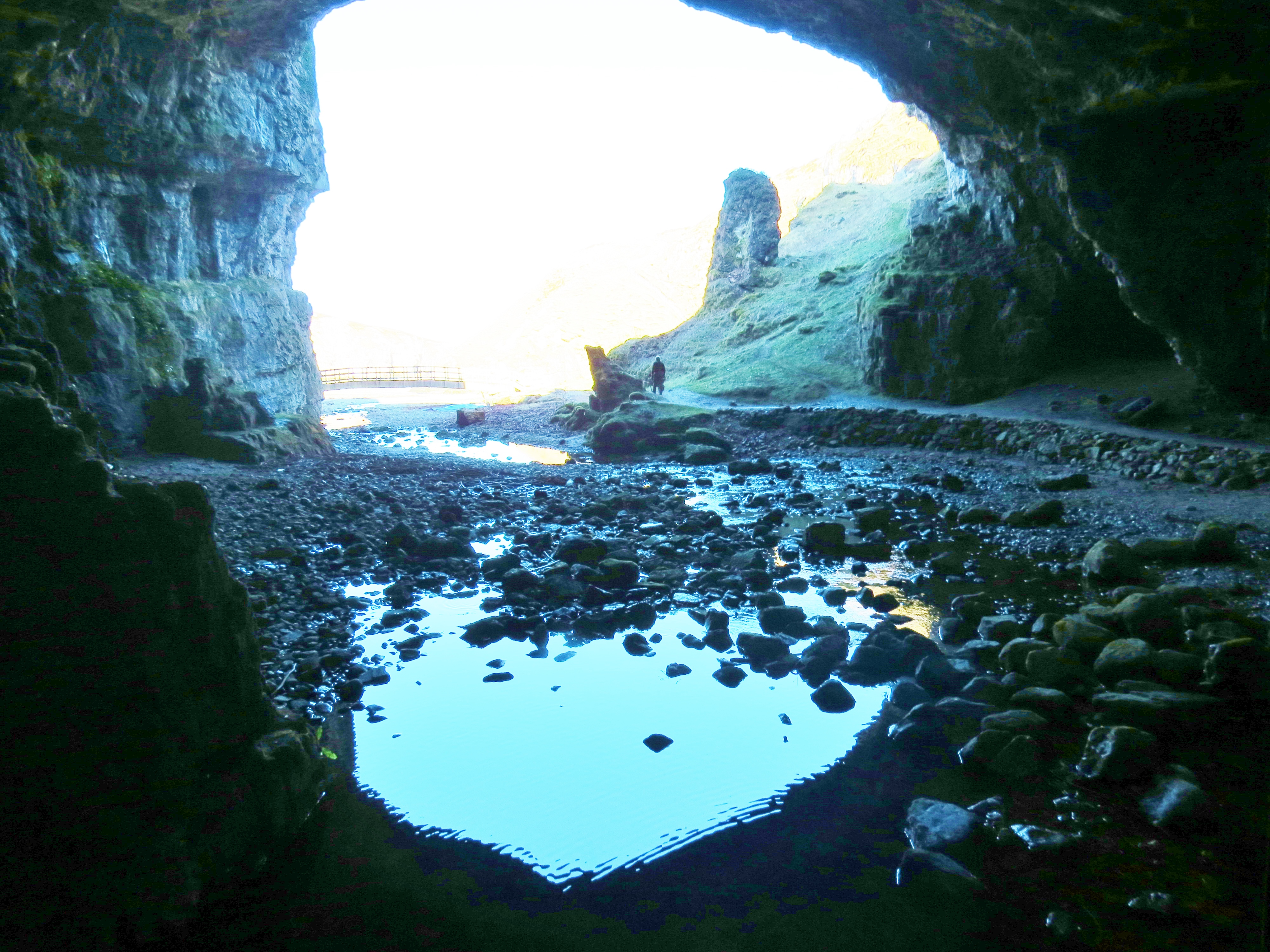
The walk from the road, across the cliff tops then down into the bottom of the canyon would be hazardous but for the wooden fence guiding visitors. The holes in the roof of the cave that make it unique by being naturally lit in places, are holes in the ground above. Unwary walkers could come to a nasty end without the rails to guide them. A staircase makes the descent easier.
Smoo Cave Entrance
The tide was out when I reached the entrance, but there was still much water inside.
A Peek Into Smoo Cave
Looking Out
Cave Exit
Once back at street level, I delighted in the pristine beaches lining my way home. Looking back at the cliffs that house Smoo Cave was interesting.
A Few Of The Many Spectacular Beaches Near Smoo Cave
From here I headed back to the village of Durness and Mackay’s Bunkhouse, stopping to take photos of that hostel, the main street and the very large sign post.
Note: In this post I have added three movies that I created, with well- chosen background music to add to the magic.
Mallaig is a small fishing port in the Western Highlands of Scotland. It is the jumping off point for the Knoydart Peninsula, an unspoiled mountain wilderness only accessible by boat, as well as many of the islands abounding off the coast. The closest of these are Skye and the Small Isles – Muk, Eigg, Rum and Canna. The area is spectacularly beautiful and, on each visit, I am overwhelmed by the sheer wild majesty of it all.
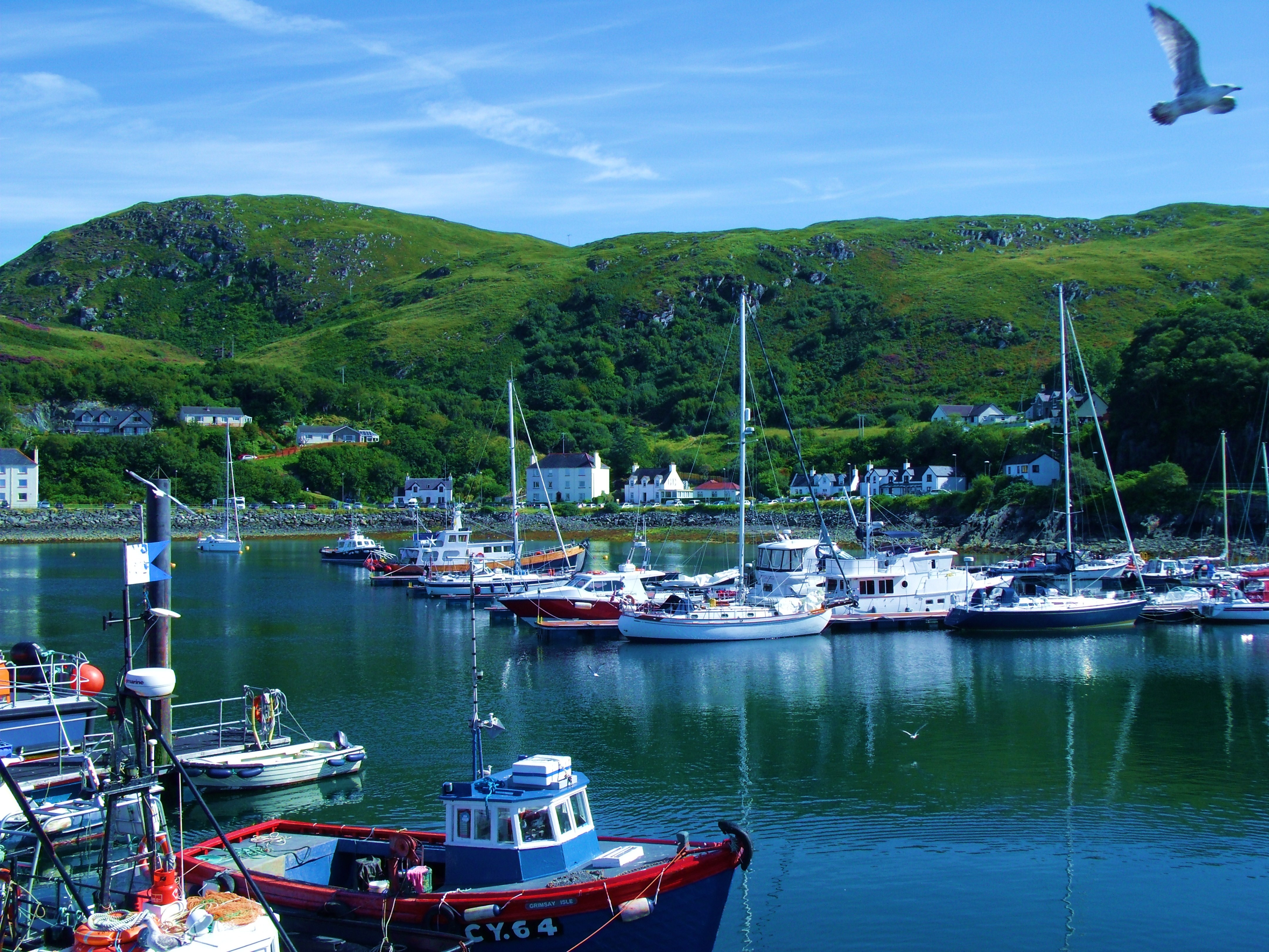
Mallaig Harbour In August
Mallaig Harbour
In Joyful Journey, Part 3, I posted an account of my train journey across Rannoch Moor to Corrour, from where I walked to the hostel beside Loch Ossian. On my way from the train halt, I stopped to watch the train as it headed on North into the moorland wilderness. I promised myself I would go with it one day, as I did a month or so later. That train journey terminates at Mallaig, which is why I ended up there.
Quayside
It was August when I first visited Mallaig. There are several boat trips available to visitors. One of my highlights was the seven hour tour of the Small Isles aboard the Caledonian MacBrayne ferry, the ‘Loch Nevis’and a close encounter with a school of basking sharks off the Knoydart Peninsulawhile aboard the much smaller and faster ‘Venturer’. The ‘Venturer’ can be seen in the ‘Quayside’ picture above.
The short movie below is ‘must see’. Background music played byJulian Lloyd Webberon cello, combined with images of my incredible experiences of sailing the waters around Mallaig, are pure magic. An encounter with the basking sharks I will recount later in this post when I ‘talk’ about the Knoydart Peninsula.
Our first stop on the tour of the Small Isles was at Muk, the smallest of this group of islands. It is privately owned and totally given over to livestock farming, cows mostly. Depending on the source of reference, the word ‘Muk’ (often spelled ‘Muck’) means cow or pig. I suspect pigs were once the livestock of choice, hence the confusion.
Muk
Cows And Cottages on Muk
From Muk, we proceeded to Eigg. The meaning of the name is lost in the mists of time and I found no reference to anyone hazarding a guess. Once privately owned by a succession of problematic owners, this island is now owned by the small community residing there.The Sgurr is an outcrop of rock whose distinctive shape makes this island instantly recognisable from a distance and saves it from being almost completely flat.
The Sgurr, Eigg
Eigg Jetty
View from Eigg
Canna is the island furthest from the mainland. It has a simple charm all it’s own. For those who like nothing but gentle walks, this isle, along with Eigg and Muk are perfect, offering stunning views of the surrounding waters and, in Spring, a host of wildlife and wild flowers. Canna does have one unusual feature in the form of a hill, so full of iron that it affects compasses for miles around.
The photo below shows the distinctive and ancient St. Edward’s Chapel.
St Edward’s Chapel, Canna
Sun Setting On Canna
The Cuillins, Isle of Skye
Rum, Behind Sanday, Canna
Rum, the largest island of the group, measures 8 miles x 8miles, which fact accounts for its name, ‘Rum’, from the old Norse word for ‘wide’. Once known as ‘The Forbidden Isle’, Rum is by far the most varied, surprising and historically interesting. Sailing past it on the way to Canna, one sees nothing but barren mountains. It is difficult to imagine life, other than birds, surviving here.
Rum
In fact the island teems with wildlife and has a small but robust community year round plus many tourists during the season. Of all the places I have visited, Rum is the most surprising. Finding that there was a hostel there, I arranged to stay for a couple of days. I did so with some trepidation. Having seen it from the water, and being long past the bloom of youth, I was unsure just how difficult a task I had undertaken. However, the above is just one of the many faces of Rum. Arriving there, I had, what may be, the greatest surprise of my life. Rum is an island of contrasts not formed by nature alone. Rumhas an intriguing story.
Loch Scresort, Kinloch, Rum.
The harbour, known as ‘Loch Scresort’, is dominated by a huge castle, as incongruous as it could possibly be. It is surrounded by pastoral, woodland, paddocks a stable yard, meandering woodland paths, a crenellated stone folly, and several ornamental stone bridges and gateways. This cultivated, gentle landscape only accounts for a tiny percentage of the island, covering a crescent shaped area three miles long and a mile wide at the centre. The rest is varied, beautiful and apart from a couple of roads built more than a hundred years ago, it is wild and totally unspoiled.A small community, some thirty strong, populate this area known as ‘Kinloch’,meaning ‘head of the loch’. Along with the castle, a small variety of dwellings, including a couple of whitewashed cottages, two similarly coated bothies, and a yurk or three, plus a tiny store adjoining the community hall make up ‘The Village’.
Kinloch Castle, Rum
In 1900, a wealthy industrialist called George Bullough took over the island with a view to making it his own personal playground. He had materials shipped in by the ton, including topsoil from Ayrshire for gardens and paddocks. His passion was racing cars so the good roads there now, he built to accommodate his hobby. As well as the castle and stables, he created miles of woodlands and all manner of luxuries to indulge his every whim. Only his wealthy friends were allowed to visit which is why it was known as ‘The Forbidden Isle’
Rum Pony
These adorable, distinctive looking ponies are only found on Rum and have been here for as long as anyone knows – I like to think thousands of years. A few are still used as work horses until retired and then are returned to the wild herd some twelve miles from the Village. To get there requires crossing a mountain range and the hike is not for the inexperienced or the faint of heart.
The Village, Rum
(with Stalker’s Bothy and Stable Bothy on right)
The castle and Village now belong to the residents who still maintain the wildlife protection begun in 1957 when the Conservation Society bought the island and turned it into a nature reserve, which status remains today. One of the legacies of George Bullough is the amazing variety of birds that now frequent the island, enjoying the huge variety of trees he had planted.
Water’s Edge, Kinloch, Rum
Low Tide
As remote as it is, the island has a telephone ‘landline. Cell/mobile phone reception is almost non-existent, as one would expect.
A mile and a half from the castle there is an otter hide. The walk there is memorable and not too challenging. The road to the hide gave me my first glimpse of island wildlife as well as a peek at the wilderness beyond Kinloch
Heron on Loch Scresort
Curlew on Loch Scresort
On The Way To The Otter Hide
Road to Otter Hide
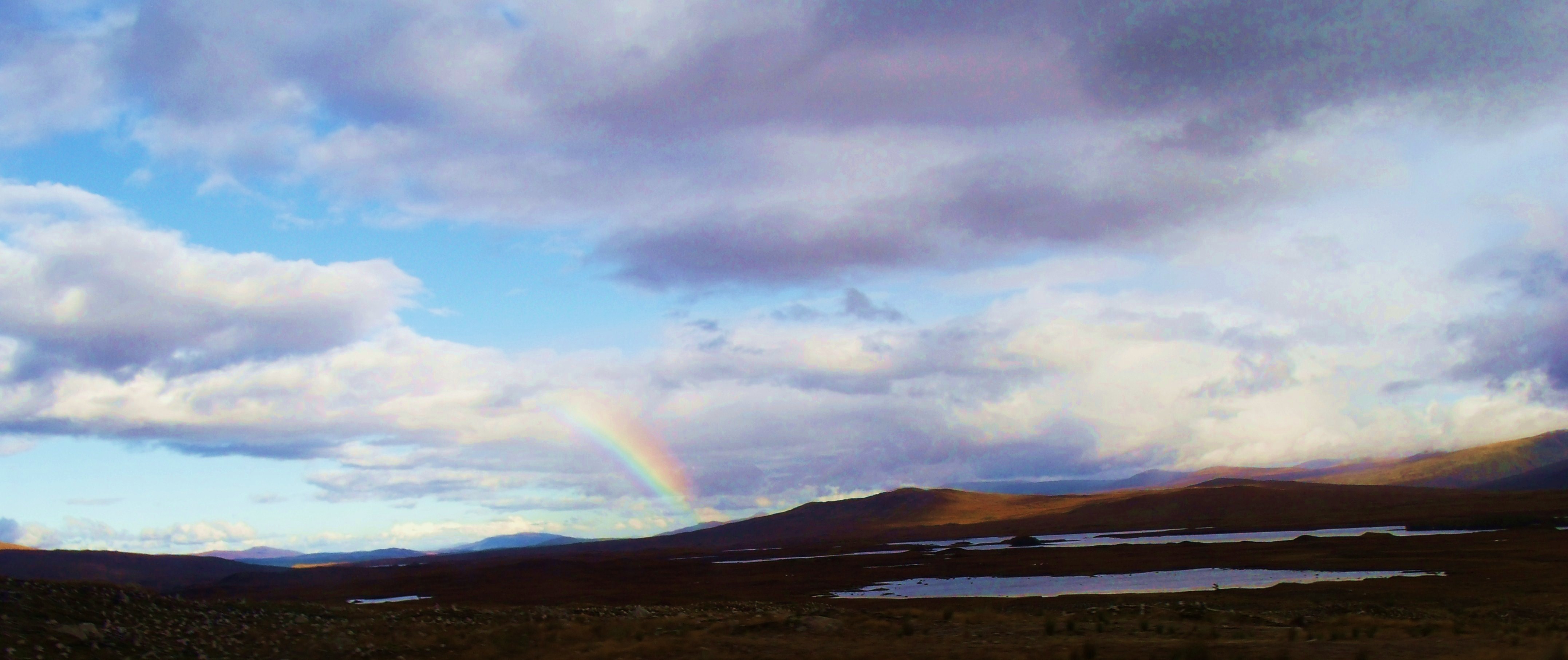
I did not see any otters or the seals that also frequent the shore there. There was the rainbow, though.
View From The Otter Hide, Kinloch, Rum
Back to the village and the intriguing crossroads.
Crossroads at Kinloch
The road going left in the picture above leads to Kilmory Bay. There, in the rutting season, deer gather on the sandy beach. With mountains and ocean creating a suitably grand setting, the stags fight for the ladies, bellowing and clashing antlers. Sadly, I only made it two thirds of the way there, so was unable to capture those wonderful scenes on film. The hike from Kinloch to Kilmory is only 5 miles, but the way is mountainous and somewhat challenging. The weather suddenly turned foul and I was forced to turn back. Hopefully, on my next visit their I will make it to the finish.
Heading To The Wilderness
A short distance from the cultivated, pastoral and wooded Kinloch, the terrain reverts to pristine wildness – with the exception of the road itself, a legacy of Robert Bullough’s car racing days. I was overjoyed to leave the man-made cultivation behind and finally experience some of the true nature of Rum.
Along the Road To Kilmory
Hiking To Kilmory
The Crofter’s Stone
These stones pictured above are a monument placed there by displaced crofters during the Highland and island Clearances.
The short movie above I made out of a desire to portray the sheer magic of this amazing isle. It only shows a tiny percentage of the whole, many more moods and faces I have yet to discover first hand. I chose ‘DarkIsland’ as the background music. I first heard this played on Indian Pipes by a native American street musician in Edinburgh, Scotland. The combination of music with images is pure magic.
I would be remiss if I did not share my close encounter with basking sharks while on a short visit to the Knoydart Peninsula. Only a short trip by fast boat from Mallaig, the peninsula is one of the last remaining unspoiled wildernesses in Europe. Rugged mountain terrain make it a suitable extended place to visit for only experienced climbers and those with excellent survival skills. I contented myself with a short walk around the edges.
Sailing to Knoydart With Rum In The Background
The ‘Venturer’ is a fast little boat and perfect for those wishing to take photographs.
Knoydart and Venturer
Ferry Dock At Knoydart
Our encounter with the basking sharks while returning to Mallaig made the trip so very worthwhile.
For those who may wish to follow in my footsteps and spend a backpacking holiday in Mallaig or the surrounding areas, here is a little information on where you might stay.
Backpackers Lodge, Mallaig
This is a cosy little hostel above the restaurant and overlooking the harbour. There is also a new hostel at the Mission – also above a restaurant.
The Stable Bothy, Rum
This is the residence of the Ranger on Rum. Adjoining this building is the Stalker’s Bothy, limited space in which can be rented.
Bed and Breakfast can be had at Ivy Cottage, Rum while a camp site and three or four pods are available.
A new hostel to replace the, now closed, temporary Kinloch Hostel, is now open.
Canna and Muk have cottages to let while Eigg has the Glebe Hostel as well as a variety of other types of accommodation.
There are two bunkhouses on Knoydart
Finally, while sailing back from the cruise around the Small Isles, I was treated to a glorious sunset. The following is a simple, simply charming short movie of the sun setting over the islands with background music again played by Julian Lloyd Webber on cello. (Watch for the school of porpoises swimming right to left across the wake.)
Loch Ossian is situated in a remote part of Perthshire, Scotland, at the North Eastern edge of Rannoch Moor.
July: New Day On Loch Ossian
Youth Hostel Dining Area
(Glencoe peaks in far right background)
In ‘Joyful Journey, Part 2, Glencoe and Rannoch Moor’, I documented my stay at The Kings House on Rannoch Moor at the latter’s Western edge. The moor stretches uninterrupted from there to Loch Ossian, north to Fort William and south East to Pitlochry and due south. The distant peaks in above photo, and several to follow, give some idea of the scale of things.
Rannoch Moor:Ringed by mountains, this vast, elevated basin is around 1300 ft. above sea level. Site of an ancient glacier, it is often bleak and forbidding but can, on occasion, briefly present a bright, inviting face, as it did during my July visit to Loch Ossian. This look is deceptive, however, as the moor is ever treacherous.
July: Rannoch Moor En Route To Loch Ossian
This unique piece of the planet is wild, desolate, unbelievably beautiful and awful in its solitude. Always it is awe-inspiring, always strange, always hazardous, always magical. It touches the soul.
It has often been observed that the Highland landscape of Scotland changes, in mood and appearance, more dramatically and more often than any other place on earth. Nowhere is this more true than on The Great Moor, as Rannoch is sometimes known. The photo below was taken from the train window, not far from Loch Ossian, in mid-May after a long arctic-like spell of weather.
May: Rannoch Moor From Train Window
On the North Eastern edge of Rannoch Moor is Loch Ossian, part of the remote Corrour Estate. I recently visited there, staying at the Loch Ossian Youth Hostel, run by the Scottish Youth Hostel Association.
To reach my destination required a journey on the Glasgow to Mallaig train. The journey itself is a thrilling adventure since the train crosses Rannoch Moor giving passengers viewing-rights of this vast wilderness, inaccessible, for the most part, by any other means. In places, the track is laid on piles of brush, in the absence of solid ground. The driver slows going over these stretches and the motion of the train feels like gently sailing. This is a ‘not to be missed’ experience.
And so to Loch Ossian.
View Of Loch Ossian From Hostel
Corrour Station And Restaurant
Alighting at Corrour railway halt, I crossed the tracks on the boards provided and decided to have a snack in the track-side restaurant before tackling the mile walk with all my gear in tow. Corrour is the highest and most remote mainline railway station and the Station House the highest and most remote restaurant in the U.K. The latter is also run by the Scottish Youth Hostel Association. The interior of the restaurant is surprisingly civilised looking and the service is excellent. It felt bizarre to find this kind of sophistication so deep in the wilderness, yet having said that, it still had a ‘not of this world’ feel to it.
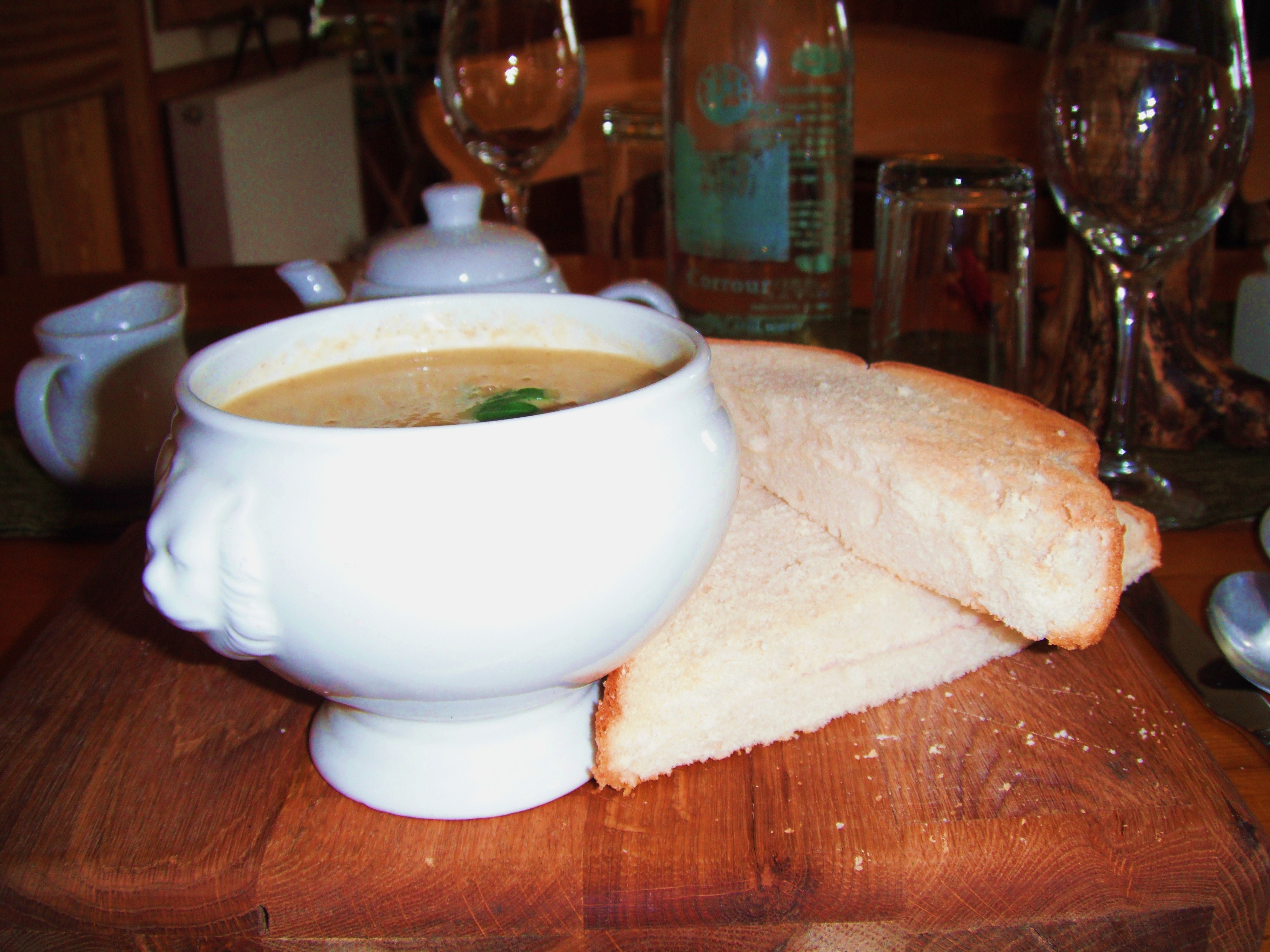
The menu, rich in local game and whisky sauces and priced accordingly, was a little too exotic for both my purse and my palette. However, I did find a delicious wild mushroom and butternut squash soup that did not break my bank and suited my taste. I was so impressed, in fact, that I photographed this culinary delight.
Soup
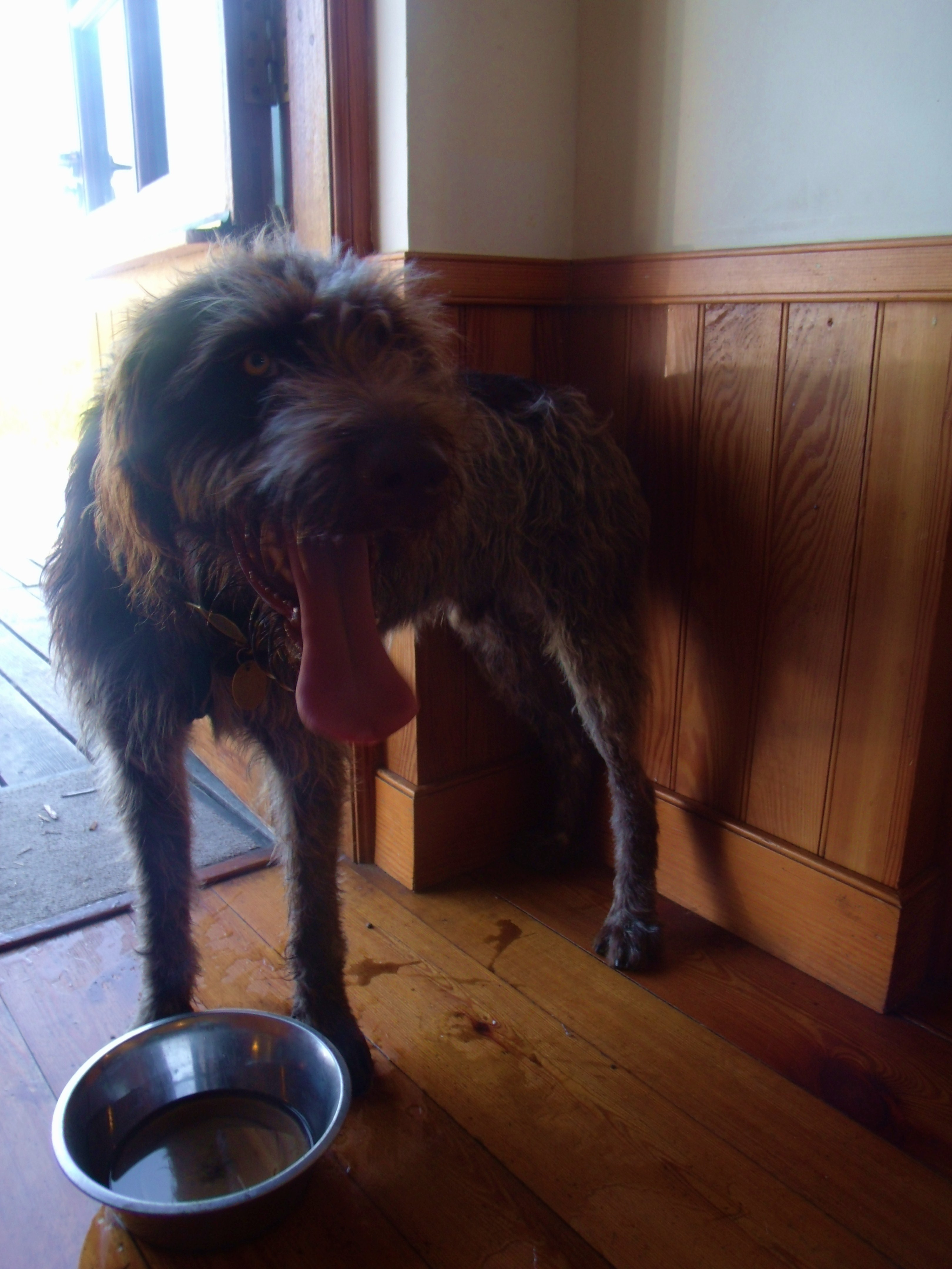
Before leaving this account of my dining experience, I would be remiss if I did not introduce you to the Station House Restaurant’s resident four legged friend. Archie hangs out at the back door and adds to the charm of the place.
Archie
Soup and a pot of tea the richer, I headed east across Rannoch Moor on a pretty good private road towards Loch Ossian and the Youth Hostel. There follows a photographic account.
Railway Line Heading North To Fort William From Corrour
Moorland
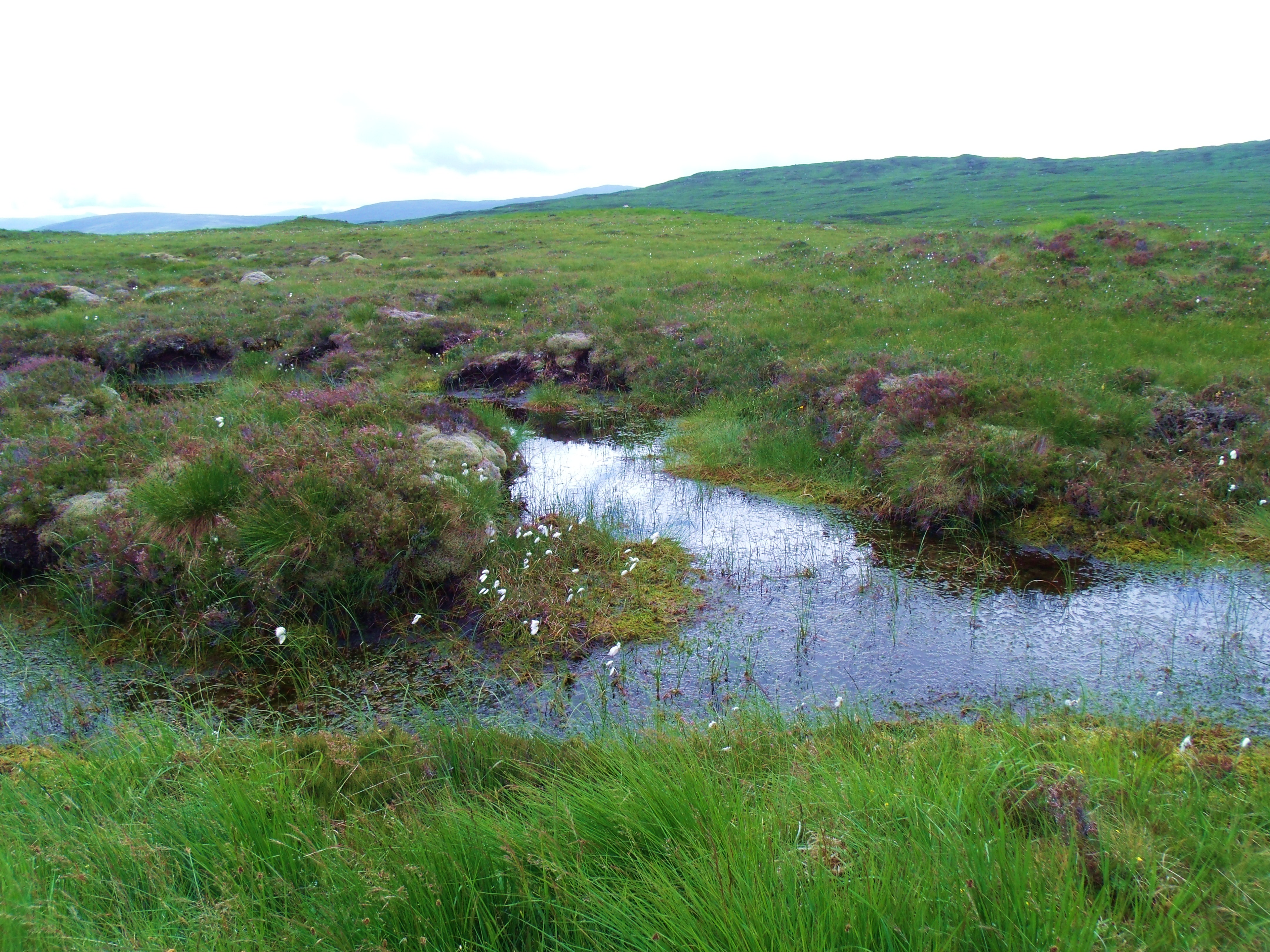
Covering an area of 50 sq. miles, (130sq kms), Rannoch Moor was the site of the last great glacier in the U.K. during the last ice age. Averaging 1,000ft above sea level, it is a basin surrounded by mountains. Its stratum is granite with a covering of peat bog punctuated by a variety of types of water bodies and streams. This ancient glacier site ‘is rising by around 3mm per year’, according to Wikipedia .
Wikipedia describes the moor as ‘a complex Blanket Bog’ , a.k.a. ‘Featherbed Bog’, made up of many different types of environment, e.g. ombrotophic, mineratrophic, mesotrophic, oligotrophic, dystrophic. These different catagories are based mainly on the water source, protein and oxygen levels of each area. In places, the peat is 20ft deep.
Rocks And Flora On Rannoch Moor near Loch Ossian
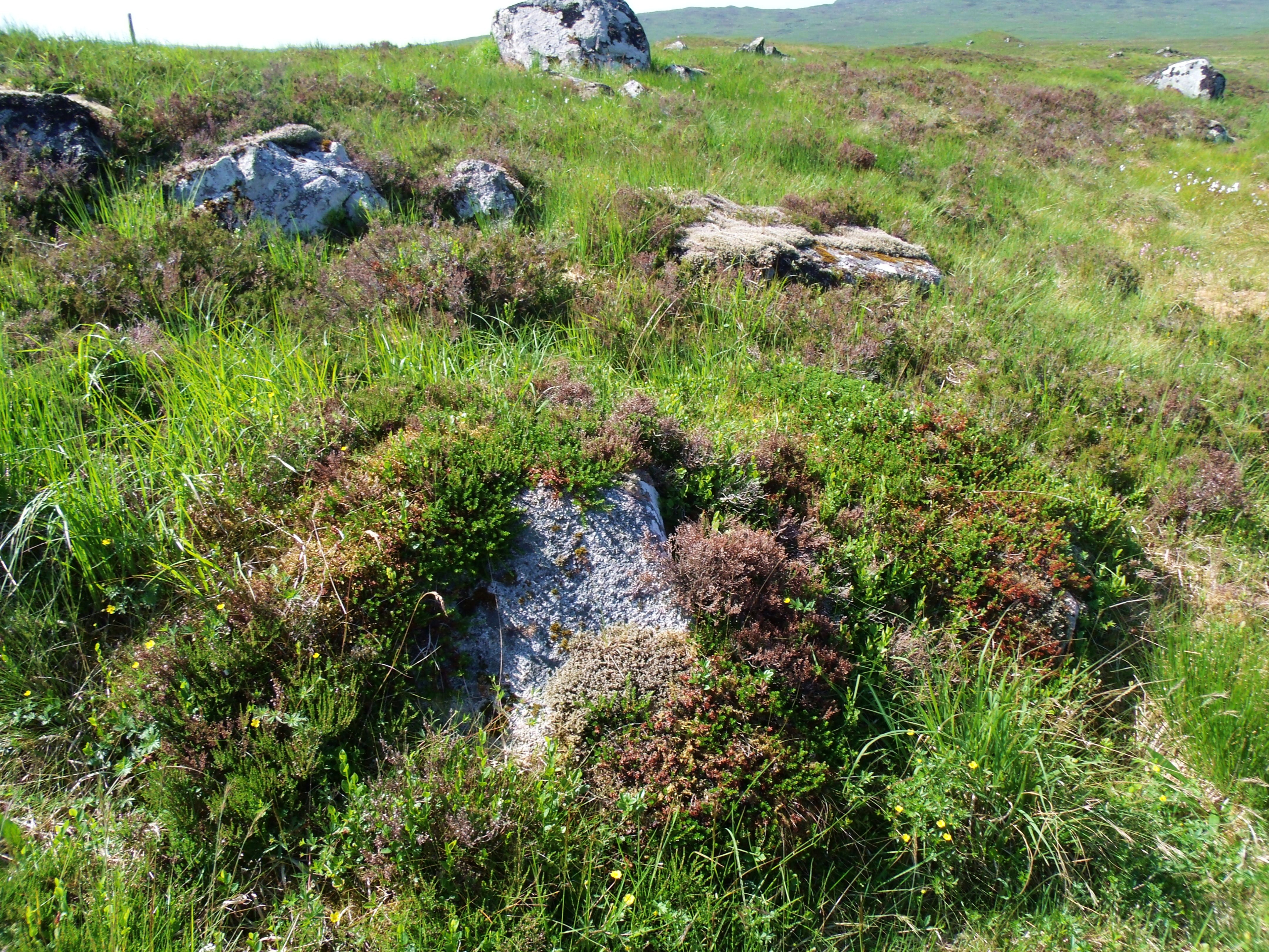
Boulders, many of them huge, litter Rannoch’s landscape. These, I believe, were dropped by the vast glacier. One of the striking changes in terrain at the edges of this ancient glacier site is the sudden absence of these giant rocks which often support a variety of flora unique to the area.
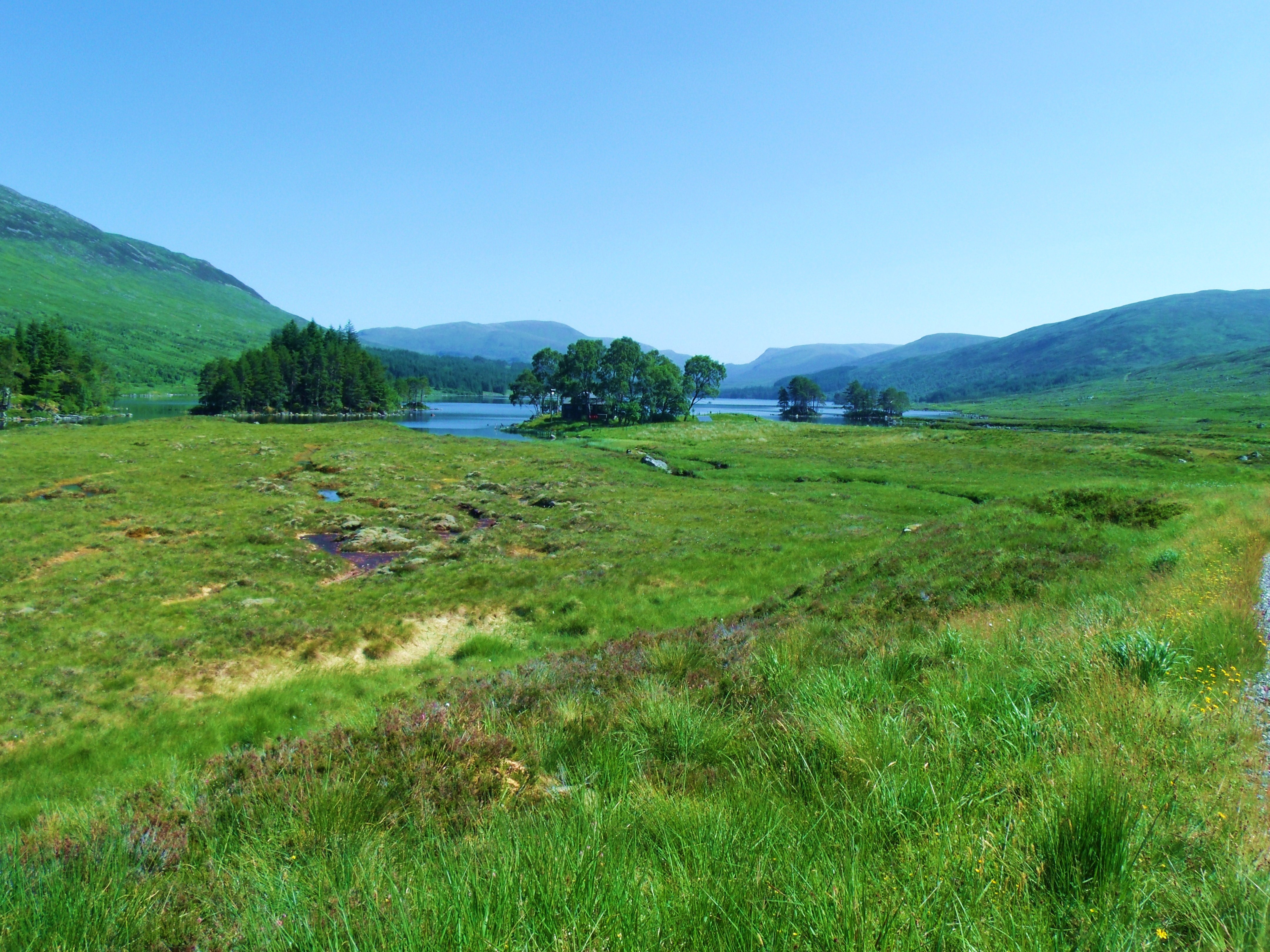
Loch Ossian
The day of my arrival was typical of a good summer day on Rannoch Moor – a stiff breeze and variable, ever changing rain clouds. The day following was to prove memorable in its uncharacteristic, cloud-free stillness. For that reason, I have used, almost exclusively, photos taken during that time.
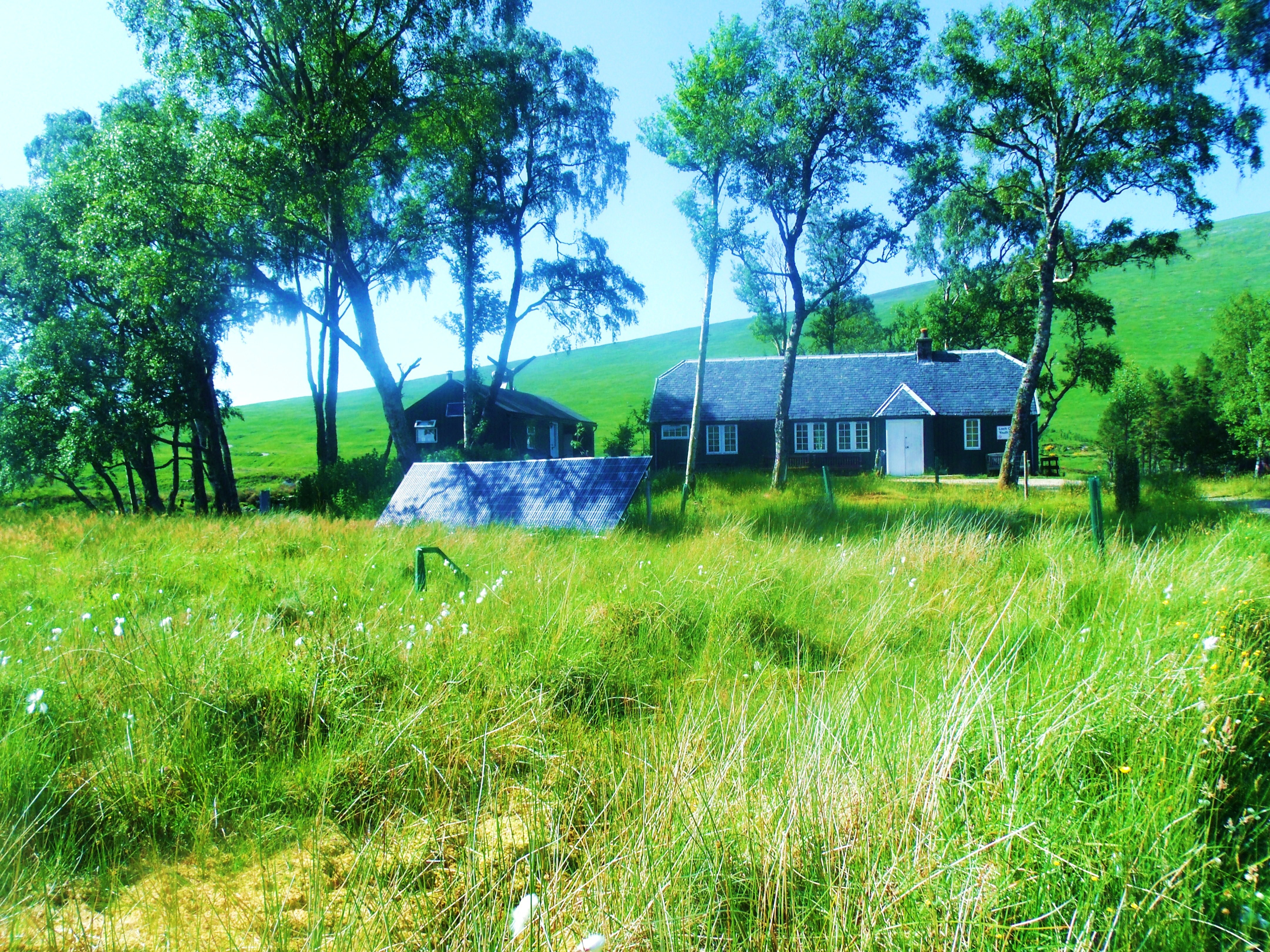
First Sight Of Loch Ossian Youth Hostel
(from Station access road)
Even after a long, hot, dry spell of weather, The air on this great bog is fresh and odour free. Low levels of nutrients and much oxygen in sitting water is probably responsible.
Almost There!
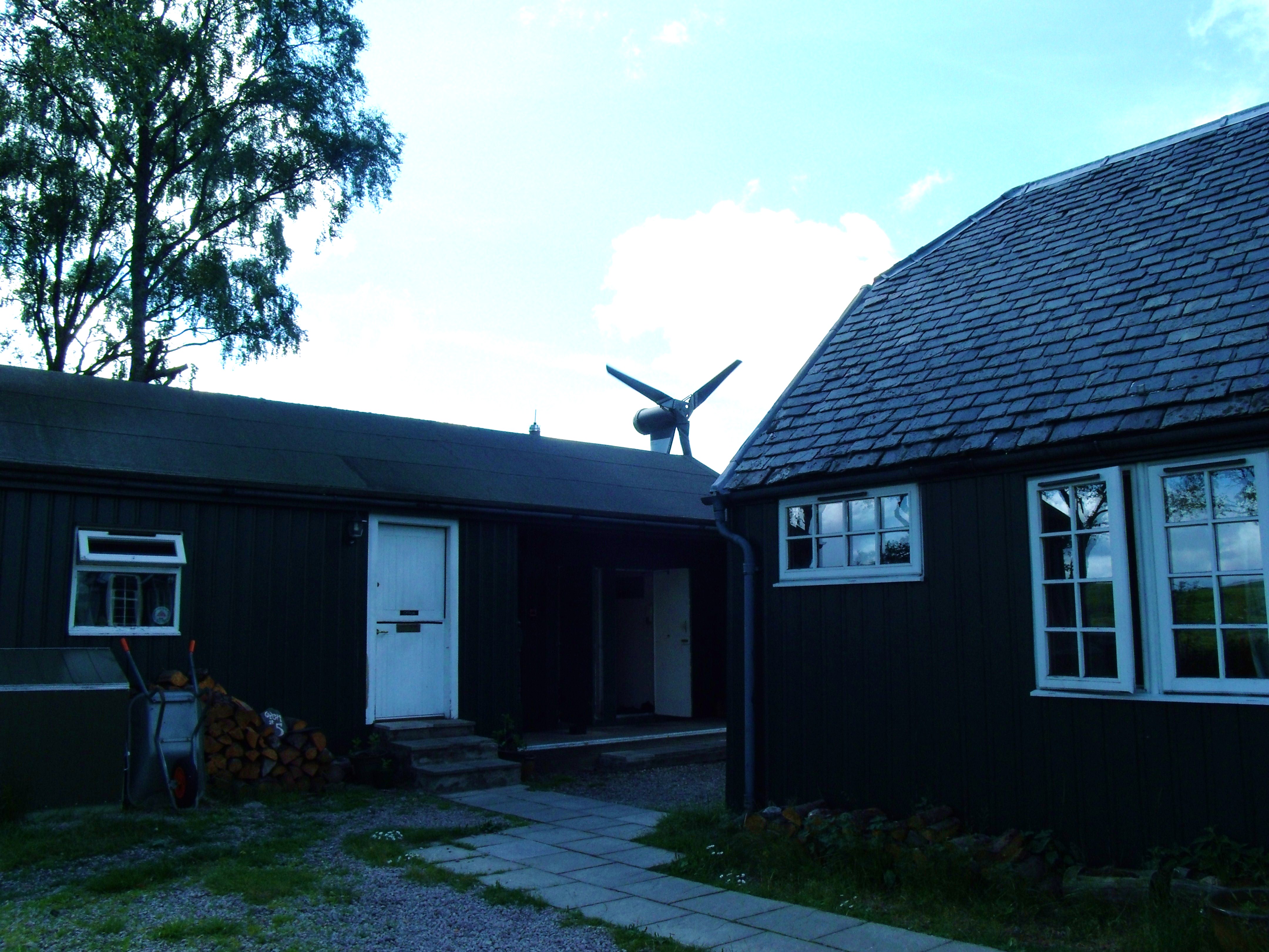
Eco-Friendly Hostel
(A wind turbine and solar panels provide all the power for the hostel.)
Radiance
New Day
These photos are so uncharacteristic of the loch and surrounding moor, they are almost unbelievable. The blue, unclouded skies and totally still air seem out of place in an area reknowned for constant wind and rain. To see mirror-like water on the loch is rare. As a frequent visitor to Rannoch Moor, this stillness feels spooky – as if the whole place is holding its breath.
Morning Calm
Loch Ossian is a narrow loch about 5km long. It drains into the River Ossian on its west side, flowing north into Loch Guilbaum and thence to the River Spean at Moy.
Glencoe Backdrop
Still Vista
Misty Morning
Beside The Still Water
Rested
Bog Cotton On Rannoch Moor
(Looking west towards Glencoe from Loch Ossian)
In Autumn during the rutting season, the moor is alive with deer. It is impossible to walk any distance without encountering several of these lovely creatures. The air rings with the clash of antlers and the bellow of the stags. The place feels busy. During the three unusually hot summer days of my visit, however, the moor appeared devoid of animal life. No curlews called, no hawks or eagles soared overhead, no deer ventured into the open.
Timeless Rannoch Moor
Only constant bombardment by a variety of large, biting insects reminded me that life abounds in this wilderness, while adding to my feeling of being in an alien place. And, in fact, humans almost never venture on to Rannoch Moor. A few of us skirt around the edges on the few walkways provided, or ride across in the train, but, mostly, the moor lies undisturbed by human footprints, carbon or otherwise.
Office And Toilets
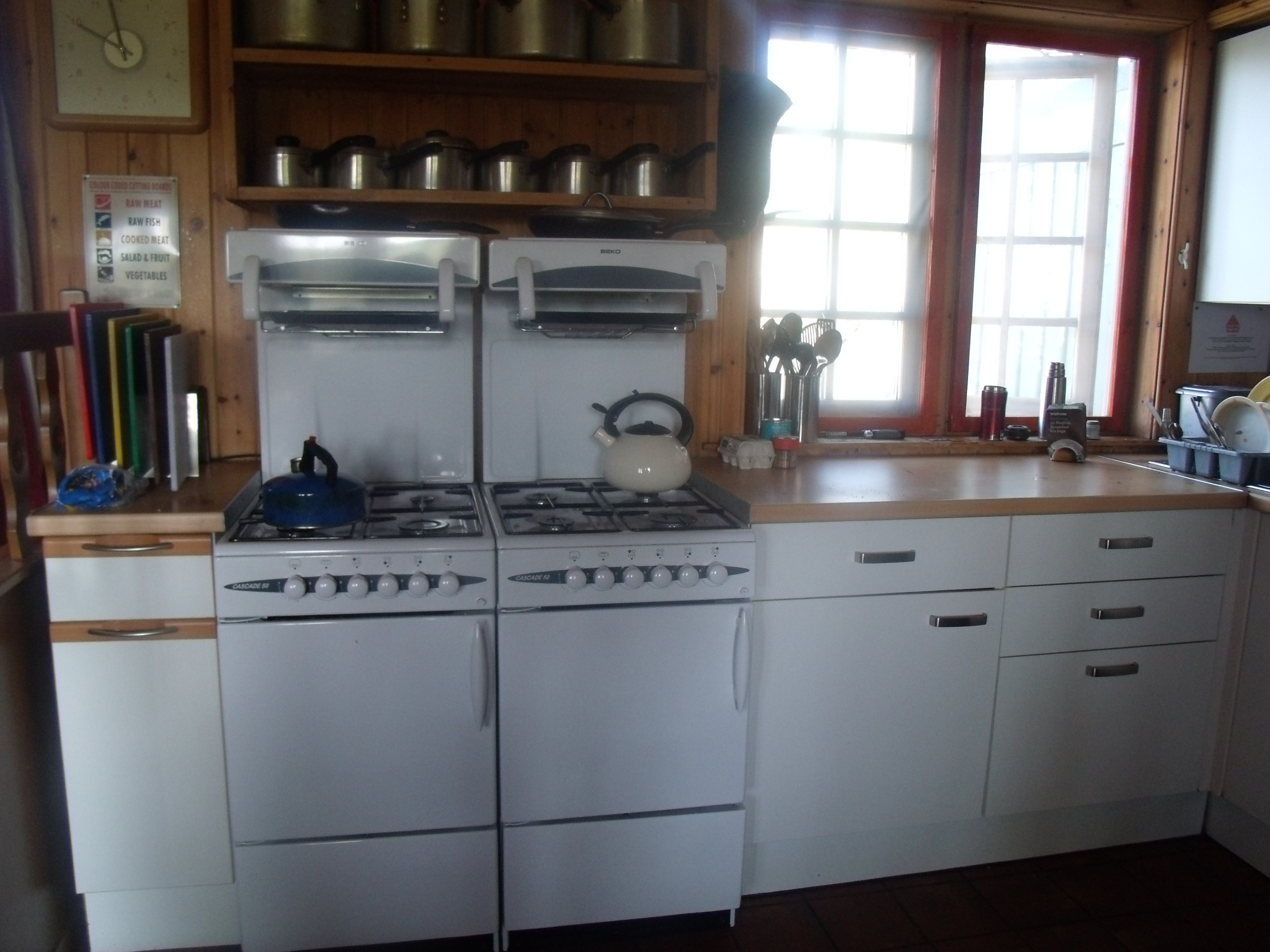
There are only outside, dry compost toilets, so this location will not suit everyone. There is no phone reception, refrigerators, T.V. or food supplies other than army-type packaged food. However there is a well equipped kitchen where residents can cook food they bring in. Water is heated by a wood stove so hot water is in short supply, particularly in warm weather when it is non-existent. There are adequate wash rooms, however. Two small dorms – one each for males and females are airy and comfortable with decent sized bunk beds. Washing machines and dryers are not to be had.
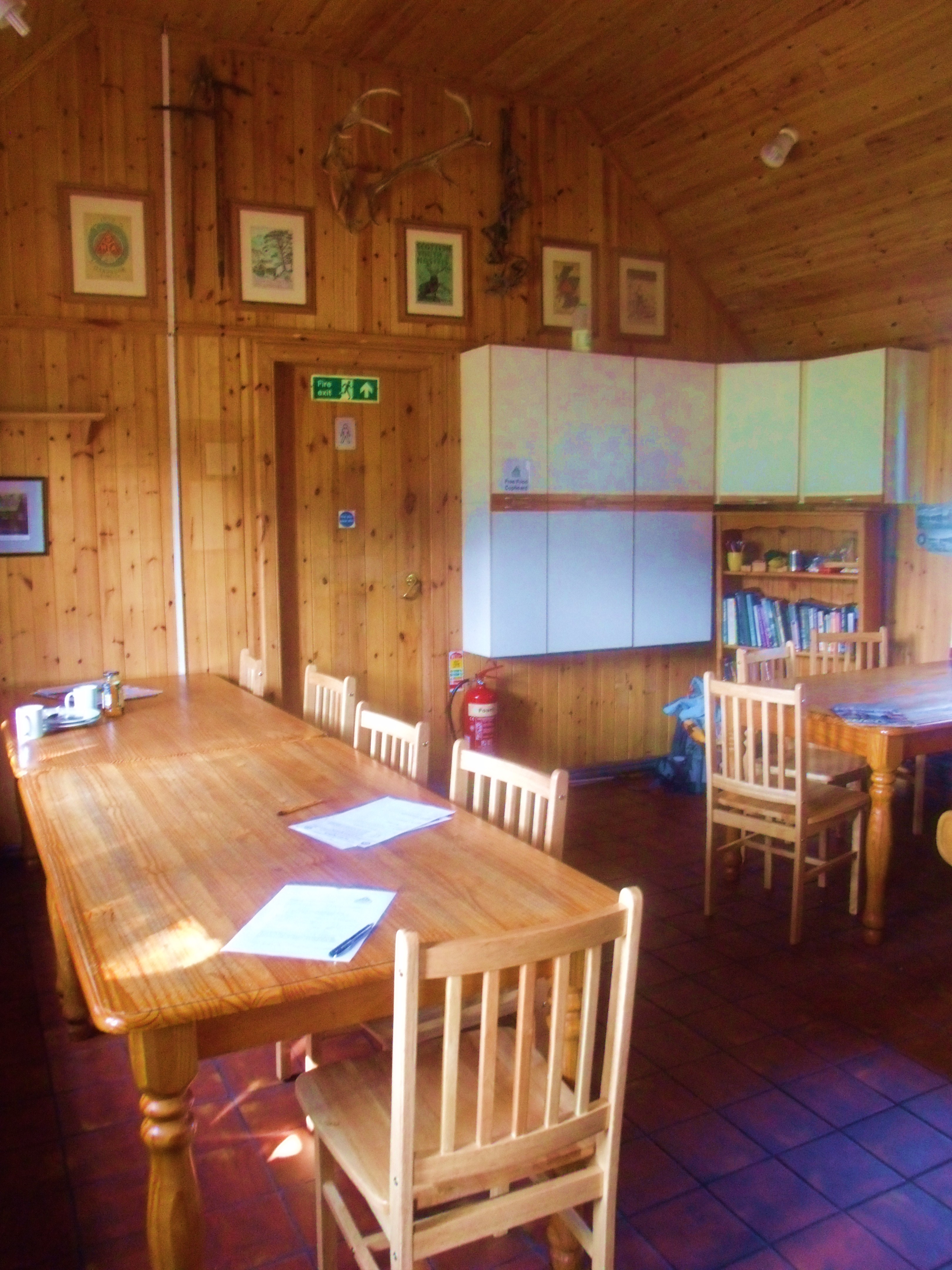
Hostel Dining Room
Hostel Kitchen
Loch Ossian
The differences between the East and West ends of the loch are striking as the unique characteristics of Rannoch Moor give way to gentler, more pastoral, less boggy, and more hospitable terrain. The change is sudden and complete as evidenced in the photos following. Even at the extreme West end, however, only one bank retains the Rannoch flora and geology as the moor ends abruptly at the water’s edge.
Changing Terrain
Looking Towards the Top Of The Loch
(The white estate house can be seen on the top shore of the loch)
No More Moor
Evening At The East End Of Loch Ossian
As well as completely different kinds of vegetation on the bank, the water of the loch at this end is free of the rocky outcrops and islets so typical of the Rannoch moorland lochs and lochans.
As evening approached, I returned from my hike, hot and bug-bitten, but mightily satisfied. And so to bed.
The Office Is Now Closed
And now…….
For those who would like more detailed information about Rannoch Moor or the Corrour Estate, the links following will serve you well. While the facts about these places are public knowledge, the sites below are interesting mines of detail and data, collected and presented beautifully. They add to the ‘bare-bones’ descriptions I have supplied. These were my sources for some of the information in the text. Observations, creative writing and photos are all my own.
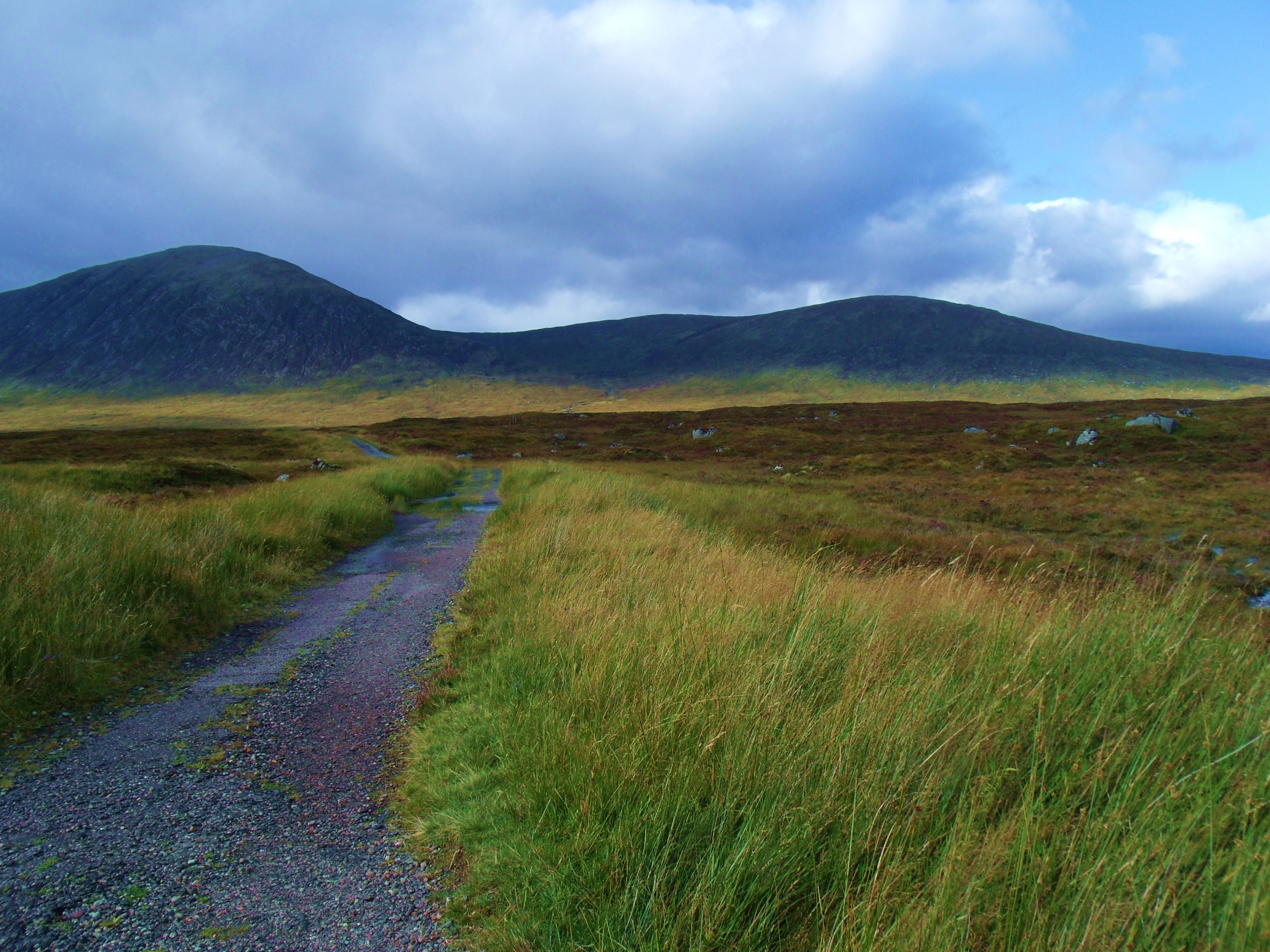
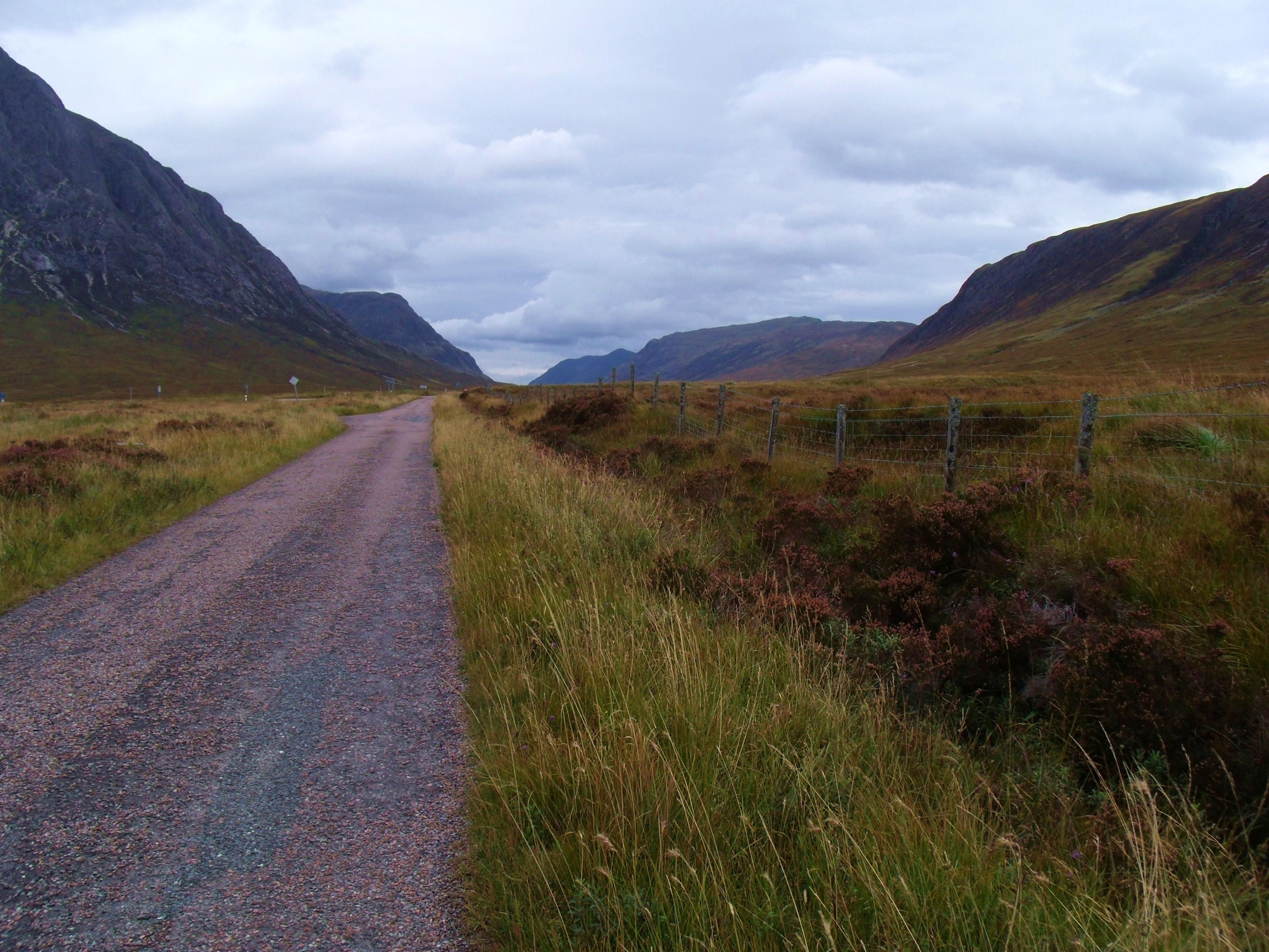
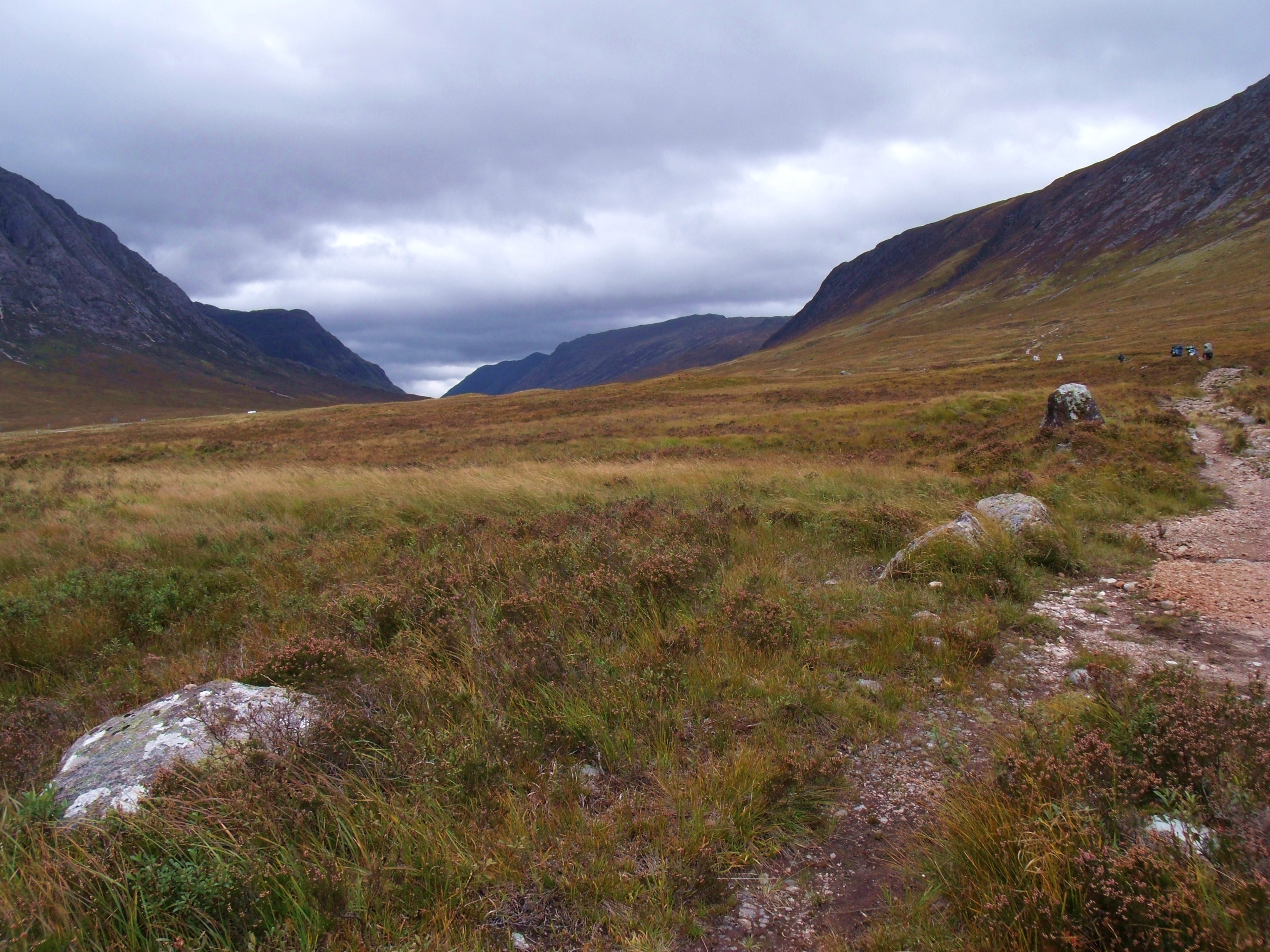
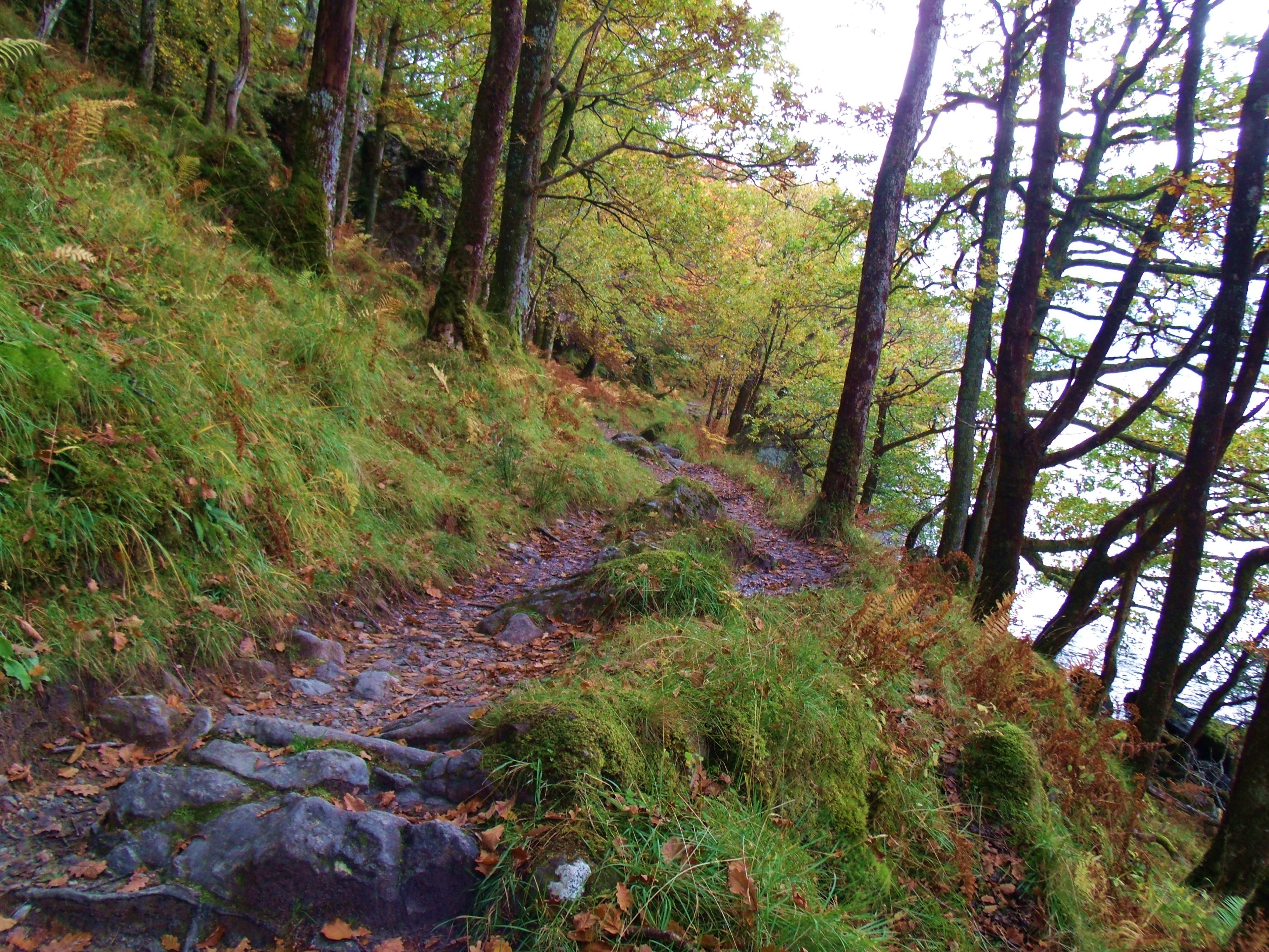
Having left Loch Lomond behind, I turned my sights north to pick up parts of the West Highland Way. Unlike some devotees of that 96 mile hike, I am not averse to straying from the path to check out other natural wonders in the area. Nor, as stated in Part One, am I able to tackle the full length of The Way. Instead, I use means other than ‘Shanks’s Pony’ to get from A to B. On loch Lomond, I travelled mostly by boat with a little help from my local bus service. And so, on to Rannoch Moor.
Rannoch Moor
Lochans on Rannoch Moor
No longer able to cruise on boats to my chosen destinations, I now rely on City Link buses to get me to the parts of the West Highland Way I want to explore. On leaving Balloch and travelling north, I passed through Crianlarach, Tyndrum and Bridge of Orchy where the West Highland Way mostly shadows the route taken by the bus. Somewhere north of Glen Falloch, in a valley at the edge of the Trossachs, the trail takes its own path up the 1,500 ft. incline to Rannoch Moor. The photo above was taken from the bus window on the moor.
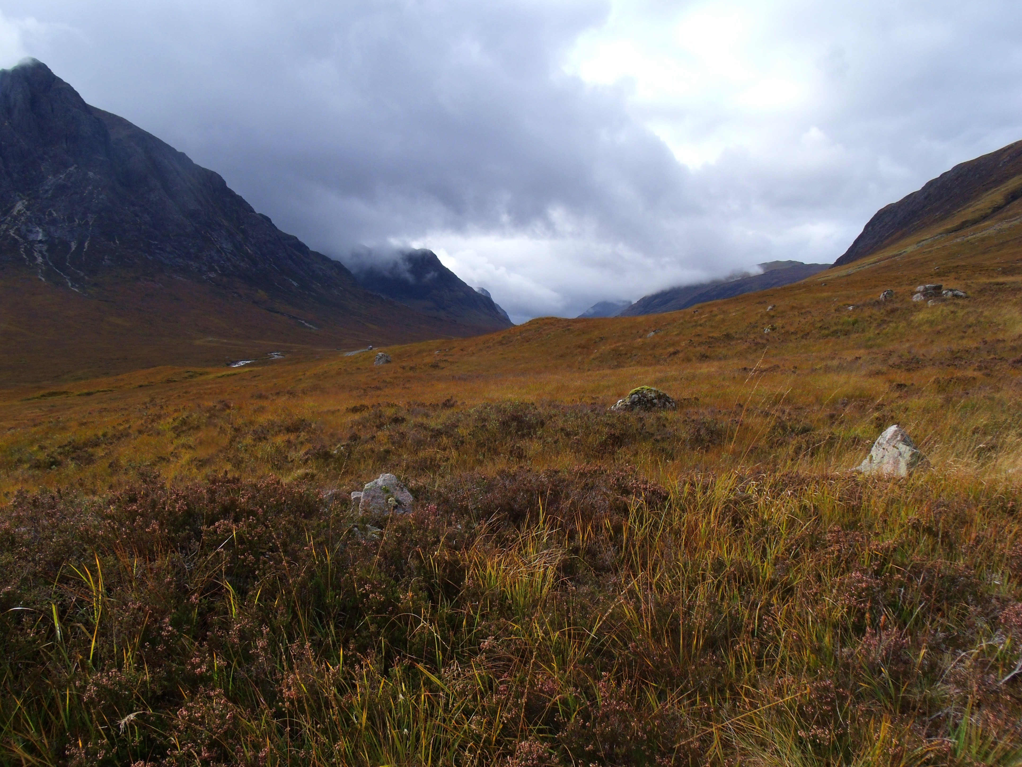
Rain Fast Approaching Buachaille Etive Mor
Rannoch Moor is a plateau, 1,200 ft above sea level. It covers 12,800 acres and is mostly peat and bog, with many beautiful streams and lochans (small lochs). It is wedge shaped and surrounded my mountains, the mountainous area to the north being Glencoe, with mountains around 2,000 ft. To the south east, the mountains are around 3,000 feet. It’s unspoiled, unique beauty is something I hope to document more fully very soon, adding some of the rich history woven into its past.
Moorland StreamRain Over Buachaille Etive Mor
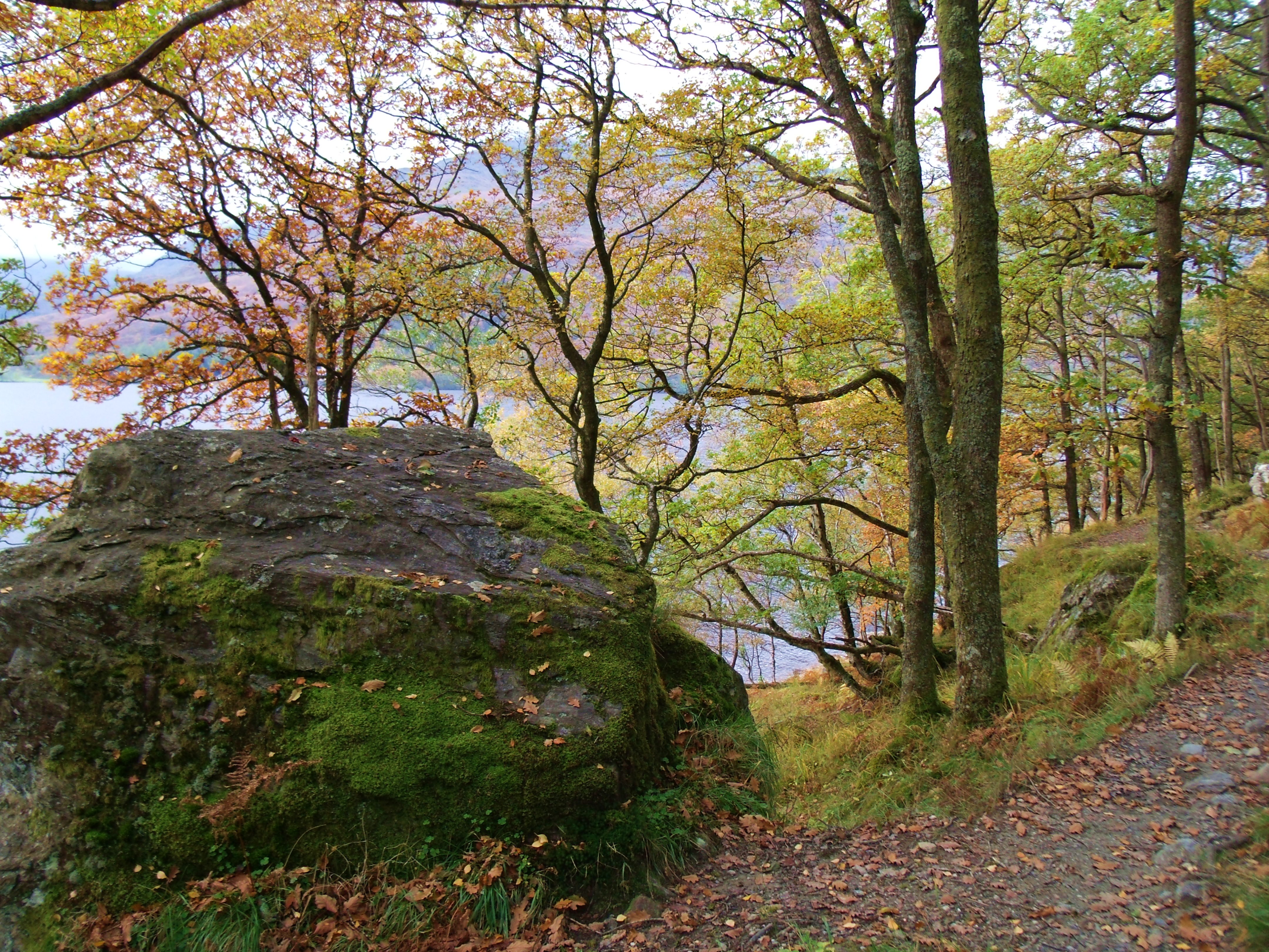
Glencoe is an area of many mountains and glens. The most beautiful glen is thought to be Glen Etive. Pyramid shaped Buachaille Etive Mor (BigShepherd of Glen Etive) dominates the Glencoe area. Across Glen Etive from the Big Shepherd is Buachaille Etive Bheag(Little Shepherd Of TheGlen).
Rain over Buachaille Etive Mor and Buachaille Etive Bheag
For climbers and hikers in the area, the rapidly changing weather can be a hazard. On this occasion, I was caught in a fast moving storm.
A82 heading into Glencoe
Above is the bus stop near White Corries Ski Centre where I alighted. I stayed only a short while before catching the bus back on it’s way from FortWilliam. A week later I returned, staying for two nights at the Kings HouseHotel, on the West Highland Way, a mile or so from the bus stop.
The Black Corries and West Highland Way leading to The Kings House
The Kings House
Highland Hearth
Reception
Sunrise over Buachaille Etive Mor
Sunrise on Buachaille Etive Mor from a window in The Kings House
On day one of my stay, I braved the morning to check out my immediate surroundings.
Double DeerBreakfastMist Over the Black CorriesRannoch Moor Looking East
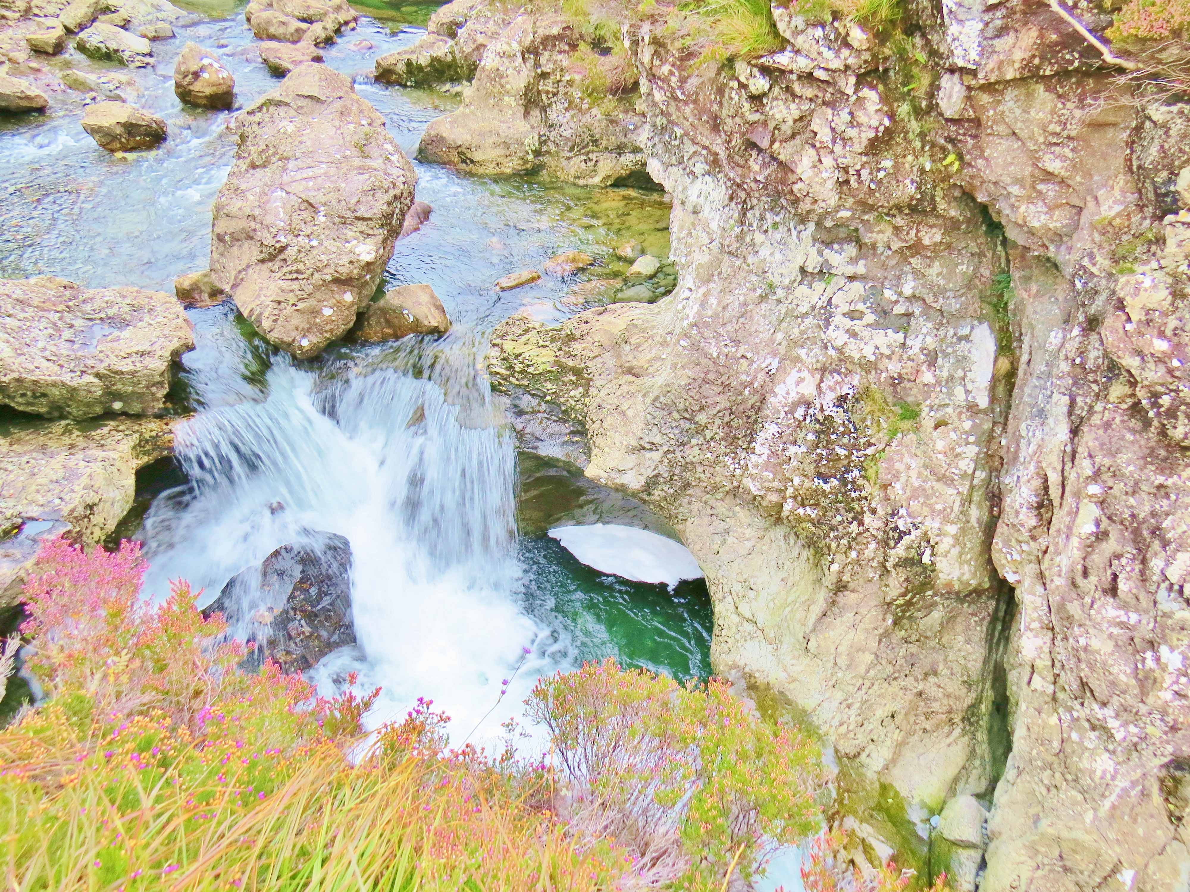
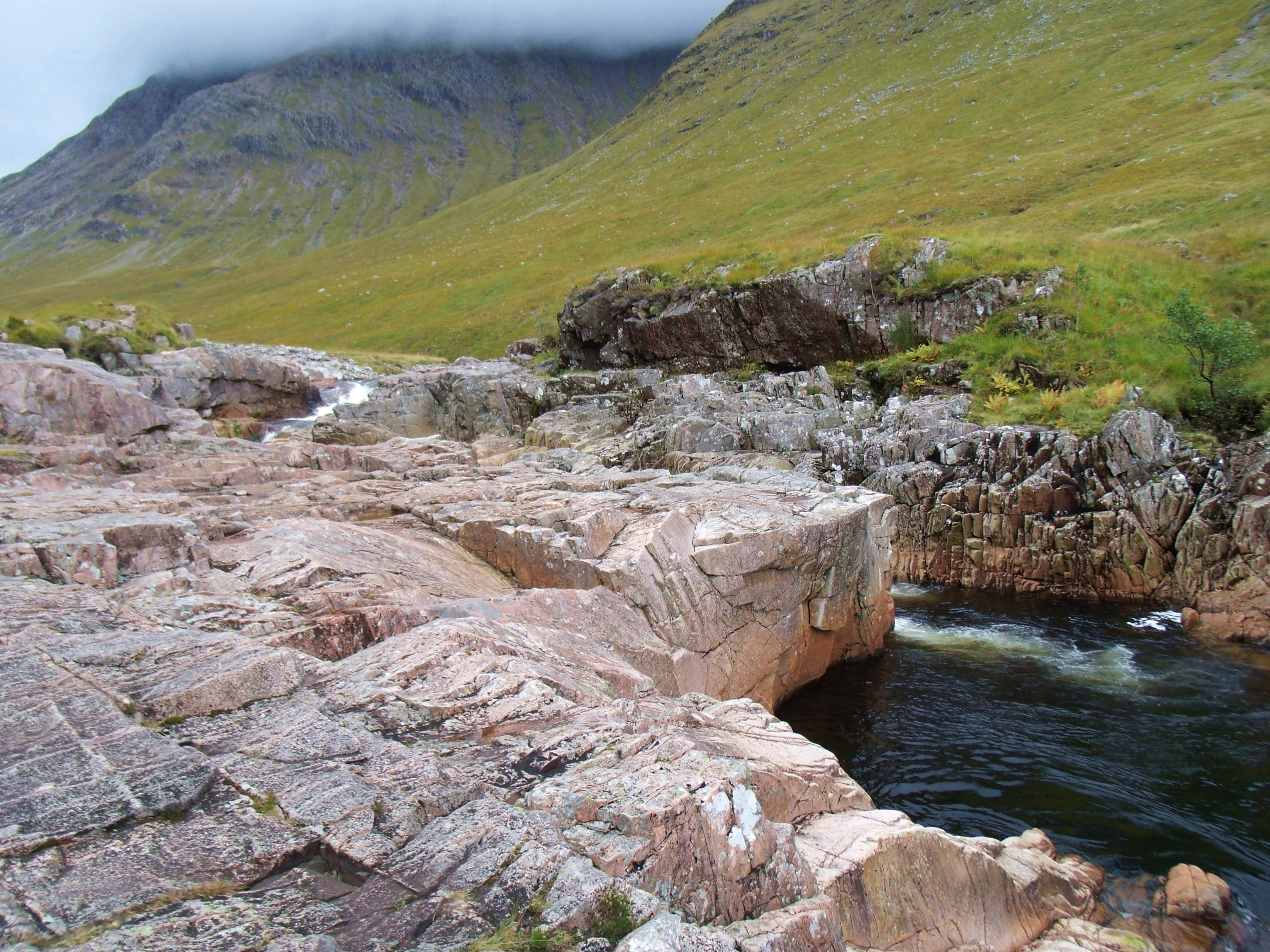
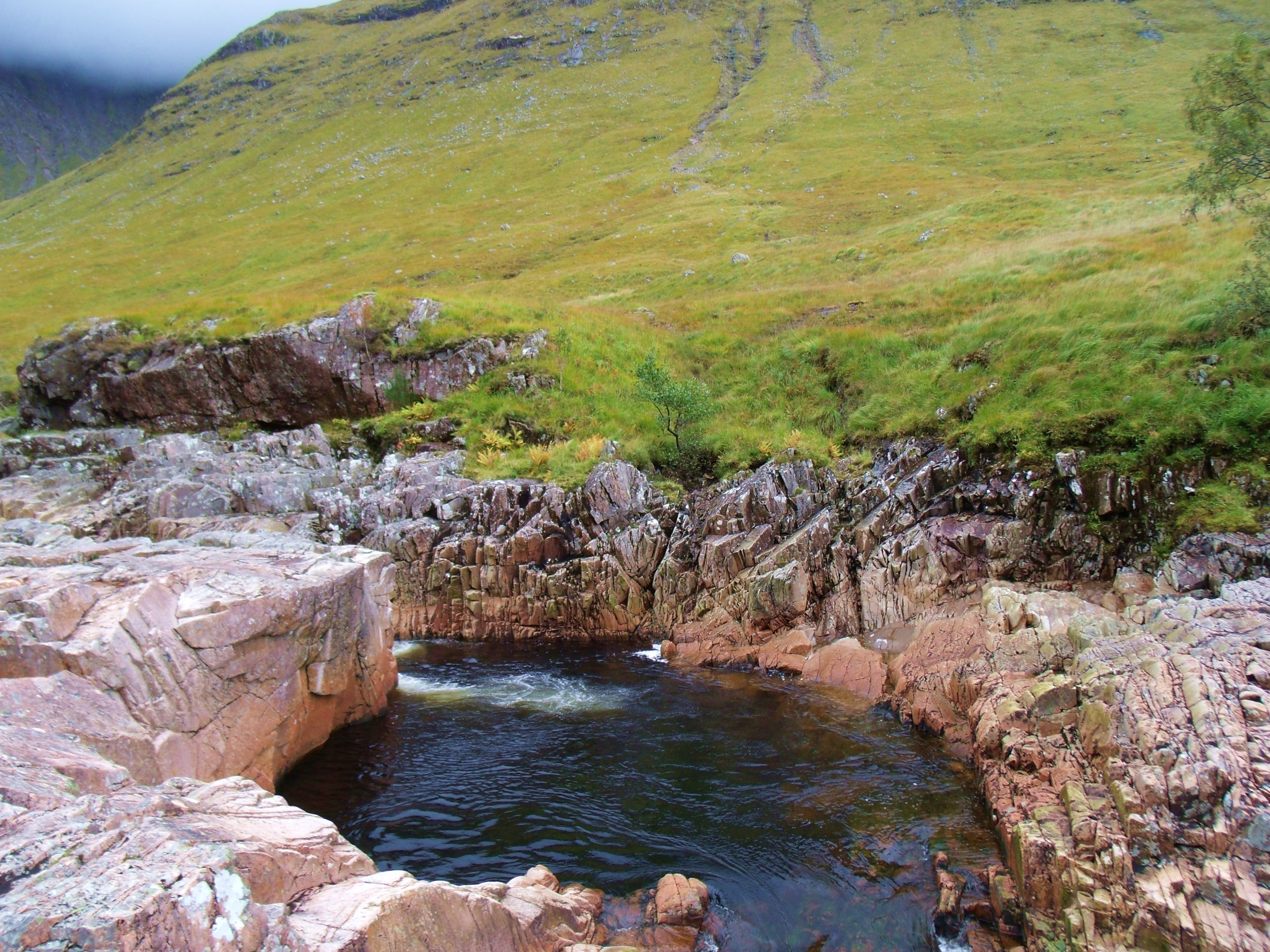
Detour to Beer Bottle Pool, River Etive
Before setting out for a hike north on the West Highland Way, I took the time to check out a beauty spot litttle known outside the local area. BeerBottle Pool in the River Etive, lies along the road leading to Glen Etive. It is hidden from the road. Its distinctive geological formations make it a must see.
River EtiveBeer Bottle Pool, River EtiveWaterfallWhite WaterShades of AutumnRiver Etive beyond Beer Bottle Pool
Hike along the West Highland Way towards The Devil’s Staircase and Lochleven.
West Highland Way Using Old Military Road
West Highland Way, a few miles from The Devil’s StaircaseWalkers on West Highland Way
Long And Winding Road
Rocky RoadThe Three SistersResting PlaceOctoberRain Coming
With rain approaching and the wind picking up I retraced my steps to The Kings House. It turned out to be only a heavy shower so I was able to document some of the trek back.
RainRainy TrailKings House and A82 from West Highland WayBrief Encounter
Stag
This fine fellow was standing right in my path but, unfortunately, I had put my camera away to protect it from the rain. By the time I got it out, he had bounded off.
Stag Up CloseWaiting for the Mr.CamouflageDeer at Kings House
And so that part of my journey ended and will continue, on and off the West Highland Way to Fort William
The journey I’m sharing here began by accident and continues still. It wasn’t planned at first, but evolved. Torn between starting a blog with the emphasis on images or text, I decided to do both and began at Balloch, where the south end of Loch Lomond becomes the River Leven.
The rich and abundant history of the loch and its many islands gave me much grist for the writing mill, and the glorious scenery gradually made the imagery take over. Various pages I previously published are only a click away in the sidebar opposite.
I was exploring the East side of Loch Lomond, camera always at the ready, when I stumbled on the West Highland Way. (pun intended).
The West Highland Way is 96 miles long, stretching from Milgavie, near Glasgow, to Fort William. It uses old military roads, disused railway tracks, and drovers’ trails dating back hundreds of years. The scenery along the way is spectacular; the going a variety of difficulty levels, from easy to very challenging. Many people, like myself, hop on and off the track, sometimes travelling by bus or boat to reach the next stretch we want to ‘do’. It joins Loch Lomond at Balmaha and shadows the loch all the way to its Northern tip at Ardleash. I first joined it on my way to Balmaha pier. As it leaves the village, it is smooth, paved and without challenge.
North from Balmaha on The West Highland Way
Autumn
Leaving Balmaha on the West Highland WayCottage along the Way
The cottage above sits at the junction of the West Highland Way and the road to Rowardennan. Steep gradients make the latter unsuitable for some vehicles.
Autumn Way
Once past the pier, the West Highland Way changes suddenly and dramatically to a rocky trail.
Summer
Rocky Trail Northwards From Balmaha Pier
The photos posted document my progress from Balmaha, Loch Lomond to Glencoe. I have tried to give viewers/readers a picture of my travels. These stretches are some of the the easier parts of the West Highland Way
Bridge In Dappled Sunshine – Heading North From Balmaha Pier
Heather and Bluebell LeavesBeauty by the Wayside
Wildflowers By The LochUnexpected EncounterNear Balmaha
Having explored the trail heading North from Balmaha, I retraced my steps along the West Highland Way to Balmaha Pier. From there I sailed to Luss, on the West side of the loch, and from there to Rowardennan.( Luss is quite well documented in some of my former posts, e.g ‘Finding Wee Peter’,‘Loch Lomond,Limericks and Life’, ‘Summer Splendour on Loch Lomond’. These are listed on the side bar of this post. Click to access.)
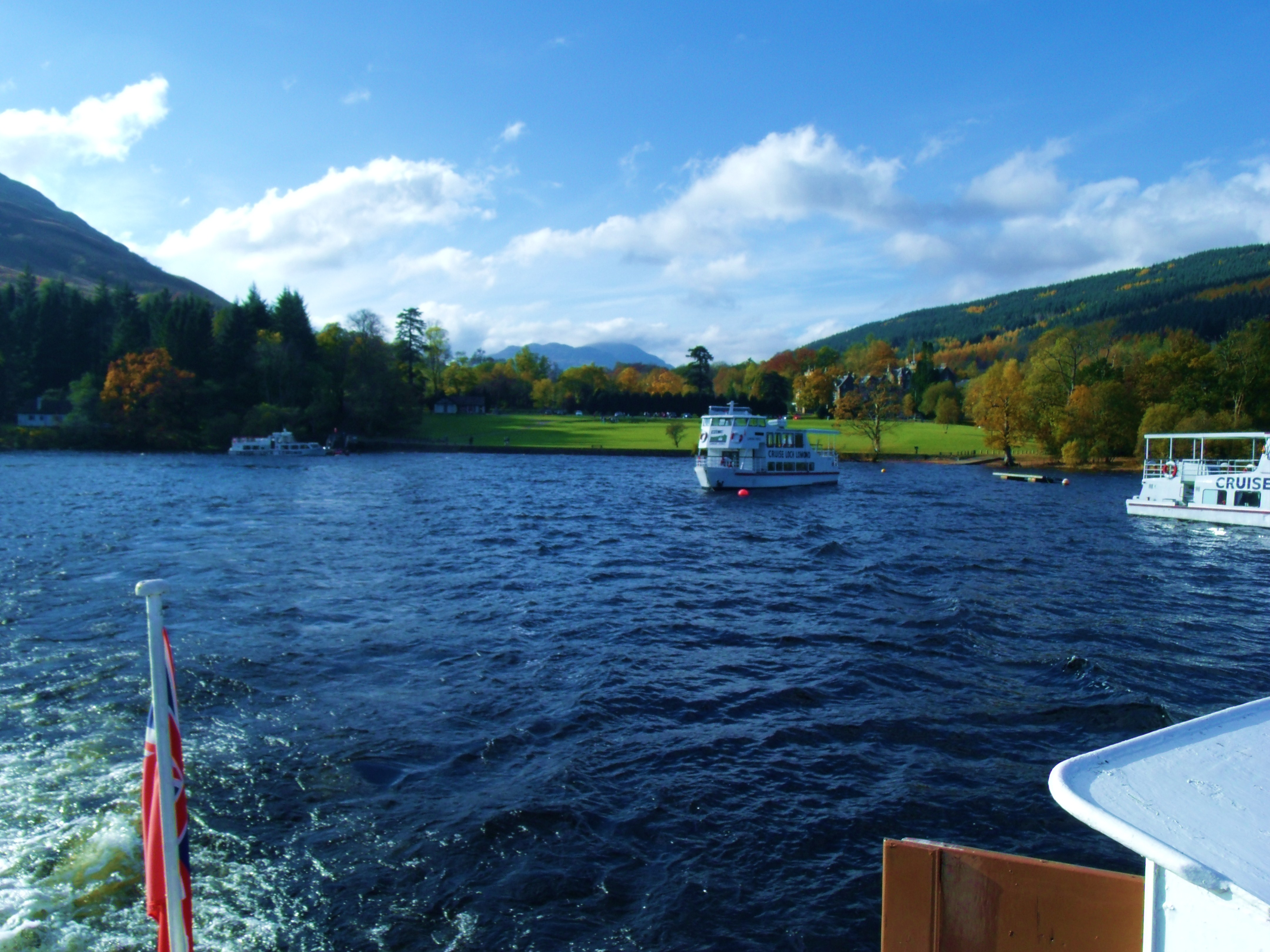
Cruise Loch Lomond is a tour boat operator based in Tarbet on the West side of Loch Lomond. For a variety of reasons, many climbers and hikers choose to hop on and off the West Highland Way, travelling by bus or boat when the going gets too tough or time is limited – or just for the fun of it. Tick all three in my case.
West Highland Way at Rowardennan
Spring
Lomond Warrier At Rowardennan Pier
.
Rowardennan Lodge: A Scottish Youth Hostel
Stream at Rowardennan South of Youth Hostel Broom Along The WayWoodlands South Of RowardennanBeach Along The WayShadows On The WayShady BeachBluebell Woods By The WayNorth of Rowardennan LodgeNearing Ben Lomond
Having explored the West Highland Way for a couple of miles south and four or so miles north of the Youth Hostel, I left the more ambitious to either climb BenLomond or walk the 8 miles to Inversnaid while I sailed there, courtesy of LochLomond Cruises. For a while, I caught sight of hikers on the Way as it winds around the loch.
Walkers on The Way
Whether hiking the trail or sailing to Inversnaid, the Loch Sloy hydro-electric plant is visible on the opposite shore of the loch. Nestled inland behind the mountains, Loch Sloy, once the gathering place of the McFarlane clan, is now a hydro-electric dam. Here we have a perfect example of perfectly green energy. A tunnel was bored the 2.5 miles through the mountain, exiting above Loch Lomond. When the level of Loch Sloy rises, the excess water runs through the tunnel and empties into Loch Lomond, passing through the generating station at ground level. The resulting power is used to top up the national grid.
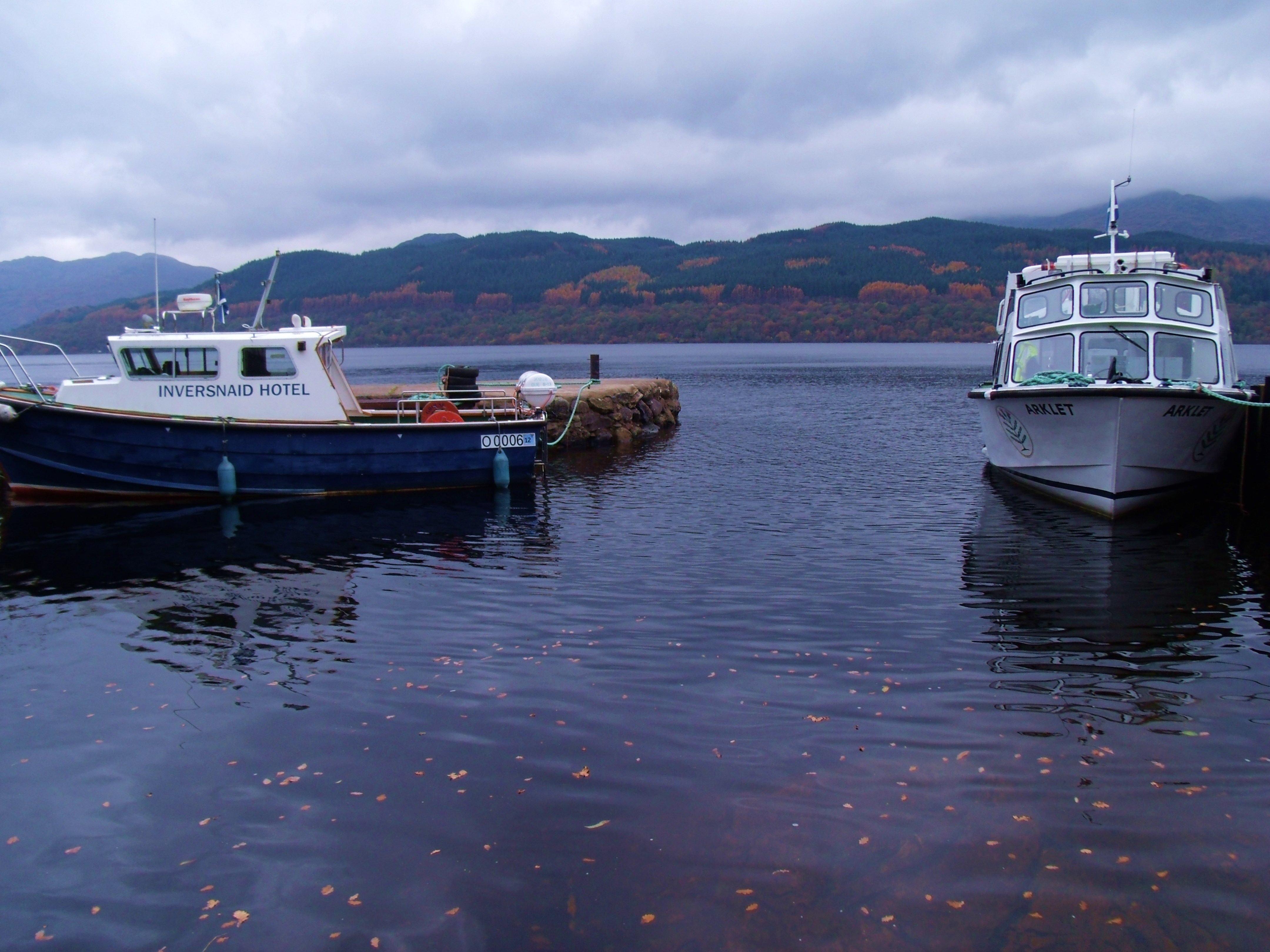
Loch Sloy Power Staion on Loch LomondSailing near InversnaidInversnaid Hotel
Passing travellers can find food or beverages in the hotel restaurant. The hostelry has a long history of serving wayfarers. It began, as most hotels along the West Highland Way did, as a rest stop for drovers. Later when the gentry and armies moved around, extensive stables were added and living conditions for the guests improved.
Cruising to Inversnaid in the shadow of the West Highland Way
As you will notice from the colours of the foliage, my first journey to Inversnaid was in the late Spring. At that time, I did not alight from the boat but continued on a short cruise as far north as the Cruise Loch Lomond boats go before returning to Tarbet, headquarters of the company. It was late Autumn when I returned to explore the woodland walk that is the West Highland Way.
Tarbet
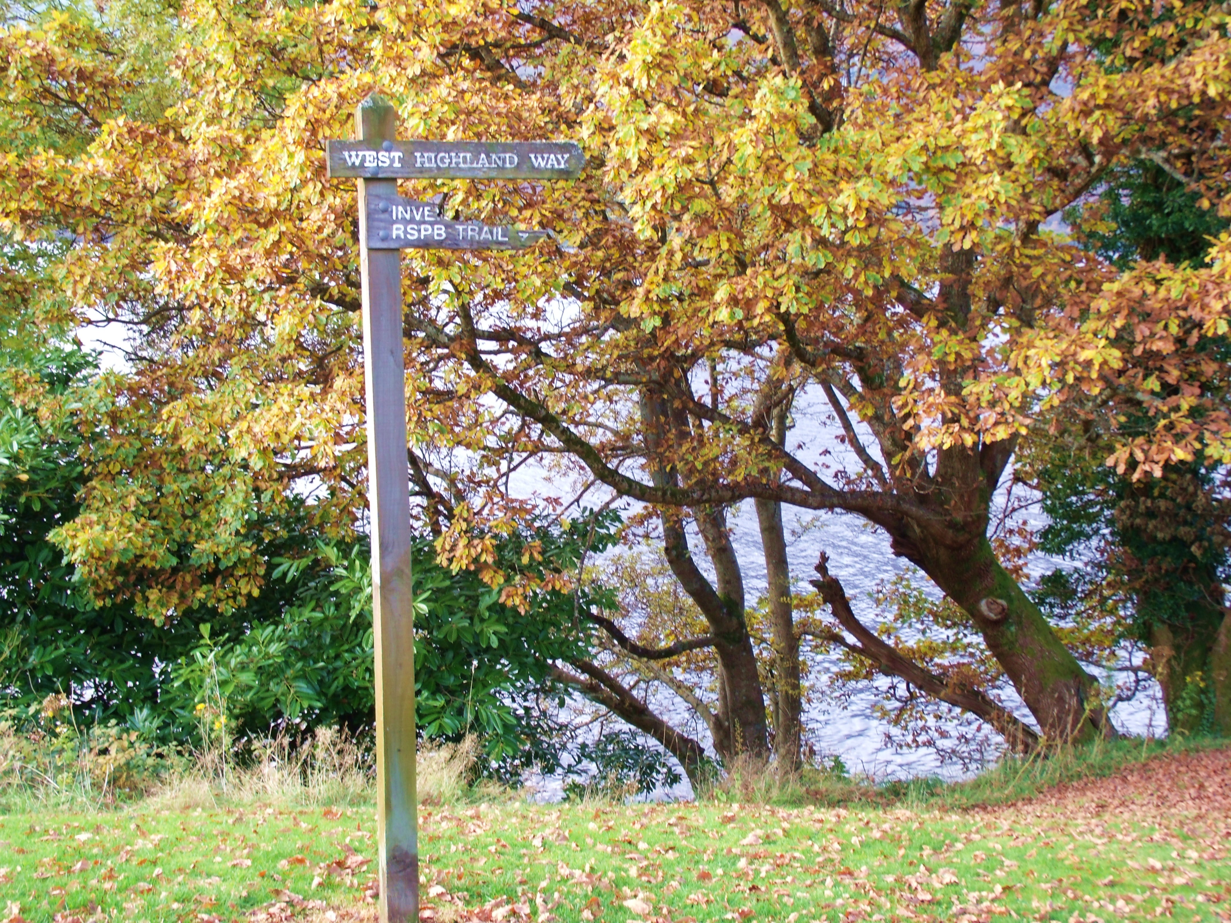
West Highland Way at Inversnaid
Autumn
Boats at InversnaidPointing The WayWoodland Way
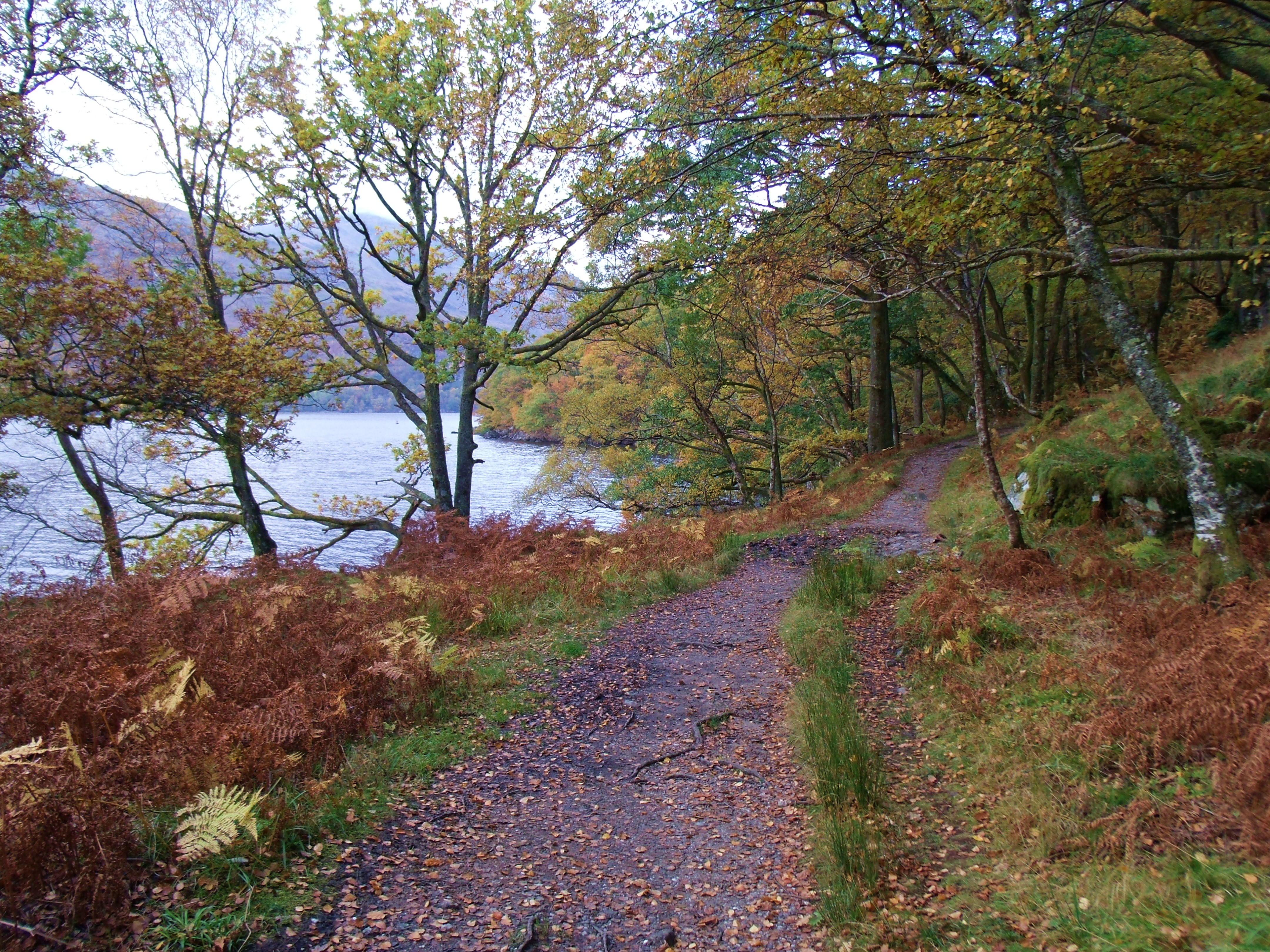
While, because of limited physical ability, I only hike on the easy parts of the West Highland Way and thus can only document those stretches that are very unchallenging, much of the West Highland Way is steep and/or arduous. The sheer length of it presents a challenge all by itself. As I got near Glencoe, I was better able to give a sense of what more able hikers could face
Rocky Trail at InversnaidRockAutumn AfternoonWoodland Trail
Having walked a short distance north through the woods, I returned to the pier and headed south a little way. Once again, the trail meandered along the lochside.
Lochside trail south of Inversnaid
Before leaving Inversnaid on a Tour Loch Lomond boat bound for Tarbet, I took a few moments to check out Arklet Falls situated beside the pier and InversnaidHotel. There is a youth hostel close by, but, late in the season as it was, the place was closed.
Arklet Falls
Having started my journey at Balloch at the south end of Loch Lomond where it empties out into the River Leven, I had, in the late summer, wanted to reach the Northern tip of the loch at its beginning. It starts where the, surprisingly small, River Falloch flows into it at Ardlui. No excursion boats go further north than Inveruglas, at the Sloy Power Station on the West bank, and Inversnaid on the East. From the pier at Inveruglas, the 5 mile route to Loch sloy is signposted. Hikers should be prepared for some uphill walking, I suspect. To reach Ardlui by public transport I had to take the Glasgow to the Isle of Skye bus which I caught at a layby on the A82 near Balloch.
Ardlui/Ardleash
Late Summer
Ardlui MarinaBouy at Ardleash DockSign at Ardleash BouyWest Highland Way at ArdleashHeading North at Ardleash
Visible from here, one can see the trail that branches off to the left up ahead. This leads to Arrochar.
Looking towards the Arrochar turn-offRocky TrailA Welcome Help Over
Having reached my limit of endurance and time, I retraced my steps to the dock, hoisted the bouy and was duly transported back across the loch by the local ferry.
Part Two
Leaving Loch Lomond
On And Off The Road To The Isles
Taking advantage of my newly discovered Glasgow to the Isle of Skye bus service, I realised that, just because I had run out of Loch Lomond, I could still hop on and off the West Highland Way all the way to its ending in Fort William.
The next part of the hike on the West Highland Way is long and arduous. Some of the time, the trail shadows the road (A83), through Glen Falloch then for an interminable seeming stretch through mountainous terrain. Finally, both bus passengers and hikers climb the 1,500 feet or so to the vast, wild expanse of Rannoch Moor. Abundant in Lochans sparkling among the peat and heather, the beauty is unique and beyond words. These next two photos were taken from the bus window.
Autumn
Lochans on Rannoch MoorRainbow Over Rannoch Moor
To continue with Part Two, Rannoch Moor and Glencoe, click on the following link to be provided shortly.
It is the only rotating boat lift in the world. It is the largest functional sculpture ever. It is astounding in its simplicity. It is excellence in design. It is ingenuity in engineering. It is the ultimate in green energy. It is gracefulness personified. ‘It has to be seen to be believed’. It is the Falkirk Wheel.’
The video above is one of a series I made when on a trip on the Falkirk Wheel. Before posting the entire video record of the trip, I am giving some technical information with photos and a couple of videos to illustrate the text. It is impossible to imagine from words alone just how this amazing machinery works.
Everything about the design of the wheel is simple – from the supporting arms, reminiscent of the Celtic, double headed axe to the two streamlined tour boats. Operating on the Archimedes Principle, the technology of the equipment that drives the lift is awesome in its simplicity. In two words, the Falkirk Wheel is elegance personified.
The Wheel From The Forth and Clyde Canal
The grass covered ‘hill’ mid-right is the Roman Antonine Wall
The sloping glass-roofed building to the left is the Visitors’ Centre
The Falkirk Wheel was opened in 2002 and is located in Central Scotland near the town of Falkirk. It connects two canals, the Union and the Forth and Clyde. Previously these were connected by a series of eleven locks. To negotiate all of them took many hours. When the canals fell into disuse in the 1930s, the area of the locks was filled in. The canals have been re-generated for leisure purposes and the wheel allows passage from one canal to the other in a few minutes. The Union Canal is 24 metres (79ft) higher than the Forth and Clyde. That’s about as high as an eight storey building. The boat lift doesn’t quite replace all the original locks due to the presence of the ancient Roman Antonine Wall. Unable to build atop this valuable relic, the engineers obtained permission from the National Trust to build a tunnel under and at the bottom of the wall. It is called the Rough Castle Fort Tunnel after the nearby Roman wall fort, Rough Castle Fort which is the best preserved of the few remaining Antonine Wall forts. ( Information, illustrations and links to my sources’ web sites can be found after the videos.)The new length of canal empties outside the tunnel into a basin. Into this, through another tunnel, flows the Union Canal boats having had to descend through only two locks to meet with its Southbound counterpart. To get to the same level as the Wheel, the Forth and Clyde boats have to rise up a step via one lock. (See photo above)
Forth And Clyde Canal
The only way to really appreciate the genius of the rotating lift is to take a boat trip on it. I did so a few months ago, recording the journey on video. There are many short videos which is a bit aggravating. Fewer, longer ones would have been better. One day, I’ll go back and re-do it but, for now, I’ll use what I have. There are several good internet sites that give, in great detail, the technical information of the design and workings of the wheel. These give the relevant facts much better than I ever could. All external links to my sources can be found in the grey sidebar to the left of the page.
Wheel Base And Entrance To Gondola
Following are technical details I found in Wikipedia, punctuated at relevant placeswith my videos demonstrating key parts of the text.
‘The wheel has an overall diameter of 35 metres (115 ft) and consists of two opposing arms which extend 15 metres beyond the central axle and take the shape of a Celtic-inspired, double-headed axe. Two sets of these axe-shaped arms are attached about 35 metres (115 ft) apart to a 3.5 metre (11 ft) axle. Two diametrically opposed, water-filled caissons (gondolas), each with a capacity of 80,000 imperial gallons (360,0001;96,000US gal), are fitted between the ends of the arms.
These gondolas always weigh the same whether or not they are carrying their combined capacity of 600 tonnes (590 long tons;660 short tons) of floating canal barges as, according the Archimedes’ Principle, floating objects displace their own weight in water, so, when the boat enters, the amount of the water leaving the gondola weighs exactly the same as the boat. This keeps the wheel balanced and so, despite its enormous mass, it rotates through 180 degrees in five and a half minutes while using very little power. It takes just 22.5 kilowatts (30.2 hp) to power the electric motors which consume just 1.5 kilowatt-hours (5.4MJ) of energy in four minutes, roughly the same as boiling eight kettles of water.’
How the gondolas are kept level
‘The gondolas (caissons) need to rotate at the same speed as the wheel but in the opposite direction to keep them level and to ensure that the load of boats and water does not tip out when the wheel turns. Each end of the each gondola is supported on small wheels which run on the inside face to the eight-metre-diameter holes at the ends of the arms, allowing the gondolas to rotate.’ (see video following)
Tour Boat In Gondola
Following is a video record of my trip on the wheel. I found the experience surreal and quite mind blowing.