The Isle of Skye
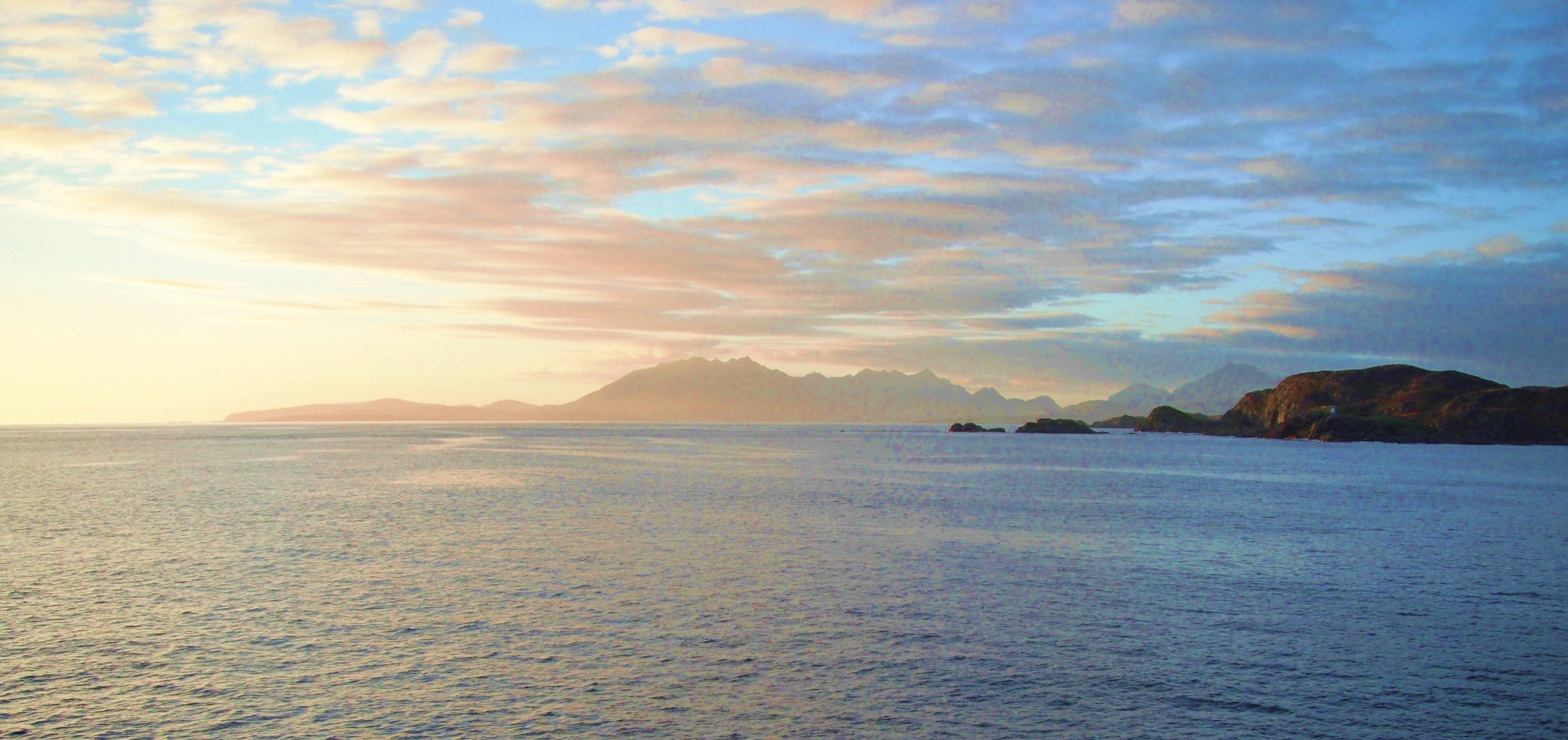
Sunset Over The Isle of Skye
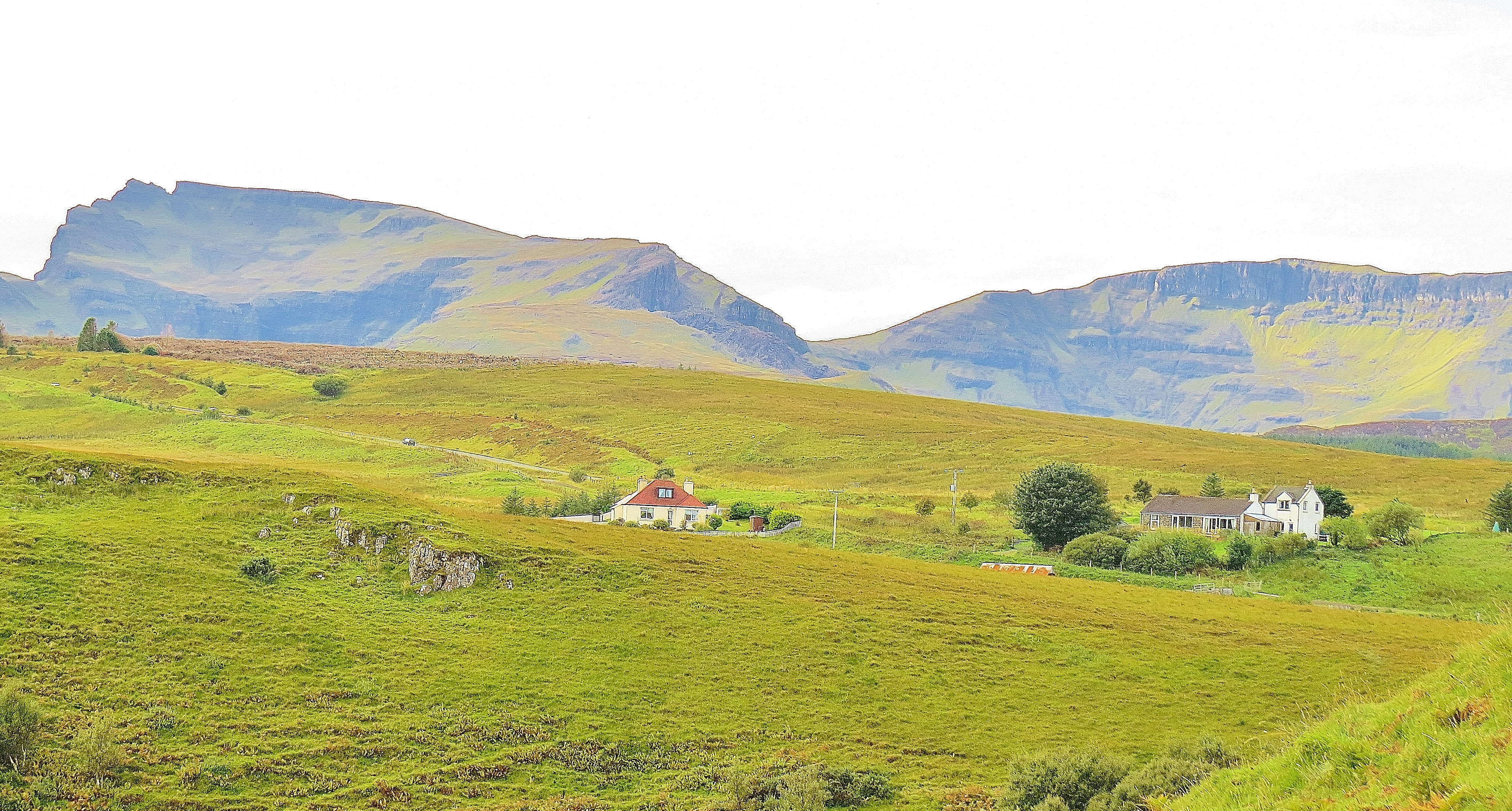
The Isle of Skye, largest and most northerly of the Western Isles in the Inner Hebrides, is connected to the Scottish mainland by the Skye Road Bridge. As the crow flies, Skye is only 50 miles long but has over 400 miles of shoreline. The population is around 10,000. For such a small area, the island landscape is amazingly varied.
At the South of the island, Brittle Beach, pictured below, lies on the edge of Glen Brittle, an area of gently rolling hills, moorland and pasture in the shadow of the Black Cuillin, a rugged mountain range that rises straight out of the Cuillin Sound, in the Atlantic Ocean.
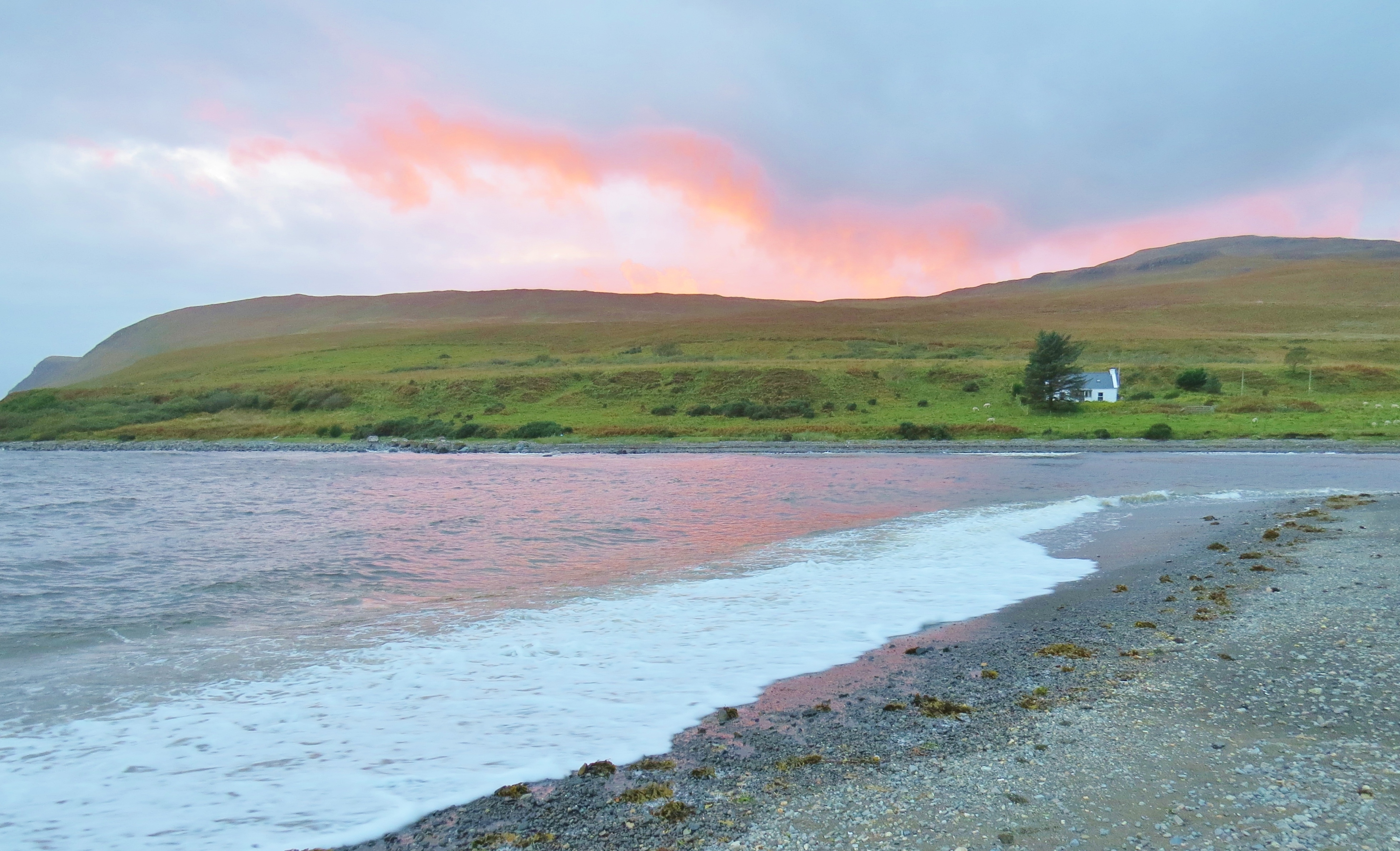
Night Falling on Brittle Beach

Fading Light on Brittle Beach
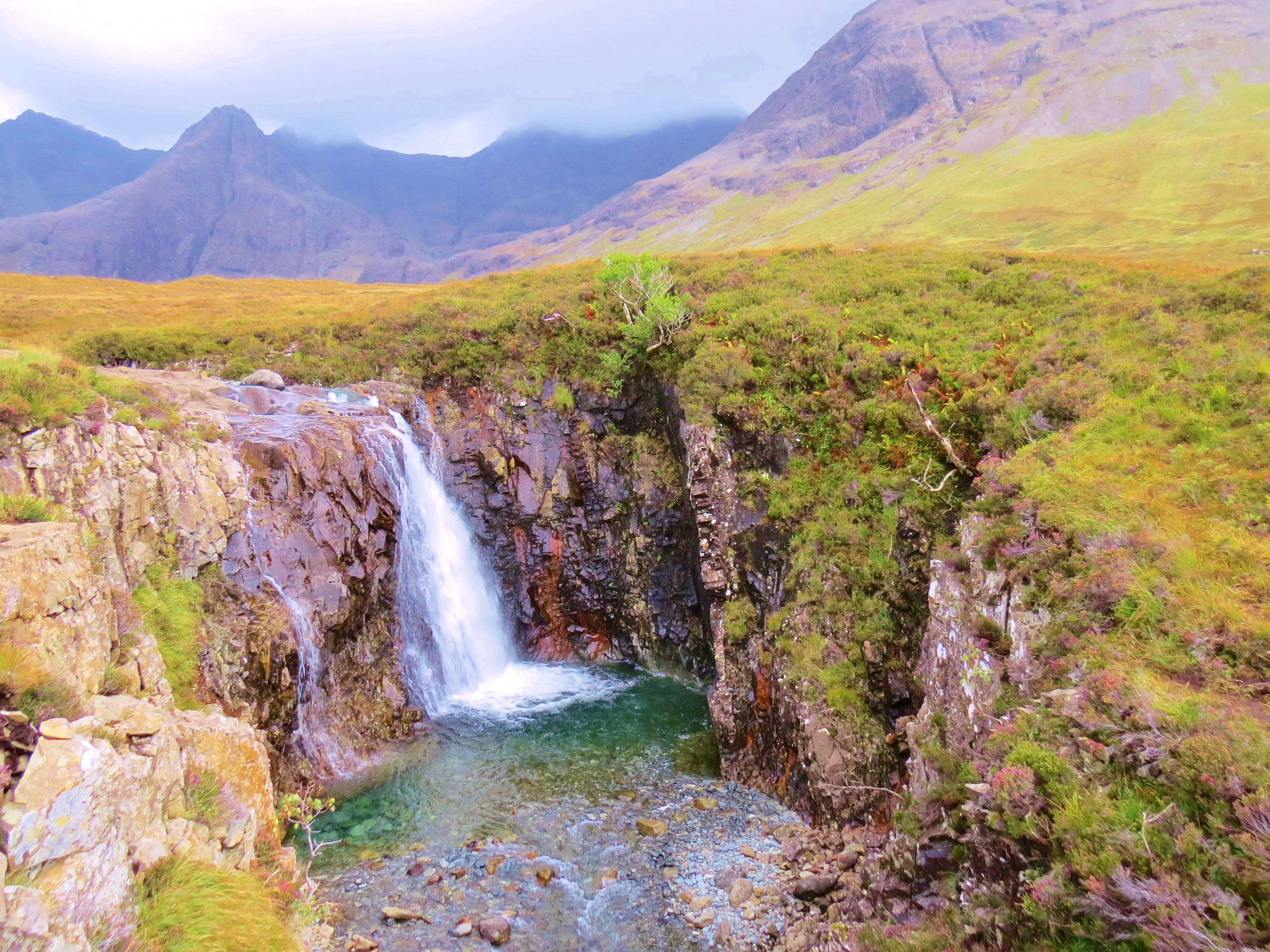
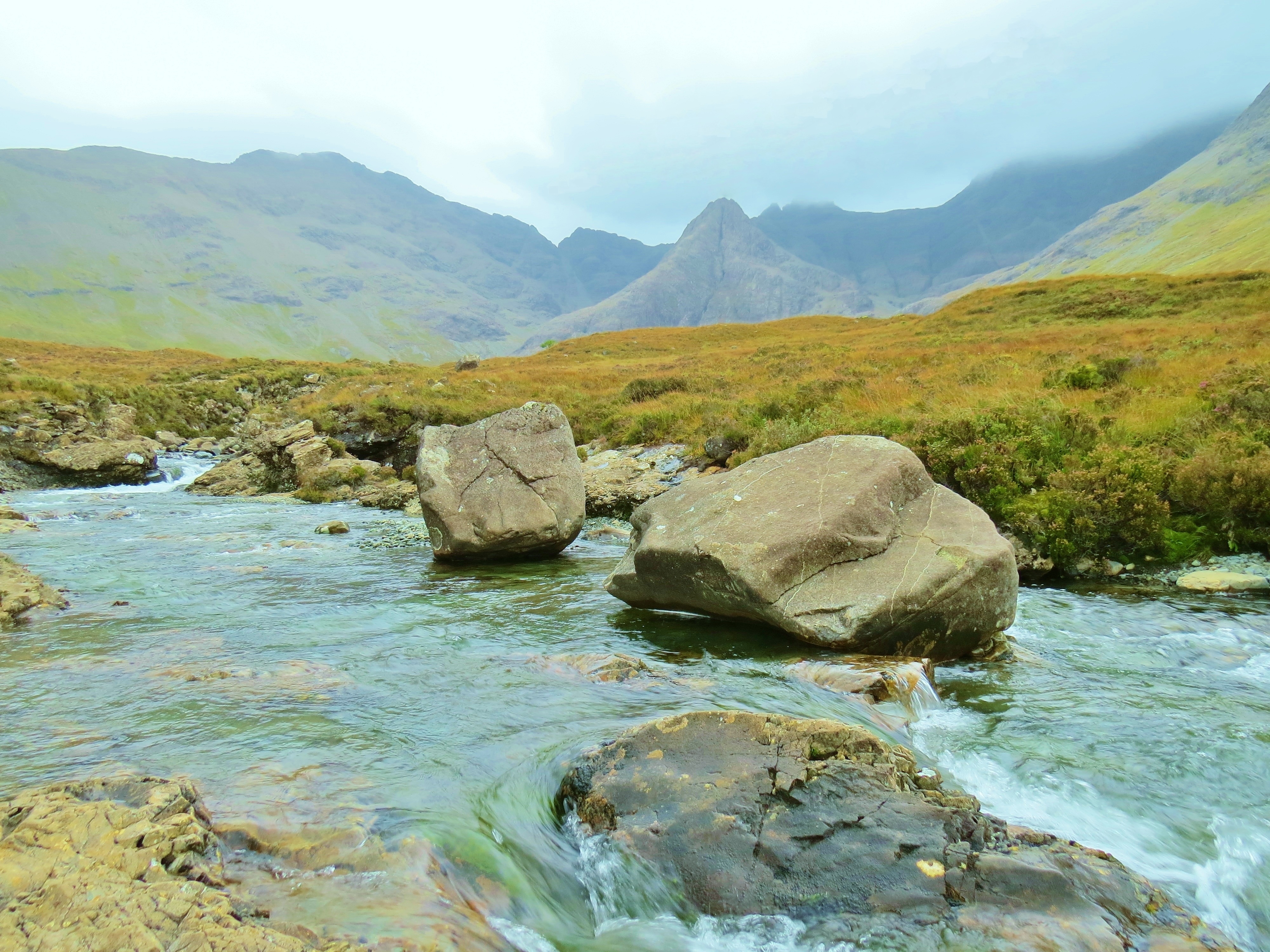
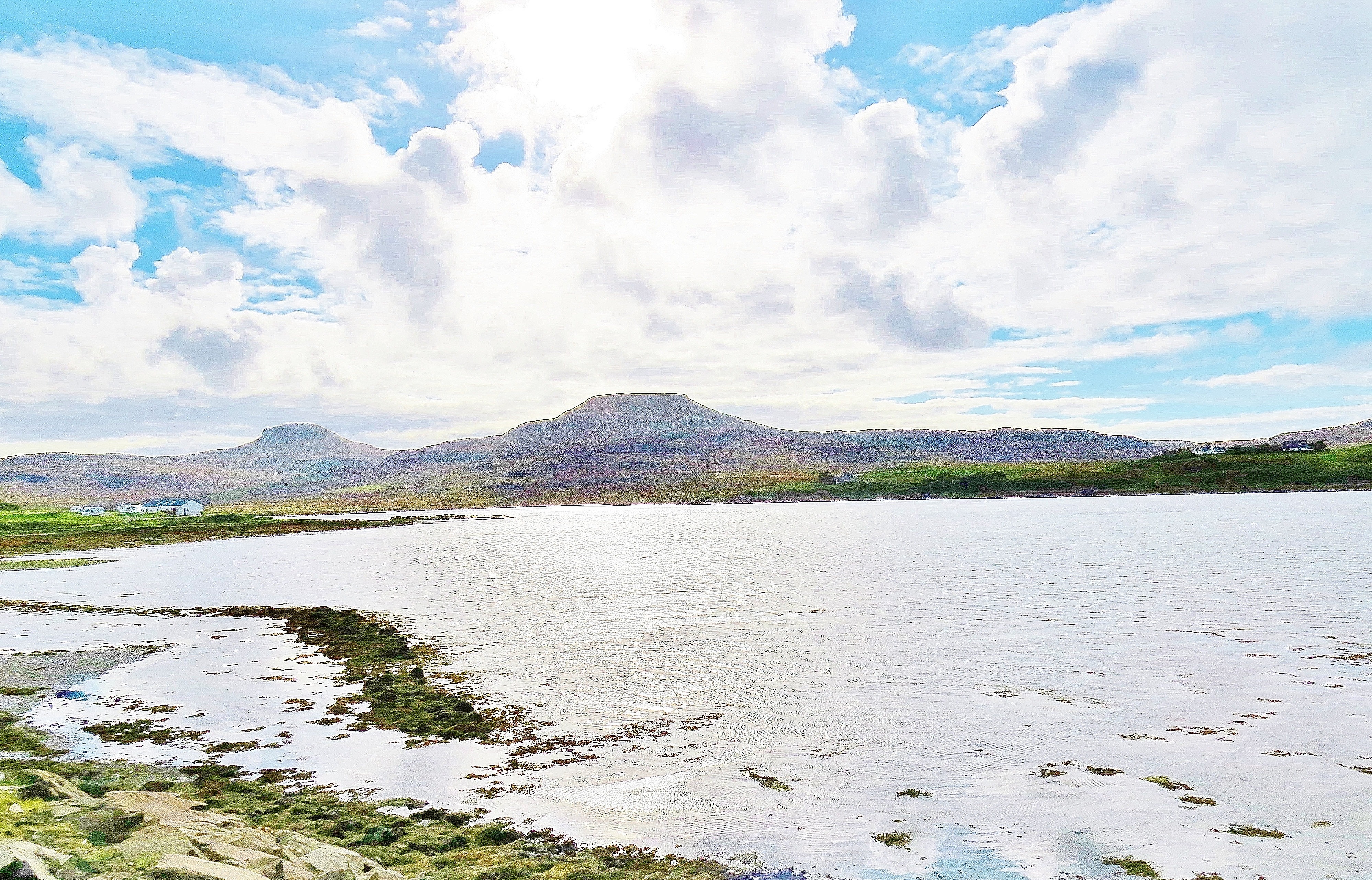
Near the north entrance to Glen Brittle, the landscape dramatically changes to wild moorland, across which runs the River Brittle, from its source below the Black Cuillin.

The River Brittle
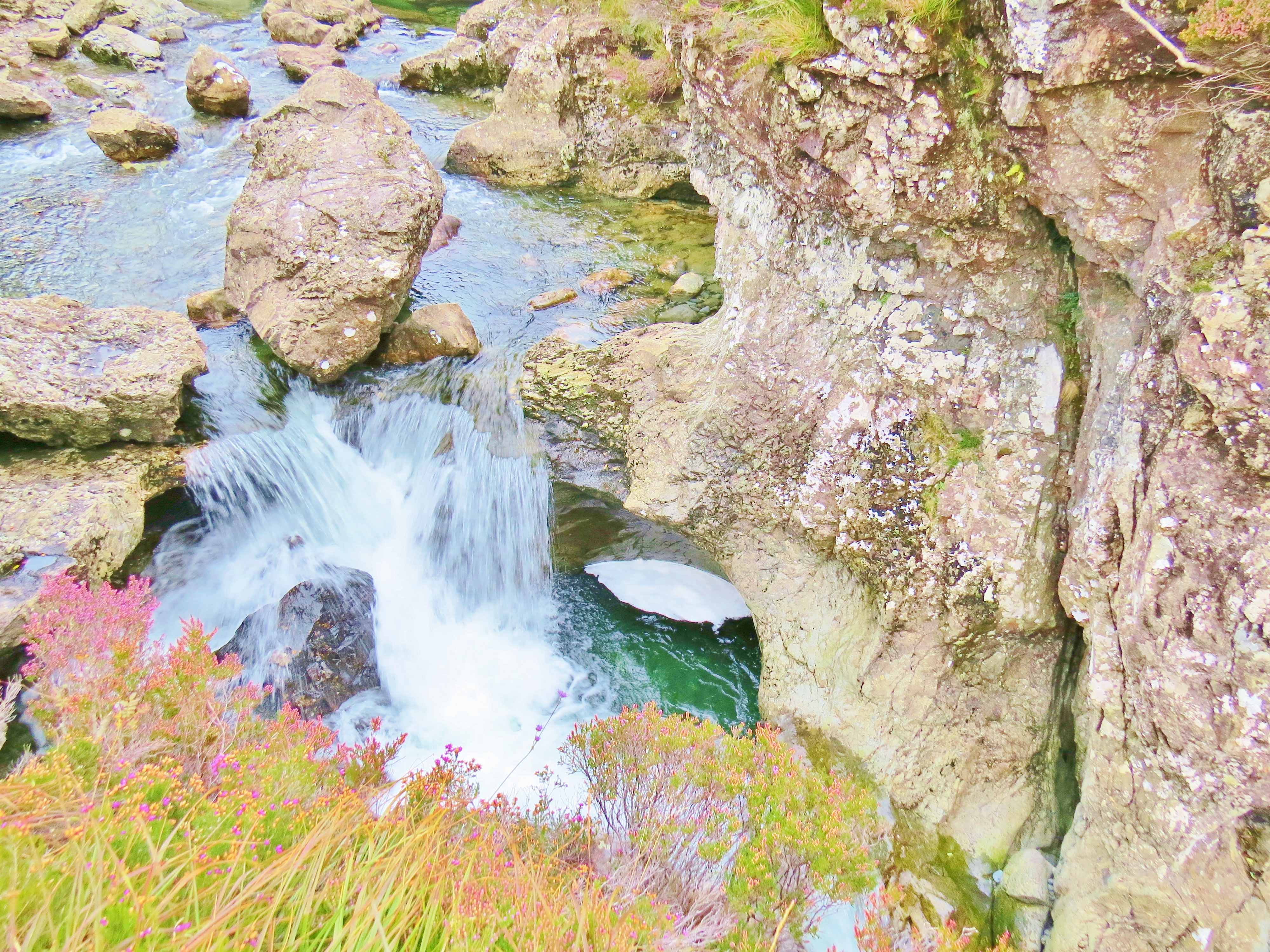
Hidden in the foothills only a short distance from Brittle Beach, is a wonderland of waterfalls, cascades, rocks and magical looking pools. The ferrous oxide (iron) that oozes from the rocks into the water, along with the variety of rock types, gives brilliant colour to the water. This area is well named, The Fairy Pools.
It was late on a cloudy day, in fading light, when the photos of the pools were taken, but, even so, the place looks truly magical.
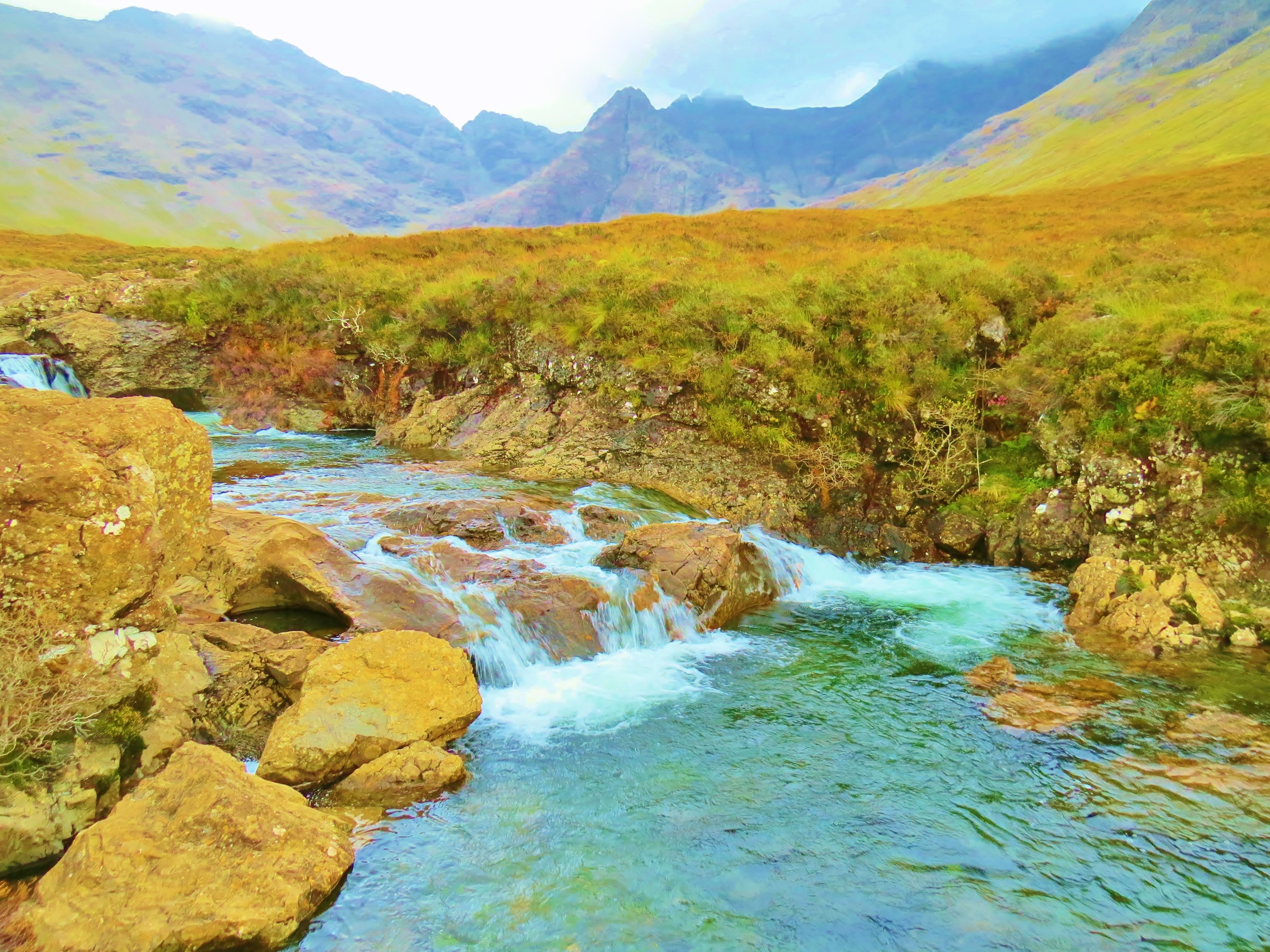
River Brittle and the Fairy Pools


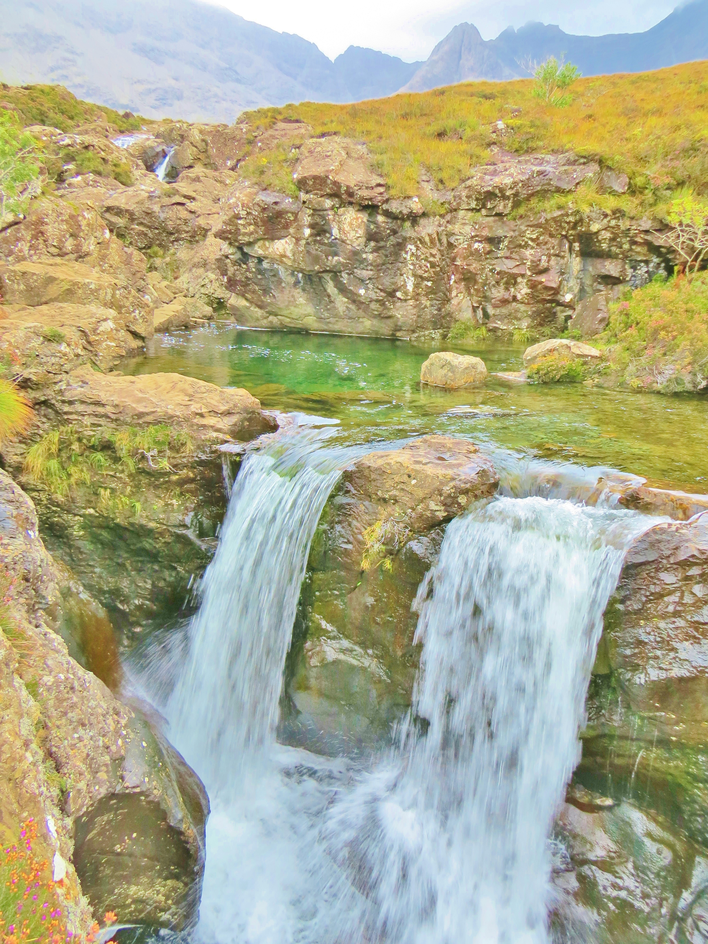


The area is called Fairy Pools because, in island lore, this magical place is home to fairies, those tiny, mystical entities, who, Celtic people believed, frequent the world of mortals and must be respected lest they use their magical powers to wreak havoc. It is difficult to be in the Western Highlands of Scotland and not find oneself being made into a believer. There is an other-worldly, mystical air in so many places. On Skye, the Fairy Pools is one such.
On a more down-to-earth note, the question of whether or not public swimming is allowed in the Fairy Pools, is often asked. The answer to that is, ‘Yes’. The ‘Right to Roam’, a long-standing Scottish tradition of unhindered access to open countryside, was formalised by a law enacted in 2003. The Land Reform (Scotland) Act spells out which activities are legally permissible to the public on countryside locations that are privately or State owned. It is a long, comprehensive list including swimming – allowed; fishing (without a permit) – not. (Private gardens and some special exceptions such as Ministry of Defense property are off limits, as are farmlands where crops are planted.)

Gathering Clouds on the Black Cuillin
The Black Cuillin creates a dark, brooding, rugged background to the contrasting light, colourful cascades and mirror-like pools. Though not as high as many other mountain ranges in the world, they are challenging nevertheless. At a little over 3,200 feet (975 metres), the weather conditions in the Highlands make traversing the 8 mile long range, or climbing the jagged peaks, an exercise fraught with danger. Gaping gullies will swallow the unwary, or loose scree send them hurtling downwards. Sudden changes can reduce visibility to zero without warning. The Black Cuillin earns the respect it is given by climbers and ‘scramblers’ (those using only hands instead of ropes on the less challenging areas.)

Looking across Loch Fala towards The Storr and the Old Man of Storr
In the north of the island, the Trotternish Peninsula provides some spectacular, varied and unique scenery. Running up the length of the peninsula is a spine-like escarpment known as the Trotternish Ridge, a series of steep hills including thirteen peaks, the highest being part of The Storr. The Storr is a series of rocky peaks, the best known of which is The Old Man of Storr, a basalt, needle-shaped column that affords a challenge to climbers. It was not scaled until 1955. At only 719 metres (2,358 ft), what it lacks in height, it makes up for in level of difficulty.
 The Trotternish Ridge
A short distance from the ridge, red coloured dolerite rock forms cliffs and columns along the Eastern Coast of the peninsula.
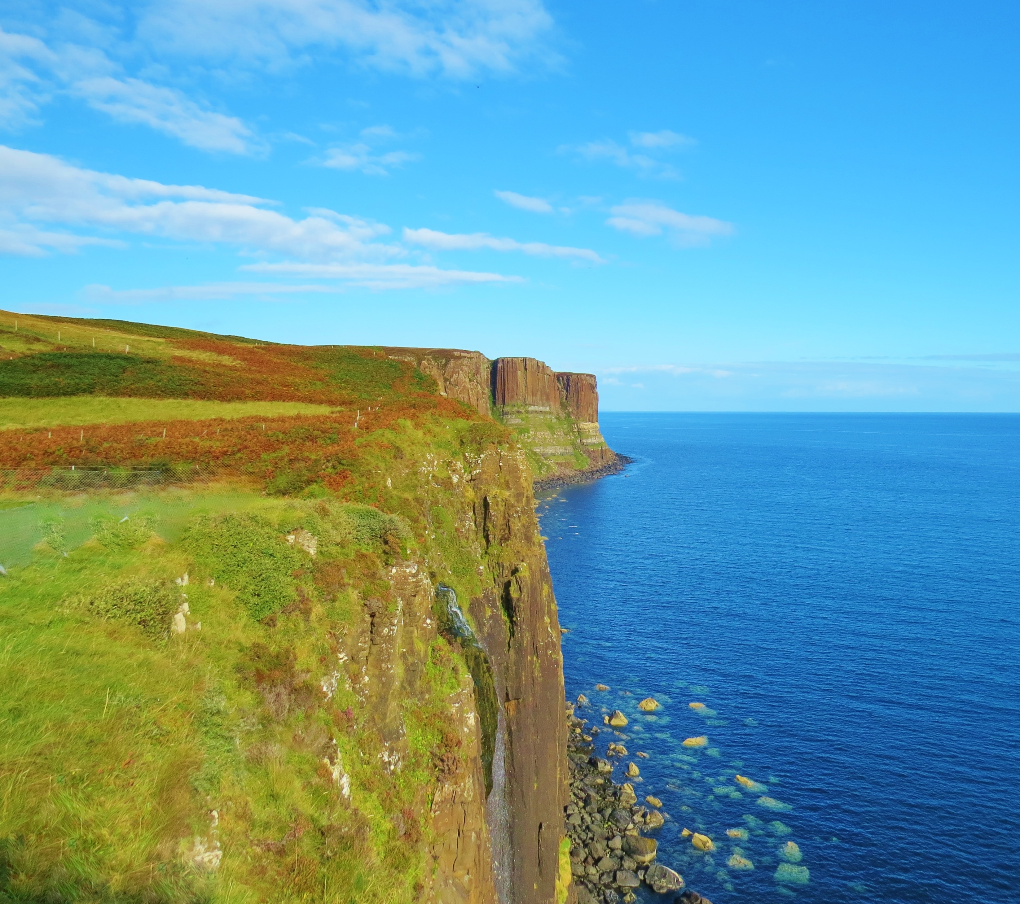
Kilt Rock
Kilt Rock is made up of massive columns of dolerite giving it a pleated look, hence the name. The light coloured lines are evidence of ice sheets pushing across the sedimentary rock. This stretch of coastline affords panoramic views of the Isles of Rona and Raasay with Wester Ross on mainland Scotland in the far background.
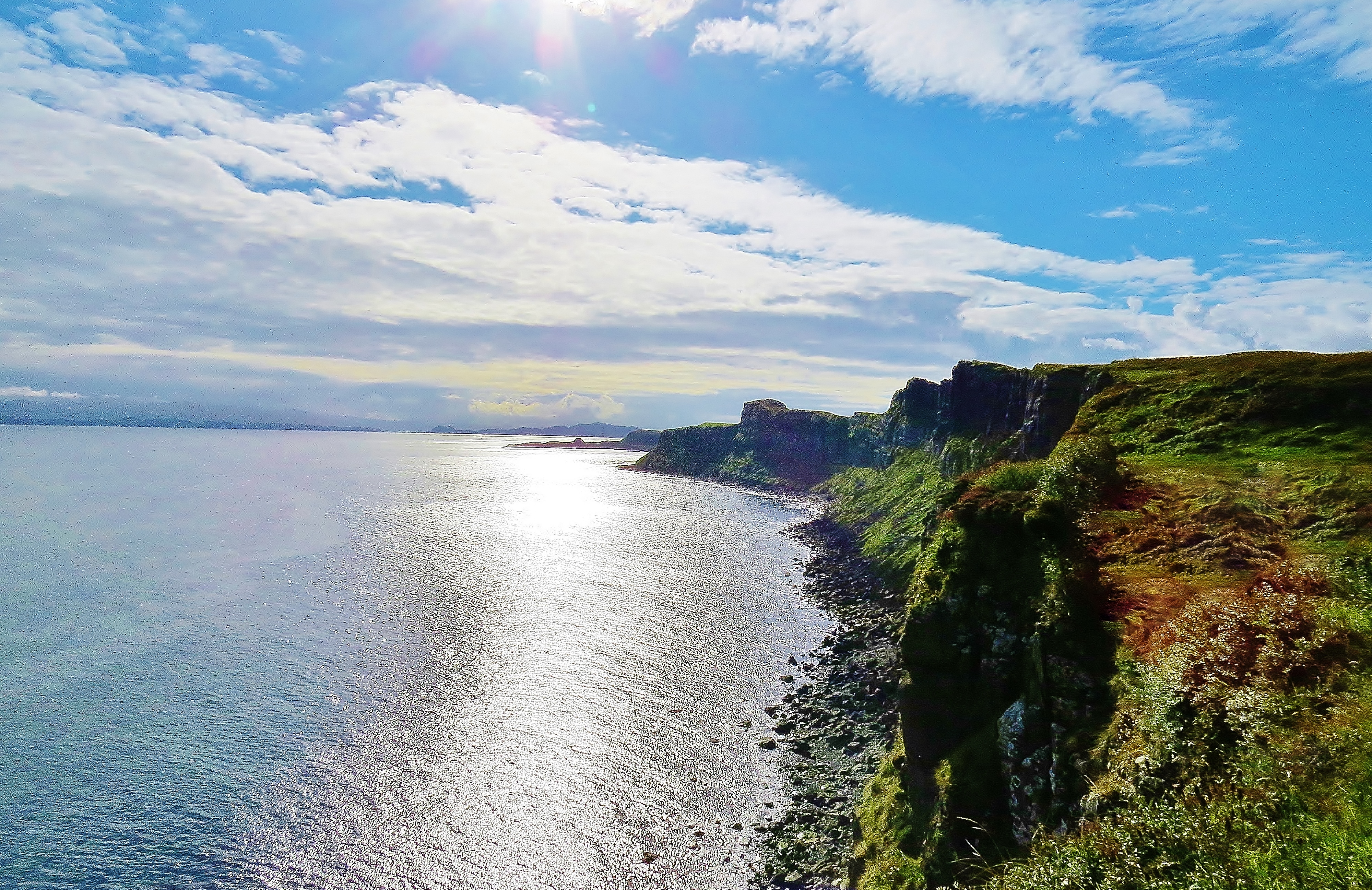
Trotternish Coast, Skye
(Looking towards Rona and Raasay)
The unique, one of a kind Quiraing is also part of the Trotternish Ridge. This landslip area of peaks and gullies is made up of many layers of basilistic lava to a depth of about 800 m (2,624 ft). On the east side, the underlying sedimentary rock has collapsed under the weight, sliding downwards with a tipping sideways motion. The result is a somewhat bizarre looking landscape of pointed, grass-covered peaks and bowl-shaped valleys giving it the look of some alien planet.

Looking Northwards from the Quiraing

Looking Westwards from the Quiraing
The slipping of the land on the east side of the ridge continues today as it has done for eons. The evidence is seen at Flodigarry where the road has to constantly be repaired.

The Road up the Quiraing
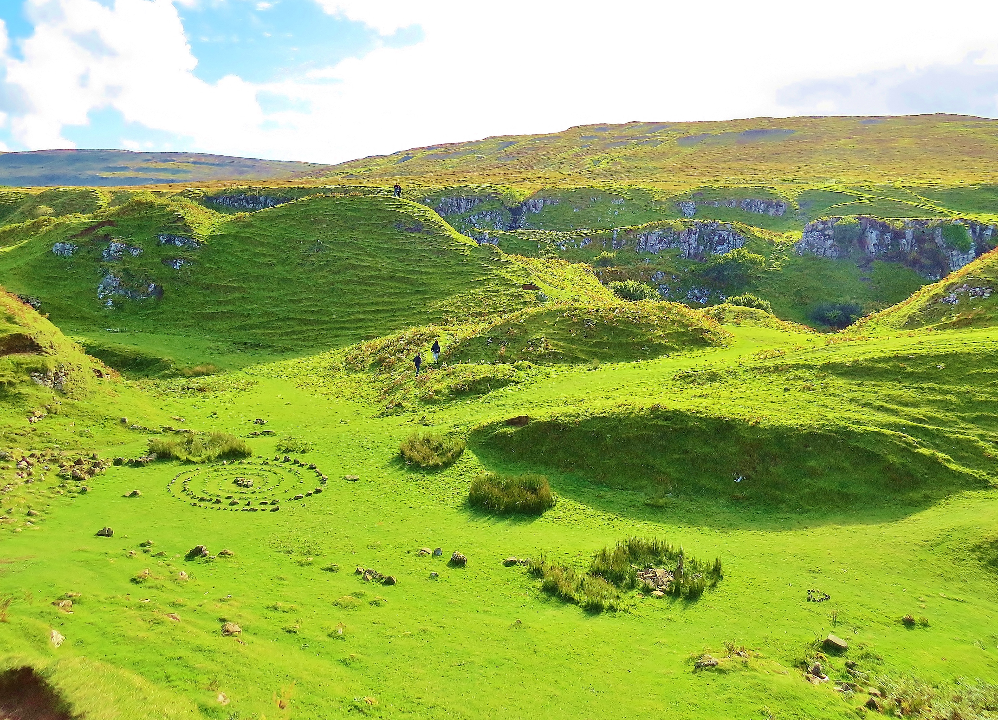
On the west side of the Trotternish Peninsula, near Uig, we once again find an area frequented by fairies, this time, the Fairy Glen. This is a place which, like the Fairy Pools, is steeped in fairy lore. It, too, has a magical feel to it. Ask about the circles of stones and the only answer one is likely to get is that this is the work of the fairies.

The Fairy Glen
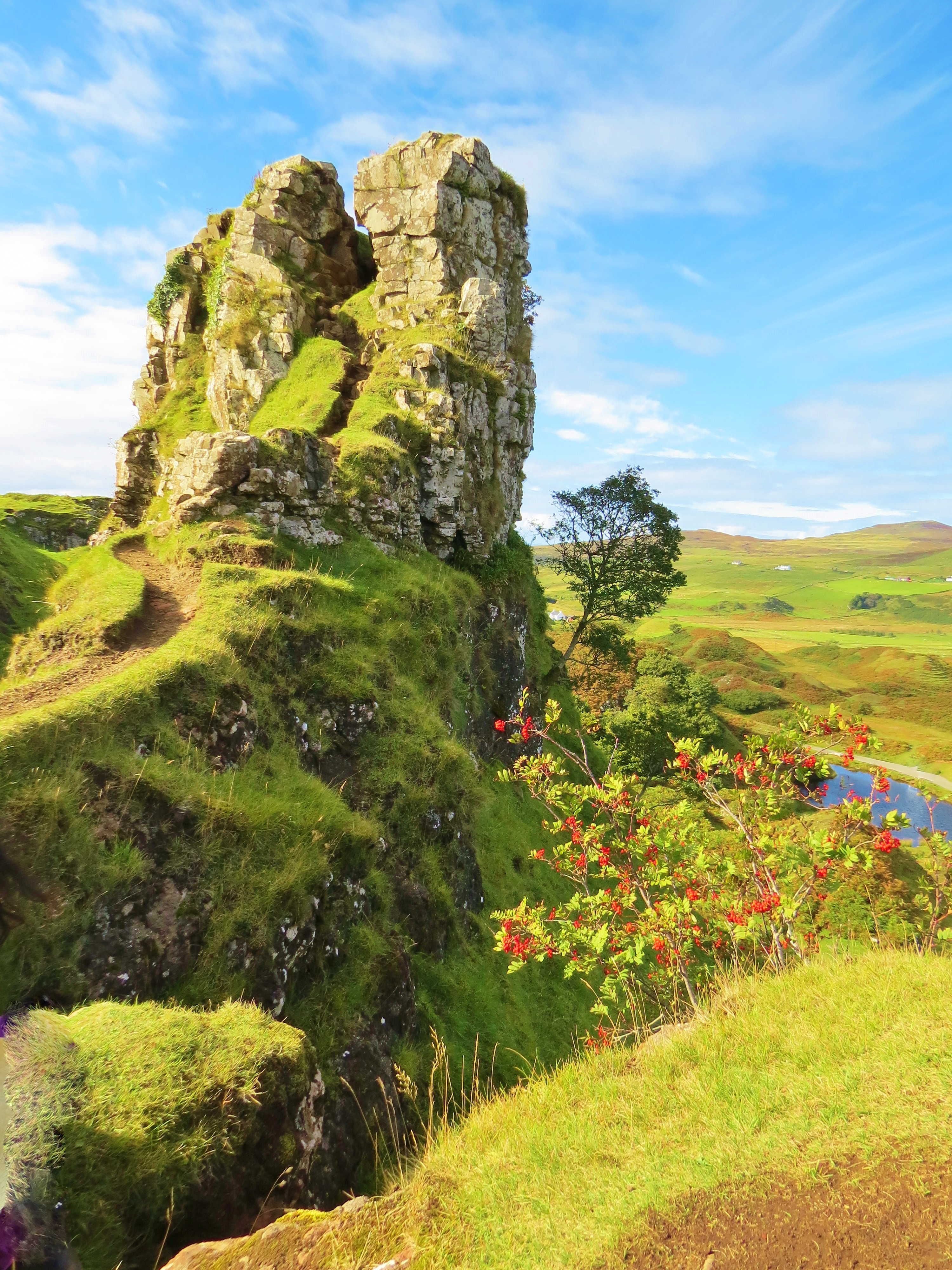
The Castle of the Fairy King
Watching over the fairy circles is, what geologists would call, ‘a basalt intrusion’, but is commonly known as ‘The Castle of the Fairy King’ or Euan’s Castle’.
In The Fairy Glen
West of the Trotternish is the Waternish Peninsula and further west still, as far as one can go, is Neist Point. There is a lighthouse there, but I was, unfortunately, unable to get to it, so contented myself with photos of the headland obscuring my view and the coastline nearby. This is MacLeod country and en route to Neist Point, the road goes through the village of Dunvegan. Dunvegan Castle, home of the MacLeod ‘chief’, is near there, but another place I missed.
Loch Dunvegan and MacLeod’s Tables

The Coast Near Neist Point

Neist Point
On the other side of this pointed headland is the lighthouse which marks the most westerly point of the Isle Of Skye. Across The Minch, the Outer Hebrides are visible.
Geology: The Isle of Skye is a geologist’s dream. The vast variety of rocks and minerals are well catalogued by both professional and amateur geologists as well as rock hounds. Google or any good search engine will provide reams of information if interested parties ask for ‘Isle of Skye geology’.
How to get to the Isle of Skye: Citylink buses run from Glasgow airport directly to Portree on Skye via the Skye Road Bridge. Trains from Edinburgh and Glasgow go to Mallaig. From Mallaig, a car ferry goes to Armadale at the South end of Skye. Good roads lead around the island.
Where to stay: There are a variety of accommodation types – hotels, B & Bs, hostels and camp sites. Portree is a small town that has two good-sized grocery stores, a post office and various other useful shops and services
Credits: The photographs of the Fairy Pools and the Black Cuillins were taken by Niall Palmer of Skye for lochsplus. They were edited by lochsplus. All other photos by lochsplus.
